Starting point: Petrovo Brdo (803 m)
Starting point Lat/Lon: 46.2157°N 13.9997°E 
Time of walking: 4 h 40 min
Difficulty: easy marked way
Difficulty of skiing: no data
Altitude difference: 1041 m
Altitude difference (by path): 1325 m
Map: Škofjeloško in Cerkljansko hribovje 1:50.000
Access to starting point:
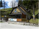
From Železniki we drive towards Tolmin or vice versa, following the road to the place Petrovo Brdo, where we park at the parking lot by the Planinska koča Petrovo Brdo. The mountain hut is located right next to the crossroads, where the road to Soriška planina branches off.
Path description:
By the mountain hut, we notice signs for Črna prst, which direct us onto a very steep path. After a short steep ascent, we step onto a wide cart track, which we follow to the right, and it quickly brings us to a torrent stream. The marked cart track soon turns slightly to the left and then ascends relatively steeply through the forest. After approximately half an hour of walking, we come to mountain signposts, where a crossing is marked.
We continue in the direction of Črna prst (left Kup and Podbrdo) and continue the ascent along the ascending cart track, which higher turns to the right and flattens out completely. After a few minutes of further walking, we leave the cart track and continue the ascent along the marked footpath. After a short ascent, the path levels out somewhat and brings us to an old but excellently preserved mule track. We continue the ascent along the mentioned mule track, which through the forest and some gullies brings us to a crossing near the Lovčev bivak Pri Koucah. Here we continue straight ahead (right Lajnar and Slatnik) and after a few tens of steps of further walking we arrive at the aforementioned bivouac (Lovčev bivak is just the name of the hut and bivouacking is not possible in it).
From Lovčev bivak we continue along the marked path in the direction of Črna prst. The path ahead crosses a belt of forest, then gradually leads to increasingly panoramic slopes, from which views open up onto the peaks and slopes surrounding Baška grapa. Higher up, the path turns slightly to the left and begins to descend gently. The path then bypasses an old barracks and brings us just a few tens of meters further to the hunting hut on Vrh Bače.
From the hunting hut we continue straight ahead (sharply right Petrovo Brdo) and ascend to the pass Vrh Bače, where a crossing is marked. Here we continue left in the direction of Črna prst (slightly right along the road to Soriška planina, right uphill Šavnik and Možic) and begin to ascend obliquely through the forest. When the path has ascended almost below the summit of Šanc itself, it begins to descend toward a smaller saddle. The path first leads past the GRS hut, then we reach the aforementioned saddle. The path ahead first begins to ascend moderately, then gradually brings us to the ridge of Kobla, where it becomes even steeper. There follow a few minutes of steep ascent along the path that runs along the edge of the occasionally exposed ridge. Higher up, the path levels out, turns slightly to the right and brings us to the less pronounced summit of Kobla.
From Kobla there follows a gentle descent, then the path continues along the less steep ridge toward the neighboring Krevl. Toward the summit of Krevl, somewhat further to the left, a marked path branches off in the direction of "Kobla žig"; we continue straight and bypass the summit on the right side, to which it is otherwise just a few tens of steps.
On the other side of Krevl the path begins to descend again, this time to the nearby ski slope. When we reach the edge of the ski run, we notice signs for Črna prst, which direct us left downhill. There follows some more descent, then we arrive at the small bog Na Kalu, where there is also a less noticeable crossing. We continue along the right path (to the left over a small saddle leads the old shepherd path, which crosses the southern slopes of the lower Bohinj mountains; it joins the path from Podbrdo toward Črna prst after some time), which continues to descend gently and a little lower brings us to a marked crossing, where the path from the mountain pasture Za Črno goro joins from the right.
At the mentioned crossing we continue slightly left, then begin to ascend moderately through the forest. Higher up the trail makes a few long zigzags, then brings us from the increasingly sparse forest or belt of bushes to the screes below Rušni vrh. Here the path temporarily levels out, then on the other side of the screes begins to ascend steeply up the grassy gully below the ridge of Home. On this section there is an increased danger of falling rocks in late spring. Higher up the gully ends and the path crosses a short steep slope, where snow can persist until early summer. Above the steep section we join the path from Orožnova koča, and just a few meters higher we step onto the ridge, which we reach at the saddle Čez Suho.
Here we continue right and, with views of Baška grapa, Bohinj and the highest peaks of the Julian Alps, ascend in a few minutes to the Dom na Črni prsti, which is located just a few meters below the summit.
We bypass the Dom Zorka Jelinčiča on the left side and over a short steep slope ascend in a few steps to the panoramic summit.
Pictures:
 1
1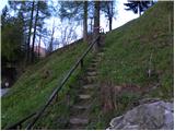 2
2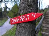 3
3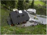 4
4 5
5 6
6 7
7 8
8 9
9 10
10 11
11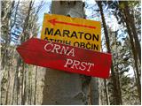 12
12 13
13 14
14 15
15 16
16 17
17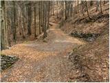 18
18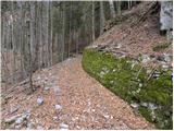 19
19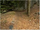 20
20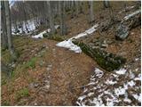 21
21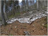 22
22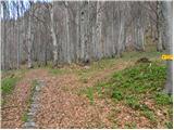 23
23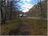 24
24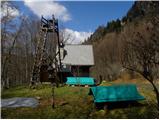 25
25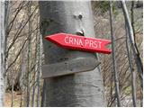 26
26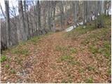 27
27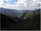 28
28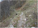 29
29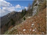 30
30 31
31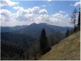 32
32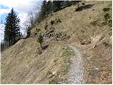 33
33 34
34 35
35 36
36 37
37 38
38 39
39 40
40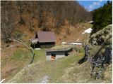 41
41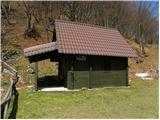 42
42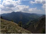 43
43 44
44 45
45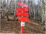 46
46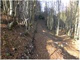 47
47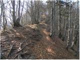 48
48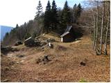 49
49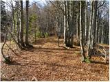 50
50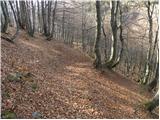 51
51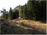 52
52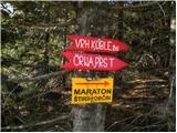 53
53 54
54 55
55 56
56 57
57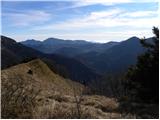 58
58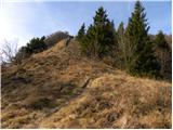 59
59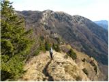 60
60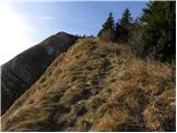 61
61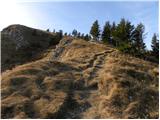 62
62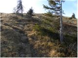 63
63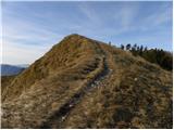 64
64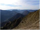 65
65 66
66 67
67 68
68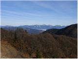 69
69 70
70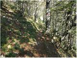 71
71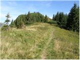 72
72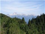 73
73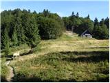 74
74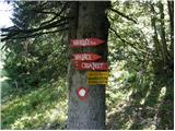 75
75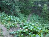 76
76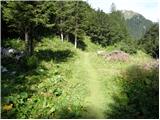 77
77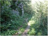 78
78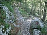 79
79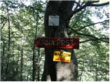 80
80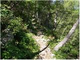 81
81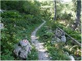 82
82 83
83 84
84 85
85 86
86 87
87 88
88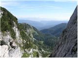 89
89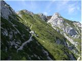 90
90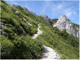 91
91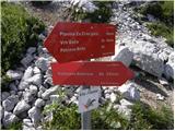 92
92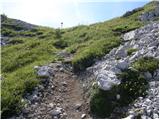 93
93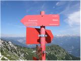 94
94 95
95 96
96 97
97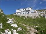 98
98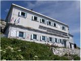 99
99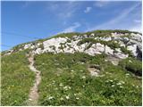 100
100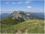 101
101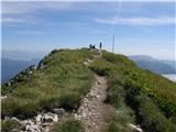 102
102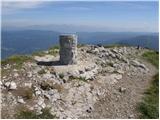 103
103 104
104