Planica (Planinšek) - Planina Podvežak
Starting point: Planica (Planinšek) (1085 m)
Starting point Lat/Lon: 46.3299°N 14.6932°E 
Time of walking: 1 h 25 min
Difficulty: easy marked way
Difficulty of skiing: no data
Altitude difference: 479 m
Altitude difference (by path): 479 m
Map: Kamniške in Savinjske Alpe 1:50.000
Access to starting point:
A) First, we drive to Kamnik, and then we continue driving towards Stahovica and mountain pass Črnivec. Few 100 meters before the mountain pass Črnivec we leave the main road which leads towards Gornji Grad and we continue driving sharply left in the direction of the mountain pass Volovljek (Kranjski Rak). From the mentioned mountain pass we continue straight (left road which leads on Velika planina, right Štajerski Rak) and start descending towards Luče. Lower the road flattens a little and brings us into a valley Podvolovljek. Further at first we drive past the turn-off of the road which leads into a valley Lučka Bela, after that also past Bar pri Gamsu. After the bar, we need to pay attention, because only few 100 meters further road which leads towards the mountain pasture Podvežak and Ravne and farm Planinšek branches off to the left (by the spot, where we leave the main road, there is a road sign approximately 11 km). Further, we drive on at first still asphalt road which is then ascending towards the plateau Dleskovška planota. A little above that, when the asphalt ends in the direction of straight the road continues towards Luče, and we turn sharp left in the direction of Korošica. Further, the road is ascending towards the plateau Dleskovška planota, and we follow it to a crossroad, where a road branches off to the right towards Planica or farm Planinšek. We park on an appropriate place by the crossroad.
B) First, we drive to Luče, and then we continue driving towards Kamnik. When by the road we notice a sign road which shows 10.5 km, we need to pay attention to the right turn off, because only a little further to the right a road towards the mountain pasture Podvežak and Ravne and farm Planinšek branches off. Further, we drive on at first still asphalt road which is then ascending towards the plateau Dleskovška planota. A little above that, when the asphalt ends in the direction of straight the road continues towards Luče, and we turn sharp left in the direction of Korošica. Further, the road is ascending towards the plateau Dleskovška planota, and we follow it to a crossroad, where a road branches off to the right towards Planica or farm Planinšek. We park on an appropriate place by the crossroad.
Path description:
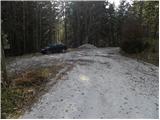
From the starting point, we continue on the left road in the direction of Korošica, mountain pasture Podvežak and mountain pasture Ravne (right Planinšek). The road at first gently ascends through a lane of a forest and then it brings us on meadows above the farm Planinšek. Here we leave the road and we continue left just through meadows upwards. When we get by the edge of the forest nice passage opens up on narrower "clearing", where we also notice the first blazes. On the top of a grassy tongue we continue right into the forest and we continue on an old cart track which is already entirely overgrown with grass. A little higher we turn left and on a cart track we ascend to a some sort of the ridge. Here we continue right and we are then ascending relatively steeply on an indistinct ridge. Higher, we leave the ridge, because rare blazes point us to the left on a quite overgrown footpath which is ascending towards the left. For some time we are still ascending diagonally, and then we ascend to the nearby macadam road which we follow to the left. From the road, on which we continue the ascent, for some time a nice view opens up, and then it returns into the forest. From the road a little higher a dead-end branch branches off to the left, and from here we walk on the road only a short time because we then quickly get to a marked crossroad below the mountain pasture Podvežak.
Here we continue right (possible also already few 10 strides earlier, because marked path from the road branches off already before the crossroad) and on the road or marked footpath in 15 minutes of additional walking, we ascend to the mountain pasture Podvežak.
Pictures:
 1
1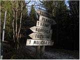 2
2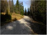 3
3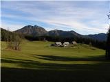 4
4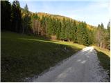 5
5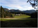 6
6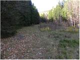 7
7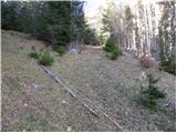 8
8 9
9 10
10 11
11 12
12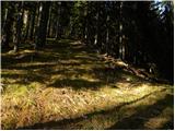 13
13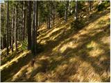 14
14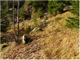 15
15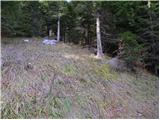 16
16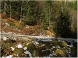 17
17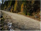 18
18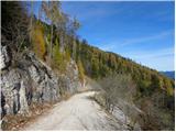 19
19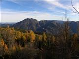 20
20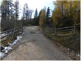 21
21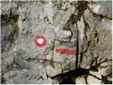 22
22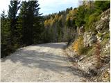 23
23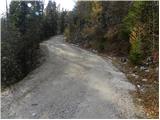 24
24 25
25 26
26 27
27 28
28 29
29 30
30 31
31