Planina Blato - Čelo (via Prodi)
Starting point: Planina Blato (1147 m)
Starting point Lat/Lon: 46.3112°N 13.8501°E 
Path name: via Prodi
Time of walking: 7 h 15 min
Difficulty: easy pathless terrain
Difficulty of skiing: no data
Altitude difference: 1081 m
Altitude difference (by path): 1500 m
Map: TNP 1:50.000
Access to starting point:
From highway Ljubljana - Jesenice we go to the exit Lesce and follow the road towards Bled and forward towards Bohinjska Bistrica. We continue driving towards the Lake Bohinj (Ribčev laz), where we come to the crossroad, where we continue right in the direction of Stara Fužina. In Stara Fužina at the crossroad at the chapel, we turn sharply left on an ascending road in the direction of the mountain pasture Blato, mountain pasture Vogar and valley Voje. The road ahead brings us to the spot, where the road toll or parking fee has to be paid, we follow it forward to the next crossroad, where we continue left (right Voje). Then we follow the road to the next crossroad (we drive for quite some time), where we turn sharply right in the direction of the mountain pasture Blato (straight mountain pasture Vogar). We follow this road to the parking lot before the mountain pasture Blato.
Path description:
From the marked parking lot on the mountain pasture Blato we return few 10 strides back, and then we go on a wide and at first also quite a steep cart track in the direction of Planina pri Jezeru. After 10 minutes of relatively steep ascent, we come at the marked crossing, where we continue on the left steep cart track (straight mountain pasture Planina v Lazu), and a little higher joins also the marked path from the mountain pasture Planina Vogar. We continue on a wide, partly rocky cart track which higher for some time flattens, and then it steeply ascends through a smaller carved passage. Further, the path again flattens and then crosses steep slopes (in snow and ice dangerous for slipping). Only a little further, the path turns sharply to the left and it brings us in a cold small valley named Pungrat, where we cross an abandoned grazing fence. The path ahead again starts ascending steeper, and then turns to the right and entirely flattens. Only few meters ahead from the left joins the path from the mountain pasture Vodični vrh, and we continue straight and after 5 minutes of additional walking, we get to the mountain pasture Planina pri Jezeru, in the middle of which stands a mountain hut.
From the mountain hut, we continue slightly left and at first downwards to a marked crossing, from which we go on the right path in the direction of the mountain pasture Dedno polje (left mountain pasture Viševnik and Pršivec). Still a wide path is at first gently, and then moderately to steeply ascending through a thin spruce forest. Higher, the path over Krištofojca branches off to the left, which leads towards the mountain pasture Viševnik, and we still continue on a wide path, which higher flattens a little and then turns slightly to the right, where in front of us we notice mountain pasture Dedno polje. Here the path turns to the left and after few additional strides, it brings us to the mountain pasture Dedno polje, by the edge of which there is a marked crossing.
We continue straight in the direction of the mountain hut Koča pri Triglavskih jezerih (right valley Za Kopico) on the path which is further gently to moderately ascending through mostly a thin forest. The path from which a nice view opens up on the mountain chain Spodnje Bohinjske gore then descends and brings us on a mountain pasture Ovčarija, where there is the next crossing.
Here we continue slightly left in the direction of the mountain hut Koča pri Triglavskih jezerih (over Prodi) on the path which after few additional minutes brings us to a nice vantage point (a view on Spodnje Bohinjske gore). Here the path turns sharply right and in a moderate descends crosses steep grassy slopes. Further, the path goes into the forest and for a short time starts ascending steeper. The steepness then decreases and the path from a dense forest brings us to a crossing, where from the left joins the path from the lake Črno jezero. We continue straight on the path which is slightly ascending and after few minutes brings us to the spot, where in front of us, we notice lake Dvojno jezero. The path ahead slightly descends to the lake and then continues on the right side. Here we come to a crossing, where right upward, the path to Tičarica branches off. We continue on the bottom path, which after few minutes of additional walking brings us to the mountain hut Koča pri Triglavskih jezerih, which we see in front of us.
From the mountain hut, we continue sharply left in the direction of the mountain hut Dom na Komni on the path which starts to ascend diagonally on the west side of the lake Dvojno jezero. After a short ascent, we come on an indistinct ridge, from which, the path turns right and starts descending. After half an hour of a gentle descent, the path brings us on the mountain pasture Lopučnica, where there is a crossing.
We continue right in the direction of the mountain pasture Za skalo (slightly left Dom na Komni) on a badly beaten path, which crosses slopes of the mountain pasture towards the northwest. The path which runs through high grass (in the summer months) little higher crosses a lane of thin forest and then turns a little towards the left. The path ahead steeply ascends and in few minutes of additional walking brings us on karst terrain of abysses and limestone pavements. Here the path flattens and on rocky terrain starts vanishing (we carefully follow the blazes). On this part, a breathtaking view opens up on mountains, which surround the valley Dolina Triglavskih jezer. We then follow the marked path only to a saddle Velika vrata, which we reach after few additional minutes of a light ascent.
On the other side of Velika vrata we leave an already little-visited path and we continue right on pathless terrain. At first, the passages among dwarf pines and limestone pavement terrain are relatively easy, because we get help from cairns, which are actually rare. We continue the ascent somehow in the direction towards the north, but there aren't any direct passages because of karst terrain. Because of the cracks, we occasionally have to do quite a large turn. When "path" finally brings us on the ridge, the orientation problems end. We continue the ascent on a more and more panoramic ridge and "path" then quickly brings us on an indistinct peak Glava za Bajto.
Further, we slightly descend, after that on a grassy slope of Čelo we ascend on a little known and even less visited peak.
Pictures:
 1
1 2
2 3
3 4
4 5
5 6
6 7
7 8
8 9
9 10
10 11
11 12
12 13
13 14
14 15
15 16
16 17
17 18
18 19
19 20
20 21
21 22
22 23
23 24
24 25
25 26
26 27
27 28
28 29
29 30
30 31
31 32
32 33
33 34
34 35
35 36
36 37
37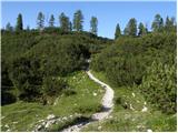 38
38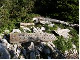 39
39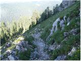 40
40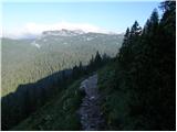 41
41 42
42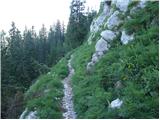 43
43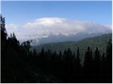 44
44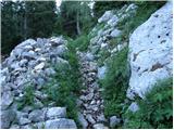 45
45 46
46 47
47 48
48 49
49 50
50 51
51 52
52 53
53 54
54 55
55 56
56 57
57 58
58 59
59 60
60 61
61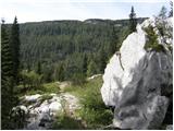 62
62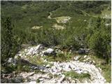 63
63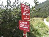 64
64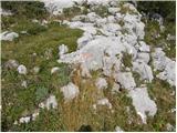 65
65 66
66 67
67 68
68 69
69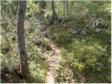 70
70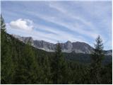 71
71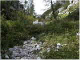 72
72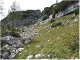 73
73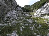 74
74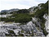 75
75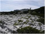 76
76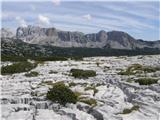 77
77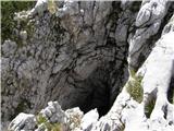 78
78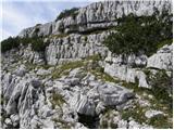 79
79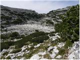 80
80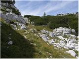 81
81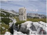 82
82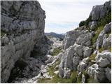 83
83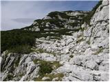 84
84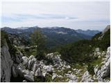 85
85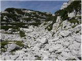 86
86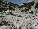 87
87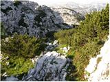 88
88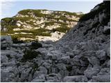 89
89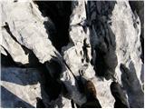 90
90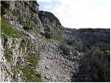 91
91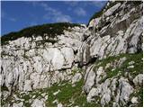 92
92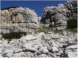 93
93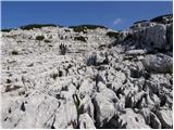 94
94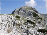 95
95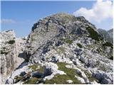 96
96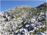 97
97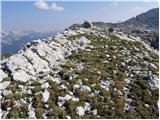 98
98