Planina Blato - Mala Tičarica (via Štapce)
Starting point: Planina Blato (1147 m)
Starting point Lat/Lon: 46.3112°N 13.8501°E 
Path name: via Štapce
Time of walking: 3 h 30 min
Difficulty: easy marked way
Difficulty of skiing: partly demanding
Altitude difference: 924 m
Altitude difference (by path): 1100 m
Map: Triglav 1:25.000
Access to starting point:
From highway Ljubljana - Jesenice we go to the exit Lesce and follow the road towards Bled and forward towards Bohinjska Bistrica. We continue driving towards the Lake Bohinj (Ribčev laz), where we come to the crossroad, where we continue right in the direction of Stara Fužina. In Stara Fužina at the crossroad at the chapel, we turn sharply left on an ascending road in the direction of the mountain pasture Blato, mountain pasture Vogar and valley Voje. The road ahead brings us to the spot, where the road toll or parking fee has to be paid, we follow it forward to the next crossroad, where we continue left (right Voje). Then we follow the road to the next crossroad (we drive for quite some time), where we turn sharply right in the direction of the mountain pasture Blato (straight mountain pasture Vogar). We follow this road to the parking lot above the mountain pasture Planina Blato.
Path description:
From the parking lot on the mountain pasture Blato we go on the road a little back to the signposts at a cart track. Here we go on a cart track which at first steeply ascends and then it is moderately ascending and in ten minutes of walking, it brings us to a crossing, where we go left (straight mountain pasture Planina v Lazu). We then follow the cart track through the forest all the way to cottages on the mountain pasture Planina pri jezeru. Here a view opens up on surrounding hills. We bypass the mountain hut on the left side and the path in a gentle descent brings us to a crossing, where we continue straight on a cart track (left mountain pasture Viševnik). Mostly rocky cart track which runs on an indistinct small valley few times steeply ascends and after a half an hour of walking from the mountain pasture Planina pri Jezeru brings us to a mountain pasture Dedno polje, where we come to the next crossing.
We continue straight in the direction of the mountain hut Koča pri Triglavskih jezerih (right valley Za Kopico) on the path which is further gently to moderately ascending through mostly a thin forest. The path from which a nice view opens up on the mountain chain Spodnje Bohinjske gore then descends and brings us on a mountain pasture Ovčarija, where there is the next crossing. We continue on the right path in the direction of the mountain hut Koča pri Triglavskih jezerih over Štapce (straight path over Prodi). The path ahead is at first moderately ascending through a thin larch forest and then it ascends steeper and through a lane of dwarf pines brings us to panoramic Štapce.
On Štapce we continue slightly right in the direction of Tičarica and Zelnarica (slightly left mountain hut Koča pri Triglavskih jezerih) and we continue the ascent on the path which at first ascends through a lane of dwarf pines, and then it brings us to a short steep and mainly in wet for slipping dangerous jump. Above the jump, the path flattens and passes on moderately steep grassy slopes, after which in few minutes of additional walking, we ascend to a small saddle, where the marked path branches off to the left on Mala Tičarica.
We continue in the mentioned direction (straight Zelnarica) and we ascend over a grassy slope on the ridge of Mala Tičarica. Here the path turns to the right and then continues on and by the ridge. This increasingly panoramic path, which a little below the summit crosses a short slightly exposed slope, we follow all the way to the top, and we reach it after few steps of additional walking.
Blato - Dedno polje 1:30, Dedno polje - Mala Tičarica 2:00.
Pictures:
 1
1 2
2 3
3 4
4 5
5 6
6 7
7 8
8 9
9 10
10 11
11 12
12 13
13 14
14 15
15 16
16 17
17 18
18 19
19 20
20 21
21 22
22 23
23 24
24 25
25 26
26 27
27 28
28 29
29 30
30 31
31 32
32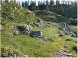 33
33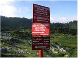 34
34 35
35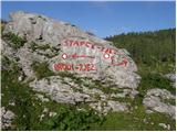 36
36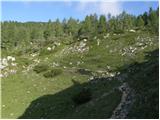 37
37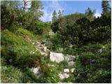 38
38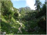 39
39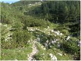 40
40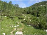 41
41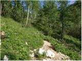 42
42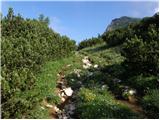 43
43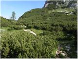 44
44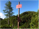 45
45 46
46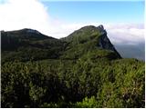 47
47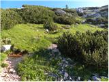 48
48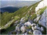 49
49 50
50 51
51 52
52 53
53 54
54 55
55 56
56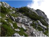 57
57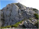 58
58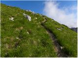 59
59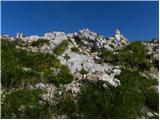 60
60 61
61