Planina Blato - Planina Lopučnica (via Štapce)
Starting point: Planina Blato (1147 m)
Starting point Lat/Lon: 46.3112°N 13.8501°E 
Path name: via Štapce
Time of walking: 3 h 45 min
Difficulty: partly demanding marked way
Difficulty of skiing: no data
Altitude difference: 411 m
Altitude difference (by path): 850 m
Map: TNP 1:50.000
Access to starting point:
From highway Ljubljana - Jesenice we go to the exit Lesce and follow the road towards Bled and forward towards Bohinjska Bistrica. We continue driving towards the Lake Bohinj (Ribčev laz), where we come to the crossroad, where we continue right in the direction of Stara Fužina. In Stara Fužina at the crossroad at the chapel, we turn sharply left on an ascending road in the direction of the mountain pasture Blato, mountain pasture Vogar and valley Voje. The road ahead brings us to the spot, where the road toll or parking fee has to be paid, we follow it forward to the next crossroad, where we continue left (right Voje). Then we follow the road to the next crossroad (we drive for quite some time), where we turn sharply right in the direction of the mountain pasture Blato (straight mountain pasture Vogar). We follow this road to the parking lot before the mountain pasture Blato.
Path description:
From the marked parking lot on the mountain pasture Blato we return few 10 strides back, and then we go on a wide and at first also quite a steep cart track in the direction of Planina pri Jezeru. After 10 minutes of relatively steep ascent, we come at the marked crossing, where we continue on the left steep cart track (straight mountain pasture Planina v Lazu), and a little higher joins also the marked path from the mountain pasture Planina Vogar. We continue on a wide, partly rocky cart track which higher for some time flattens, and then it steeply ascends through a smaller carved passage. Further, the path again flattens and then crosses steep slopes (in snow and ice dangerous for slipping). Only a little further, the path turns sharply to the left and it brings us in a cold small valley named Pungrat, where we cross an abandoned grazing fence. The path ahead again starts ascending steeper, and then turns to the right and entirely flattens. Only few meters ahead from the left joins the path from the mountain pasture Vodični vrh, and we continue straight and after 5 minutes of additional walking, we get to the mountain pasture Planina pri Jezeru, in the middle of which stands a mountain hut.
From the mountain hut, we continue slightly left and at first downwards to a marked crossing, from which we go on the right path in the direction of the mountain pasture Dedno polje (left mountain pasture Viševnik and Pršivec). Still a wide path is at first gently, and then moderately to steeply ascending through a thin spruce forest. Higher, the path over Krištofojca branches off to the left, which leads towards the mountain pasture Viševnik, and we still continue on a wide path, which higher flattens a little and then turns slightly to the right, where in front of us we notice mountain pasture Dedno polje. Here the path turns to the left and after few additional strides, it brings us to the mountain pasture Dedno polje, by the edge of which there is a marked crossing.
We continue straight in the direction of the mountain hut Koča pri Triglavskih jezerih (right valley Dolina za Kopico) on the path which is further gently to moderately ascending through mostly thin forest. The path, from which a nice view opens up on Spodnje Bohinjske gore then descends and brings us on the mountain pasture Ovčarija, where there is the next crossing.
We continue on the right path in the direction of Koča pri Triglavskih jezerih over Štapce (straight path over Prodi). The path ahead is at first moderately ascending through a thin larch forest and then it ascends steeper and through a lane of dwarf pines brings us to panoramic Štapce.
Here we continue left downwards towards the lake Dvojno jezero, which we clearly see below us (right Mala Tičarica). The path immediately from Štapce starts descending steeply on very well secured path (path is secured with a steel cable, in the lower part also with a ladder). After less than 5 minutes of descent path passes on the scree and then descends to the lake Dvojno jezero, where we continue right towards the mountain hut (left path over Prodi and lake Črno jezero). A gently sloping path then on the right side bypasses lake and it quickly brings us to the mountain hut Koča pri Triglavskih jezerih.
From the mountain hut, we continue sharply left in the direction of the mountain hut Dom na Komni on the path which starts to ascend diagonally on the west side of the lake Dvojno jezero. After a short ascent, we come on an indistinct ridge, from which, the path turns right and starts descending. After half an hour of a gentle descent, the path brings us on the mountain pasture Lopučnica, where there is a crossing.
Pictures:
 1
1 2
2 3
3 4
4 5
5 6
6 7
7 8
8 9
9 10
10 11
11 12
12 13
13 14
14 15
15 16
16 17
17 18
18 19
19 20
20 21
21 22
22 23
23 24
24 25
25 26
26 27
27 28
28 29
29 30
30 31
31 32
32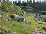 33
33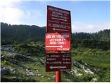 34
34 35
35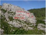 36
36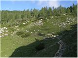 37
37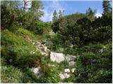 38
38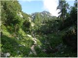 39
39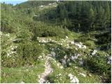 40
40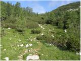 41
41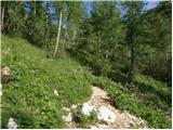 42
42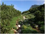 43
43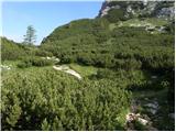 44
44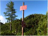 45
45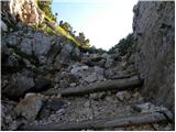 46
46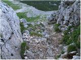 47
47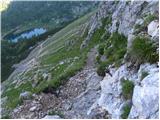 48
48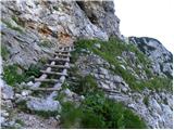 49
49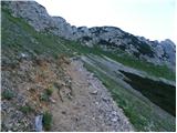 50
50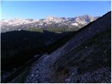 51
51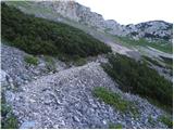 52
52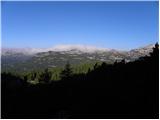 53
53 54
54 55
55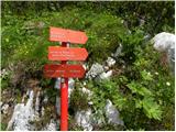 56
56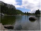 57
57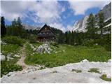 58
58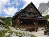 59
59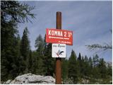 60
60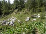 61
61 62
62 63
63 64
64 65
65 66
66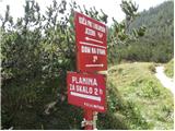 67
67