Planina Blato - Planina v Lazu
Starting point: Planina Blato (1147 m)
Starting point Lat/Lon: 46.3112°N 13.8501°E 
Time of walking: 1 h 40 min
Difficulty: easy marked way
Difficulty of skiing: partly demanding
Altitude difference: 413 m
Altitude difference (by path): 500 m
Map: Triglav 1:25.000
Access to starting point:
From the Ljubljana-Jesenice motorway, take the Lesce exit and follow the road towards Bled and further towards Bohinjska Bistrica. Continue driving towards Lake Bohinj (Ribčev laz), where you reach a junction and continue right towards Stara Fužina. In Stara Fužina, at the junction by the chapel, turn sharply left onto the ascending road towards Planina Blato, Planina Vogar and Voje valley. The road then takes you to the toll and parking fee point, but follow it further to the next junction, where you continue left (right Voje). Follow the road to the next junction (driving takes quite some time), where you turn sharply right towards Planina Blato (straight Planina Vogar). Then follow this road to the parking lot above Planina Blato.
Path description:
From the marked parking lot in front of Planina Blato, return slightly back and head to a wide and initially steep cart track, alongside which are signs for Planina pri Jezeru. After about ten minutes of ascent, arrive at a marked junction, from where continue slightly right towards Planina v Lazu (left Koča na Planini pri Jezeru).
The path also continues through the forest, but gently ascends to a junction a few minutes away, where a steep path to Planina pri Jezeru branches left.
Here the path to Planina v Lazu turns right and gradually becomes steeper again, ascending transversely through the forest for some time, higher up entering the forested valley Pri deklici. The path continues northwestwards, still ascending through the spruce forest. When the forest flattens higher up, arrive at an unmarked junction, where an unmarked shortcut to Ogradi and Planina Krstenica branches right, we follow the gentle path continuation to the marked junction near Planina v Lazu.
Here a marked path to Planina Krstenica and path to Ogradi branches sharply right, we continue straight towards Planina v Lazu and in a few minutes of moderate descent arrive at the mentioned pasture, where a large number of shepherds' huts stand, and in the middle of the pasture also a dairy.
Starting point - Pri deklici 1:00, Pri deklici - junction before Planina v Lazu 0:35, junction before Planina v Lazu - Planina v Lazu 0:05.
On the way: Pri deklici (1463m), Razpotje pred Planino v Lazu (1602m)
Trip can be extended to: Planina Blato (5 h 30 min)
,
Koča na Planini pri Jezeru (1 h)
,
Vrh Hribaric (3 h 30 min)
,
Debeli vrh (2 h 30 min)
,
Vršaki (Vrh za Koritami) (4 h 10 min)
,
Vršaki (Srednji vrh) (3 h 50 min)
,
Vršaki (South peak) (4 h 20 min)
,
Vršaki (Vzhodni vrh) (3 h 30 min)
,
Teme (Hribarice) (4 h 35 min)
,
Poprovec (4 h 50 min)
,
Kanjavec (4 h 15 min)
,
Kanjavec (West peak) (4 h 15 min)
Pictures:
 1
1 2
2 3
3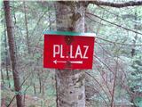 4
4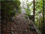 5
5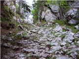 6
6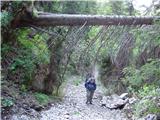 7
7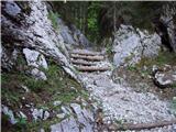 8
8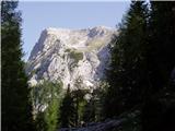 9
9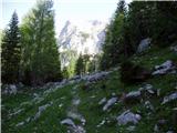 10
10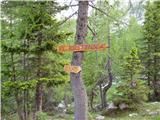 11
11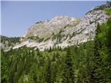 12
12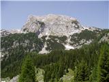 13
13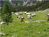 14
14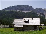 15
15