Planina Blato - Prevalski Stog
Starting point: Planina Blato (1147 m)
Starting point Lat/Lon: 46.3112°N 13.8501°E 
Time of walking: 3 h 20 min
Difficulty: partly demanding unmarked way
Difficulty of skiing: partly demanding
Altitude difference: 928 m
Altitude difference (by path): 1000 m
Map: Triglav 1:25.000
Access to starting point:
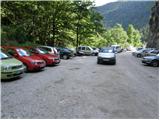
From highway Ljubljana - Jesenice we go to the exit Lesce and follow the road towards Bled and forward towards Bohinjska Bistrica. We continue driving towards the Lake Bohinj (Ribčev laz), where we come to the crossroad, where we continue right in the direction of Stara Fužina. In Stara Fužina at the crossroad at the chapel, we turn sharply left on an ascending road in the direction of the mountain pasture Blato, mountain pasture Vogar and valley Voje. The road ahead brings us to the spot, where the road toll or parking fee has to be paid, we follow it forward to the next crossroad, where we continue left (right Voje). Then we follow the road to the next crossroad (we drive for quite some time), where we turn sharply right in the direction of the mountain pasture Blato (straight mountain pasture Vogar). We follow this road to the parking lot above the mountain pasture Planina Blato.
Path description:
From the parking lot, we continue on a macadam road which past a gate in few steps brings us to a right turn. On the right side of the mentioned turn, we will notice the beginning of the hunting path, which with the help of steel cables leads over a shorter very steep slope. The path soon passes into the forest and turns slightly towards the right, where soon crosses a wide cart track (to here possible also on the road, or higher cart track). Further, we are ascending on a pleasant forest path, which is ascending parallel with a relatively steep cart track. Higher, the path turns to the left, and from the right joins the footpath which leaves the cart track approximately 15 minutes above the mountain pasture Blato.
The hunting path further continues through the forest with some shorter steep ascents and after a good hour of walking, it brings us to a smaller hunting cottage on the left side of the path. Here a minute long path to the vantage point branches off to the left, where below us we can notice a mountain pasture Blato.
From the hunting cottage ahead, the path soon brings us out of the forest, where we again join the cart track. Next follows only a good five minutes of walking to the mountain pasture Krstenica, where a beautiful view opens up on Ogradi, Krn and Spodnje Bohinjske gore.
From the mountain pasture, we continue further on the path which at first is a little poorly visible on the western (left) side of the mountain pasture. Already after few ten meters, several smaller footpaths join into a one well visible path. The path ahead with some shorter ascents and descents crosses slopes of Mali and Jezerski Stog. After approximately half an hour of walking from Krstenica, the path brings us on a grassy terrain of abandoned mountain pasture Jezerce.
From the mountain pasture, we continue to a trough with water and we ascend few ten meters upwards towards the saddle Jezerski preval. Here we leave the marked path and go left into a smaller valley below the scree, where we notice an unmarked footpath. The path which at first slightly ascends, then in a gentle descent crosses slopes below the cliffs on our right side. A little further, the path turns right and starts ascending on in parts poorly visible footpath. The path then through a series of smaller valleys brings us below the slopes of Prevalski Stog. Here in front of us we notice Mišeljski preval, which is situated between Škednjovec on the left and Prevalski Stog on the right. The path which in the last meters relatively steeply ascends brings us on the mentioned saddle.
On the saddle, we go right steeply upwards. Steep and in wet for slipping dangerous ridge path we follow to the upper slopes of Prevalski Stog. After a little less than ten minutes, the steepness decreases and then follows five more minutes of walking on panoramic upper grassy slope of the mountain.
Blato - Krstenica 1:30, Krstenica - Jezerce 30 minutes, Jezerce - Prevalski Stog 1:20.
Pictures:
 1
1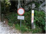 2
2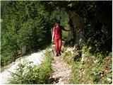 3
3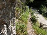 4
4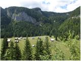 5
5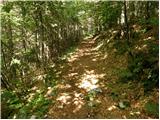 6
6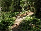 7
7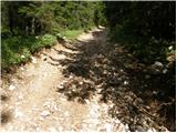 8
8 9
9 10
10 11
11 12
12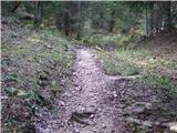 13
13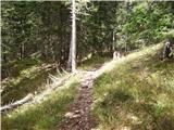 14
14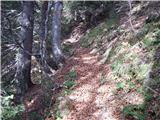 15
15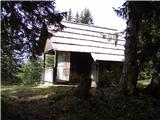 16
16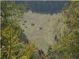 17
17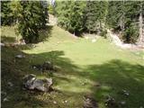 18
18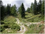 19
19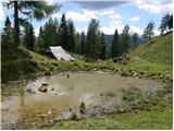 20
20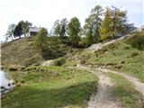 21
21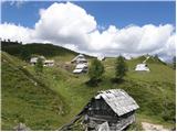 22
22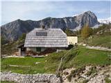 23
23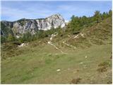 24
24 25
25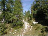 26
26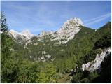 27
27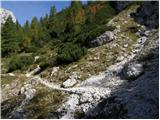 28
28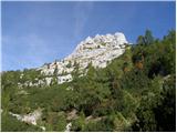 29
29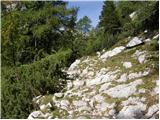 30
30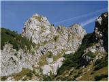 31
31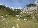 32
32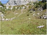 33
33 34
34 35
35 36
36 37
37 38
38 39
39 40
40 41
41 42
42 43
43 44
44 45
45 46
46 47
47 48
48