Starting point: Planina Krnica (1240 m)
Starting point Lat/Lon: 46.35274°N 13.50801°E 
Time of walking: 4 h
Difficulty: very difficult pathless terrain
Difficulty of skiing: no data
Altitude difference: 1166 m
Altitude difference (by path): 1180 m
Map: Julijske Alpe - zahodni del 1:50.000
Access to starting point:
We drive into the center of Bovec, where from a crossroad at the main square we continue on an ascending road which past the post office starts ascending towards the nearby church. We bypass the mentioned church on the left side, and then we get to Kaninska vas. Bovec then ends and the road for some time leads towards the west. At a smaller crossing we leave the main asphalt road which leads towards the village Plužna and we continue driving on a slightly right road (behind the crossroad there are signs for road Gozdec). Behind the nearby homestead, the road once again splits, this time we choose a slightly left road (slightly right Zavrzelno and the starting point of the path on Rombon). Further, we are ascending on a macadam road which higher brings us to B cableway station on Kanin. At B station, the road turns sharply left and then in a diagonal ascent after approximately 1 km of additional driving brings us to the next crossroad. At the mentioned crossroad, we continue sharply right towards the mountain pasture Krnica (left Gozdec). Later road towards C and D station branches off to the left. We continue straight all the way to the mountain pasture Krnica where there is a smaller parking lot. In the last part towards the mountain pasture Krnica the road is in quite bad condition.
Path description:
From the parking lot on the mountain pasture Krnica we go left on a marked footpath which starts ascending and it quickly brings us into a lane of thin forest. The forest soon ends and the path further leads on a mostly grassy terrain by which at first still grow dwarf pines. The path which runs through the valley Krnica slowly turns slightly to the left and then runs towards the northwest. Only occasionally a little steeper path, higher passes over from grassy slopes on the scree below the slopes of Lopa. The path later a little steeper ascends and soon brings us to a ski slope on Prevala where there is also a crossing.
On the saddle Prevala we continue right and start ascending on the ski slope towards the upper station of italian cable car. Here from the path at first a nice view opens up towards the west, after that also towards the north where there are clearly visible Montaž and Viš. When the path on a ski slope turns to the right from the left also the path 536 from the saddle Nevejsko sedlo (Sella Nevea) joins. Only a short ascent follows to the upper cableway station.
At the upper station of the cable car we go left on an unmarked footpath which crosses scree on the northern slopes towards the east. The path at first in a gentle ascent crosses slopes below the northern walls of the ridge Vršiči pod Lopo (Monte Golovec). When we come on northwestern side of the mentioned ridge on the right a view opens up towards the notch Forca sopra Medon. We still continue on a footpath which crosses slopes towards the east. The footpath which then occasionally also ascends a little we follow all the way to the notch on the eastern side of the peak Lopa.
Approximately 10 meters before the notch (first a little easier passage from the saddle on the north side) we go right upward towards the ridge. After an initial very short ascent terrain slightly flattens and in front of us, we will notice a short gully. On this part there's also some gravel on the slope. We go straight towards the mentioned gully. After only few meters of the ascent on gully we continue left on a ledge.
When we are on the mentioned ledge we have two options. We can already after a few meters of crossing on the ledge, go right and few meters of climbing to the ridge follows. If we go right on the right spot difficulty of climbing doesn't exceed 1st grade. The second option is that on the mentioned ledge we continue to cross so that we come on the south side of the ridge. On the south side where the slope is a little covered with grass for a short time, we still cross a steep slope below the ridge. When the slope above us becomes a little less steep we go right on a ridge.
Further, we walk on the ridge and ascent for some time becomes less demanding. While walking on a panoramic ridge we also have some help from the cairns. A little higher we come again to more steep slopes. In the initial part of the steep slopes we stick to the left side, after that approximately on the halfway we cross a steep slope, which is partly covered with grass to the right. For orientation we also get some help from the few cairns. Next a short steep ascent follows and then we continue to the left and soon we again reach the ridge.
Further then we all the time walk on a ridge all the way to a scenic summit. In the last part of the ridge there's few very short steep ascents, which don't cause any bigger problems.
We descend on the ascent route.
For less experienced on the harder parts belaying with a rope is recommended.
On the way: Prevala (2067m), Sella Golovec (2133m)
Pictures:
 1
1 2
2 3
3 4
4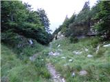 5
5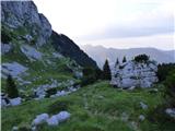 6
6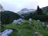 7
7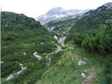 8
8 9
9 10
10 11
11 12
12 13
13 14
14 15
15 16
16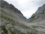 17
17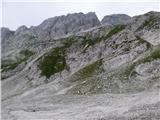 18
18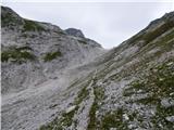 19
19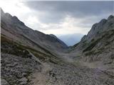 20
20 21
21 22
22 23
23 24
24 25
25 26
26 27
27 28
28 29
29 30
30 31
31 32
32 33
33 34
34 35
35 36
36 37
37 38
38 39
39 40
40 41
41 42
42 43
43 44
44 45
45 46
46 47
47 48
48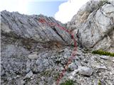 49
49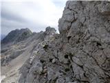 50
50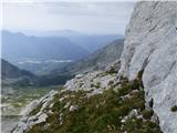 51
51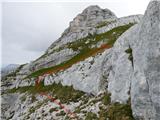 52
52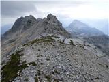 53
53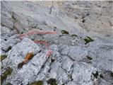 54
54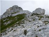 55
55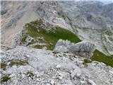 56
56 57
57 58
58 59
59 60
60 61
61 62
62 63
63 64
64 65
65 66
66 67
67 68
68 69
69 70
70 71
71 72
72 73
73 74
74 75
75 76
76 77
77 78
78