Starting point: Planina Kuk (1150 m)
Starting point Lat/Lon: 46.2112°N 13.7872°E 
Time of walking: 2 h 45 min
Difficulty: easy unmarked way
Difficulty of skiing: no data
Altitude difference: 420 m
Altitude difference (by path): 450 m
Map: TNP 1:50.000
Access to starting point:
Between Most na Soči and Tolmin we notice signs for village Poljubinj, which point us on a side road, on which we soon get to the mentioned village. We continue driving on an ascending road which a little higher brings us in the village Ljubinj, where we continue left in the direction of the mountain hut Koča na planini Razor and mountain pasture Stador. Further, we are ascending on narrow, steep and asphalt road which higher brings us to the spot, where the road towards the mountain hut Koča na planini Stador and Paragliding site Kobala branches off sharply to the right. Here we continue straight, further to the mountain pasture Lom we drive without large changes in altitude. Behind the mountain pasture Lom we follow the signs for mountain hut Koča na planini Razor, and on the road which is mostly ascending diagonally towards the right, we drive to a marked parking lot, which is located before the mountain pasture Kuk. Further driving is forbidden.
Path description:
From the parking lot, we continue on for public traffic closed road, on which we quickly get to mountain dairy on the mountain pasture Kuk (also Podkuk). Behind mountain dairy path starts moderately ascending towards the right, on left turn (zig zag), from the right also joins geological trail (also the path from Kneške Ravne).
We continue left and we quickly get to a crossing, where the path on Žabiški Kuk branches off to the right (also Žabijski Kuk) - path past Gradič (old military path).
We continue in the direction of the mountain pasture Razor and we continue on a gently sloping macadam road which crosses the western slopes of Žabiški Kuk. On the road, from which occasionally a nice view opens up towards the northwest, where we see Rdeči rob, Vrh nad Peski, Grušnica, Tolminski Migovec and other surrounding mountains, after approximately 25 minutes of additional walking, we get to the spot, where signs for mountain hut point us to the right, on the path which ascends diagonally above the road. Next follows only few minutes of walking and the path brings us to the mountain hut Koča na planini Razor.
Mountain hut we bypass on the right side, and then we continue in the direction of Tolmin and Krn. A gentle descent follows on partly concrete road, and when the road turns left towards the nearby cheese cottage, we go slightly right on a marked footpath in the direction of the mountain pasture Planina na Kalu and Krn. Next follows an easy walk on an ample and panoramic mountain pasture Razor, and the path turns also a little to the left, so that the path leads towards the west. A gently sloping path at first leads with nice views on Grušnica and Tolminski Migovec, and when we reach the edge of the mountain pasture, nice view opens up also in the direction of Tolmin. From edge of the mountain pasture path turns right and passes into the forest, through which is occasionally gently descending. A little further, the path brings us by the bottom edge of the cliffs of the peak Kopecko, and follows also a crossing of Alpine valley. On the other side of a small valley path returns into the forest, and from the left joins the worse beaten path from Tolminske Ravne (path, which from Tolminske Ravne leads directly towards Škrbina), and a little ahead we also get to a well-marked crossing.
We continue right in the direction of the mountain pasture Planina na Kalu and Krn (straight Tolminske Ravne and mountain pasture Spodnji Kal) and we start ascending steeper, mostly through the forest. After 15 minutes of ascent we get to the next crossing, where we choose the left path (right Škrbina and Vrh nad Škrbino). The path ahead flattens and gradually brings us out of the forest. Next follows gently sloping diagonal ascent towards the left, and from the path increasingly beautiful views are opening up. When lane of dwarf pines end, we get to the mountain pasture Planina na Kalu, and we walk to the nearby cottages.
From the saddle, from where a nice view opens up towards the valley of Tolminka, Vrh nad Peski, and a view is also nice on peaks above Tolminske Ravne, which we occasionally already saw during the ascent, we continue slightly left from the ridge of Grušnica, on easy to follow path. After a shorter diagonal ascent we reach the eastern ridge of Grušnica, from where a nice view opens up towards the south. Here the path turns a little to the right, and then in few minutes of more and more panoramic walking it brings us on a panoramic peak, from which a nice view opens up on surrounding mountains.
The starting point - Koča na planini Razor 1:00, Koča na planini Razor - Planina na Kalu 1:30, Planina na Kalu - Grušnica 0:15.
Pictures:
 1
1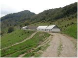 2
2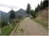 3
3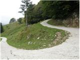 4
4 5
5 6
6 7
7 8
8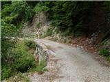 9
9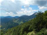 10
10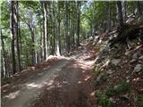 11
11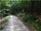 12
12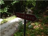 13
13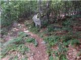 14
14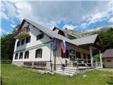 15
15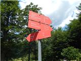 16
16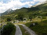 17
17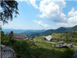 18
18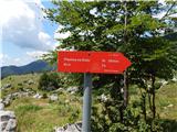 19
19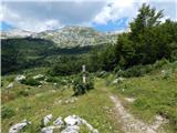 20
20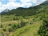 21
21 22
22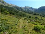 23
23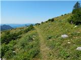 24
24 25
25 26
26 27
27 28
28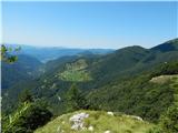 29
29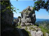 30
30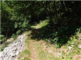 31
31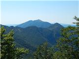 32
32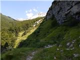 33
33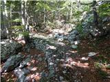 34
34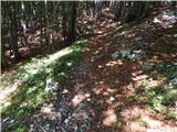 35
35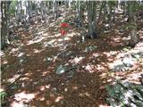 36
36 37
37 38
38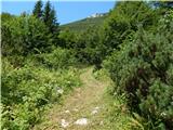 39
39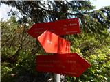 40
40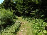 41
41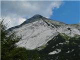 42
42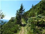 43
43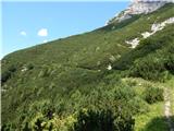 44
44 45
45 46
46 47
47 48
48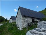 49
49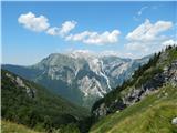 50
50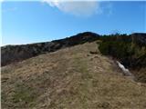 51
51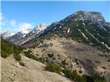 52
52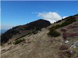 53
53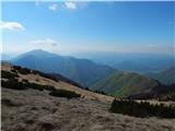 54
54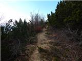 55
55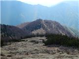 56
56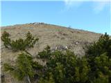 57
57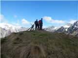 58
58 59
59