Planina Kuninja - Srednji vrh (above lake Jezero v Lužnici)
Starting point: Planina Kuninja (991 m)
Starting point Lat/Lon: 46.2413°N 13.663°E 
Time of walking: 3 h 30 min
Difficulty: easy marked way, easy pathless terrain
Difficulty of skiing: no data
Altitude difference: 1041 m
Altitude difference (by path): 1085 m
Map: Julijske Alpe - zahodni del 1:50.000
Access to starting point:
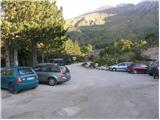
From Tolmin we drive towards Kobarid or vice versa, but only to the place where signs for Kamno direct us to the right (from the direction of Kobarid, left) over a bridge. We then follow a relatively narrow and ascending road in the direction of the village Vrsno and higher Krn. From the village of Krn we continue in the direction of the Koča na planini Kuhinja mountain hut. When we arrive at a large parking lot, where the road towards Koča na planini Kuhinja continues on a slightly left road, we park on a large paid parking lot.
Path description:
From the parking lot, we head to the upper right road in the direction of the mountain pasture Kašina, mountain pasture Leskovica and lake in Lužnica (left Koča na planini Kuhinja 3 minutes, Krn and Batognica). The road, which further moderately ascends, already after a few steps of further walking brings us to the next crossroad, where we again continue right (left mountain pasture Zaslap). A relatively gentle road, which gradually turns into a cart track, then brings us to expansive grassy slopes, where we step onto the pastures of Planina Kašina.
Here the road or cart track turns even more to the right, then makes a sharp left turn and continues crossing the slopes to the right. After approximately 40 minutes of moderate ascent, a relatively panoramic path brings us to the Planina Leskovca overgrown with nettles.
From the mentioned mountain pasture we continue slightly left along the marked and initially quite gentle mountain path. The path, which transitions to the western and increasingly steep grassy slopes, is joined higher from the right by a somewhat less trodden path from Planina Sleme.
We continue in the direction of Krn and the path steepens upwards. Further we ascend steep slopes between Maselnik (1906 m) on the left and Veliki Stador (1903 m) on the right. Higher the path turns and brings us into a smaller cirque, where to the right an unmarked path to Rdeči rob branches off (the junction is marked). The marked path here turns left and ascends a short steep slope, then levels out and brings us to the saddle between Maselnik and Škofič. Here we continue straight ahead and then along the lower path (the right upper path bypasses the lake); in a few minutes of descent we arrive at the lake in Lužnica, which we can already see from the aforementioned saddle.
From the lake we gently ascend along a poorly visible track (direction north), then join the path that bypasses the lake on the right side. Further we ascend through a beautiful high mountain valley (Peski po Lužnici), then the path turns slightly left and ascends more steeply. A short steep ascent follows and the path brings us to the ridge north of Srednji vrh.
At this point we leave the marked path and continue the ascent left through easier pathless terrain. Already after a few steps we return to the ridge and a less trodden path quickly brings us across the locally narrower ridge to the panoramic summit.
Planina Kuhinja - Planina Leskovica 0:40, Planina Leskovica - Jezero v Lužnici 2:20, Jezero v Lužnici - Srednji vrh 0:30.
Pictures:
 1
1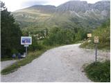 2
2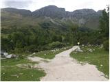 3
3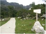 4
4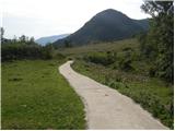 5
5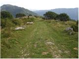 6
6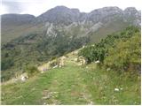 7
7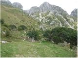 8
8 9
9 10
10 11
11 12
12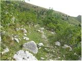 13
13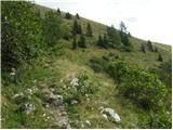 14
14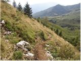 15
15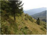 16
16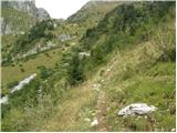 17
17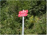 18
18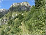 19
19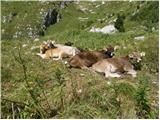 20
20 21
21 22
22 23
23 24
24 25
25 26
26 27
27 28
28 29
29 30
30 31
31 32
32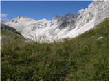 33
33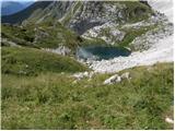 34
34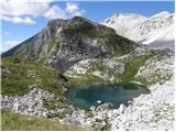 35
35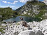 36
36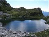 37
37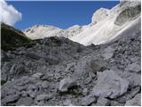 38
38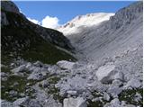 39
39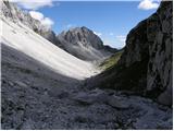 40
40 41
41 42
42 43
43 44
44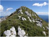 45
45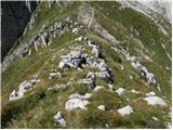 46
46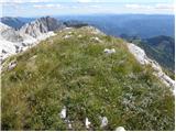 47
47