Planina pod Golico - Barentaler Kotschna/Struška
Starting point: Planina pod Golico (980 m)
Starting point Lat/Lon: 46.4706°N 14.0599°E 
Time of walking: 3 h
Difficulty: easy unmarked way
Difficulty of skiing: easily
Altitude difference: 964 m
Altitude difference (by path): 964 m
Map: Karavanke - osrednji del 1:50.000
Access to starting point:
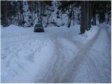
From highway Ljubljana - Jesenice we go to the exit Lipce (possible also Hrušica) and follow the road ahead in the direction of Jesenice, and there signs for Planina pod Golico point us on an ascending road (turn-off is marked and is located at health center in Jesenice). The relatively steep road soon brings us in the mentioned village, where we can in May on surrounding meadows admire blooming of daffodils. From Planina pod Golico we drive ahead to the next crossroad, where we notice numerous signposts. Here we continue right and we drive good 50 meters to the parking lot below Savske jame.
Path description:
From the parking lot, we continue on the bottom road in the direction of Golica and sledding track Savske jame. After 10 minutes sledding track goes left steep upwards, and we continue on a wide road which is still moderately ascending by the stream. A little further, we come to the crossroad, where we continue straight (between the both roads) in the direction of Golica. Further, we are ascending on a worse, quite overgrown cart track which after 15 minutes of a moderate ascent brings us to a macadam road which we only cross. Next follows crossing of a grazing fence and the path brings us on grassy slopes of Markljev rovt.
From Markljev rovt we continue slightly right (slightly left Golica) on a footpath which is slightly ascending by the riverbed of a torrent. Higher, the path becomes a little steeper, crosses the mentioned torrent and then turns right, where after few minutes of additional walking joins the road from Pusti rovt.
We follow the road to the left, but only to a crossing, where signs for Struška point us to the right (left Golica). And only few steps ahead we step on a newer forest road which we follow to the right (straight old path). This road which at first runs through the forest, and higher over avalanche slope, we follow all the way to the mountain pasture Belska planina (Svečica) from which a beautiful view opens up.
From the mountain pasture, we continue towards the east at first only slightly upwards. After five minutes of walking from the hut path brings us to less steep gully, where we continue left on a poorly visible unmarked path (straight mountain pasture Seča).
Further, we are ascending on with grass vegetated gully, which is surrounded by dwarf pines. Still hard to follow footpath on the top of this gully turns right on ample slopes of Struška. The path ahead in a moderate ascent crosses southwestern slopes of Struška, which are partly covered with dwarf pines (because the path is hard to follow we can quickly go astray into dwarf pines). A little below the summit "path" brings us on a ridge which we follow to the peak.
Orientation from the mountain pasture to the top is a little harder, and in fog very difficult.
Pictures:
 1
1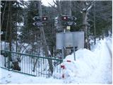 2
2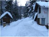 3
3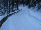 4
4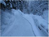 5
5 6
6 7
7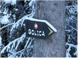 8
8 9
9 10
10 11
11 12
12 13
13 14
14 15
15 16
16 17
17 18
18 19
19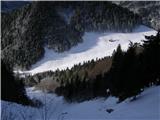 20
20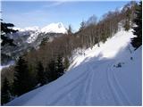 21
21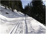 22
22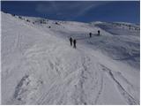 23
23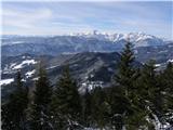 24
24 25
25 26
26 27
27 28
28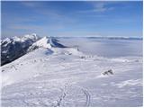 29
29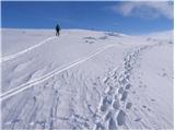 30
30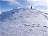 31
31 32
32