Planina Podvežak - Deska (Veža) (snowy approach)
Starting point: Planina Podvežak (1500 m)
Starting point Lat/Lon: 46.3319°N 14.6726°E 
Path name: snowy approach
Time of walking: 1 h 30 min
Difficulty: easy unmarked way
Difficulty of skiing: partly demanding
Altitude difference: 470 m
Altitude difference (by path): 470 m
Map: Kamniške in Savinjske Alpe 1:50.000
Access to starting point:
A) From Kamnik we drive to Stahovica, where we come to a crossroad of two roads. The left one goes into the valley of Kamniška Bistrica, ours goes straight in the direction of Črnivec. We follow the considerably winding road almost to the mountain pass Črnivec. A few hundred meters before the mountain pass, a steep road to Kranjski rak branches off sharply to the left. The road then brings us to the snack bar at Kranjski rak, and only a few meters ahead to a crossroad. We continue straight downwards towards Luče. After a longer descent, the road brings us into the valley of Podvolovjek. Here on the left side of the road, we notice the bar Pri Gamsu. We drive approximately another 100 m to the spot where on the right side we notice signposts for Korošica, Podvežak, Ravne... (the road marker is just over 11 km). Here we turn left onto this road and follow it in the next crossroads according to the signs for mountain pasture Podvežak. The crossroads are marked with signposts. We park on the parking lot by the smaller wooden garage, where a worse road closed to traffic branches off to the right (barrier; if it is open, do not continue driving because others are already on the outer side).
B) From the Štajerska side, we drive to Mozirje and follow the road ahead towards Logarska dolina. In the village Luče, we turn left towards Kamnik and follow the road to the road marker 10.5 km. Here we need to pay attention because soon a road to mountain pasture Podvežak branches off to the right. On the left side of the road are signposts for Korošica. We turn onto this road, and at the crossroads follow the signs for mountain pasture Podvežak. Further, follow the upper description.
PS: The road is in winter time plowed up to Planinšek approximately 1100 m altitude. When the road crosses a large clearing above Planinšek, we can continue the ascent along this clearing to the left upwards, where there is a marked path. When we reach the road, we follow it to the left to the parking lot. Further, follow the description.
Path description:
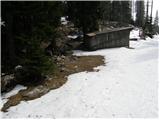
From the parking lot, we head onto the worse road, which first takes us through the forest and then along the edge of the mountain pasture to the hut on the mountain pasture. On the mountain pasture, a signpost directs us to the right upwards along the mountain pasture. Quickly the path takes us into the forest, which we soon leave. Further, we walk through a smaller valley surrounded by sparse forest. At the end of the smaller valley, the path turns slightly left and then crosses the slopes with a few short descents and ascents. After the last descent, the path brings us to a nice plain, where we leave the marked path to Korošica. At the end of the plain, slightly to the left an at first indistinct valley opens up. We head into this valley and follow it upwards. If there is little snow, we must pay attention to find suitable passages between the dwarf pines. Since the dwarf pines are not very dense, it will not be hard for us to find these passages. We follow the valley, which in unfavorable conditions is exposed to avalanches, further to the spot where on the right side a nice passage opens (the passage straight upwards is quite steep and dangerous for slipping and avalanche). This passage is somewhat steeper but not too much. At the top of this passage, to the left an indistinct gentle valley opens up. Further, we walk through this valley, which soon bypasses a sinkhole on the right side and then brings us with a gentle ascent to the saddle between Tolsti vrh on the right and Deska on the left. Here we head left along the wide summit ridge, which is locally overgrown with dwarf pines, and in about ten minutes reach the summit where a cairn stands.
Pictures:
 1
1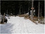 2
2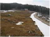 3
3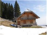 4
4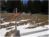 5
5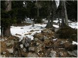 6
6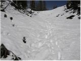 7
7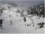 8
8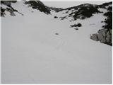 9
9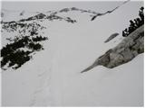 10
10 11
11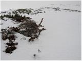 12
12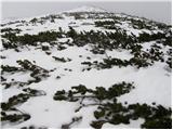 13
13 14
14