Planina Polog - Velika Baba (via Velika Montura)
Starting point: Planina Polog (457 m)
Starting point Lat/Lon: 46.238°N 13.7232°E 
Path name: via Velika Montura
Time of walking: 5 h 40 min
Difficulty: easy unmarked way
Difficulty of skiing: no data
Altitude difference: 1559 m
Altitude difference (by path): 1615 m
Map: TNP 1:50.000
Access to starting point:
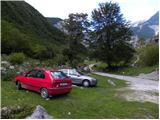
First, we drive to Tolmin, from there we follow the road in the direction of Zatolmin (main road we leave at the traffic light). In Zatolmin we notice signposts for Javorca, which point us on an ascending road towards Javorca. Occasionally quite narrow and in parts precipitous road after approximately 8 km of driving brings us to a smaller crossroad, where the road towards Javorca branches off to the left upwards. We continue straight, and we follow the road only for approximately 100 meters and then on an appropriate place by the gate we also park.
Path description:
From the starting point, we continue on a macadam road which is closed for public traffic, and there in few minutes of easy walking we get to the main part of the mountain pasture Polog, where there are few cottages.
Behind the mountain pasture, the road becomes even a little worse, and after few minutes of additional walking brings us to a crossing, where the path towards the mountain pasture Planina na Prodih branches off to the right (access to the mountain pasture is very interesting, because we have to cross river Tolminka, and this is done by a manual cableway). We continue straight, and the road finally changes into a cart track and higher into a well-preserved mule track. The path then becomes a little steeper and past two benches and higher fresh rockfall (earthquake in Posočje 1998) brings us to a grazing fence, over which we step on the south edge of the mountain pasture Planina pod Osojnica. Only few meters ahead, the path splits, and we continue on the right bottom path, on which in a gentle descent, we quickly get to the hunting cottage at the source of Tolminka.
From the source of Tolminka we continue a gentle ascent through the mountain pasture Planina pod Osojnico, and from the left soon joins the upper path, which is exposed to active rockfall.
We continue in the direction of "Planina Prode and Prehodci" on the path which brings us to a mighty torrent. We cross a torrent and on the other side, we continue left in the direction of Prehodci (slightly right mountain pasture Dobrenjščica). Further, we are gently ascending on a well preserved military mule track, which we can leave few times, because marked path runs on "shortcuts". Higher bushes and grass is slowly replaced by gravel, and the path is turning more and more to the left. A little higher, we again come to a mighty torrent gully, which is here already joining with nearby scree, which are falling from the nearby Mali and Veliki Kuntar.
Here to the left through mighty torrent unmarked path branches off, which leads towards the mountain pasture Planina Lašča and ahead on Rdeči rob and Mali peski, and we continue right on a marked path, which gradually passes into a dense forest. Mule track is then ascending in numerous zig-zags and for some time still runs through the forest. Higher the forest gets thinner and the path is turning more and more towards the right, where it brings us to panoramic and steep slopes. Over wide carved ledge we get help from a steel cable, which comes in handy in time, when on the ledge is still snow (snowless the passage is undemanding). The path ahead once again moderately ascends and in few minutes brings us to a marked crossing on Prehodci.
At the crossing, we continue right following the signs »Dom on Komni« and »Koča na planini Razor« (left Krn and Dom pri Krnskih jezerih). Further, the path turns slightly to the right and mostly runs by dwarf pines. Not that steep path, from which beautiful views are opening up towards Bogatin and Mahavšček then brings us to a well-marked crossing. Here we continue left following the signs Dom na Komni, and right leads the path towards the mountain hut Koča na planini Razor. The path then slightly descends and brings us into a small valley Za Lepočami, where we will notice quite a lot of buildings, which Italian built between the both wars for the purpose of protecting Rapallo border.
Za Lepočami, where there is also a crossing we continue right following the signs Komna (left lake Krnsko jezero). From the crossing, the path at first ascends a little steeper, and then becomes less steep and it brings us to the spot, where we leave the marked path.
We leave the marked path, when on the left side a nice passage opens, by the spot or a little left in grass, where we leave the marked path, is usually situated a smaller cairn. We at first walk over a grassy terrain, where we catch a footpath which with the help of cairns leads towards indistinct small valley, which is situated between Velika Montura and survey point 1919, which is situated a little right from Velika Montura. When we reach small valley the footpath becomes steeper, and there we are ascending all the way to a small saddle between the mentioned peaks.
From the saddle, we go right (left Velika Montura) and we follow the footpath and cairns to survey point 1919, and from there to the crossing of unmarked footpaths below the summit of Predolina.
From the crossing, we go slightly left (right we can come on Lanževica), and we cross slopes of Predolina, and then we get closer to the ridge, which connects Predolina with Velika Baba. We continue slightly left and we walk below the ridge, so that we cross occasionally with dwarf pines vegetated slopes. The footpath through dwarf pines is relatively easy to follow, but on some spots is quite overgrown. The path then it brings us on a ridge and a little further we reach a marked path which leads from Lepena towards Velika Baba.
We continue on a marked path, and there in approximately 10 minutes of ascent, we ascend on a panoramic peak.
Planina Polog - source of Tolminka 1:00, source of Tolminka - Planina na Zgornjih Prodih 0:30, Planina na Zgornjih Prodih - Prehodci 2:20, Prehodci - Za Lepočami 0:30, Za Lepočami - Velika Baba 1:25.
Pictures:
 1
1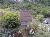 2
2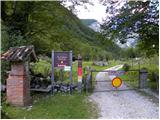 3
3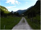 4
4 5
5 6
6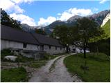 7
7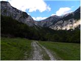 8
8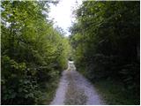 9
9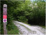 10
10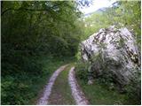 11
11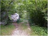 12
12 13
13 14
14 15
15 16
16 17
17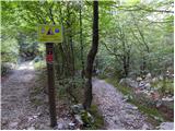 18
18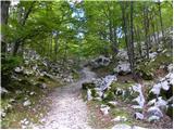 19
19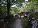 20
20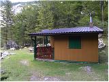 21
21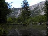 22
22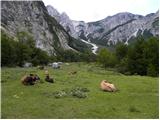 23
23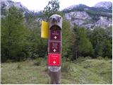 24
24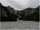 25
25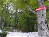 26
26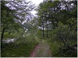 27
27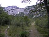 28
28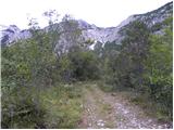 29
29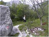 30
30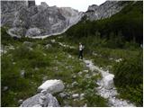 31
31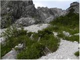 32
32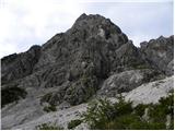 33
33 34
34 35
35 36
36 37
37 38
38 39
39 40
40 41
41 42
42 43
43 44
44 45
45 46
46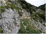 47
47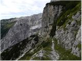 48
48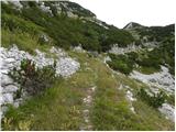 49
49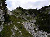 50
50 51
51 52
52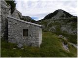 53
53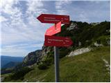 54
54 55
55 56
56 57
57 58
58 59
59 60
60 61
61 62
62 63
63 64
64 65
65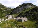 66
66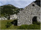 67
67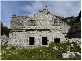 68
68 69
69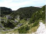 70
70 71
71 72
72 73
73 74
74 75
75 76
76 77
77 78
78 79
79 80
80 81
81 82
82 83
83 84
84 85
85 86
86 87
87 88
88 89
89 90
90 91
91 92
92 93
93 94
94 95
95 96
96 97
97 98
98 99
99 100
100 101
101 102
102 103
103 104
104 105
105 106
106 107
107 108
108 109
109 110
110