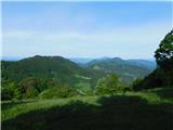
Planina pri Sevnici - Ješivec
Starting point: Planina pri Sevnici (588 m)
Starting point Lat/Lon: 46.10116°N 15.41185°E 
Time of walking: 3 h 40 min
Difficulty: easy marked way
Difficulty of skiing: no data
Altitude difference: 346 m
Altitude difference (by path): 500 m
Map:
Access to starting point:
A) We drive to Sevnica (to here from Radeče, Mokronog or Krško), and then we go on the road in the direction of Planina pri Sevnici. When we get to Petrol gas station, which is located right next to Planina pri Sevnici, we turn right in the direction of company Montpreis and immediately after the crossroad we park on a larger asphalt parking lot by the cemetery.
B) We drive to Šentjur (to here from Celje, Štajerska highway exit Dramlje or Šmarje pri Jelšah), and then we follow the signs for Kozje and Planina pri Sevnici. At the end of Šentjur we go right in the direction of Planina pri Sevnici (slightly left - Kozje and Podsreda). Further, we are mostly ascending, and when the road flattens we on the right side we notice Petrol gas station, which is located right next to Planina pri Sevnici, and we go left in the direction of company Montpreis and then immediately after the crossroad we park on a parking lot by the cemetery.
Path description:
From the parking lot, we return to the main road, carefully cross it, and from the nearby crossroad head towards the center of the settlement Planina pri Sevnici. At first, we slightly descend, then past a larger NOB monument in a gentle ascent arrive at a marked crossroad below the parish church of St. Marjeta.
Here we turn left towards Lisca, Ješivec, and Rudenik (slightly to the right are the ruins of the castle Planina) and continue on a scenic asphalt road that gently ascends and descends a few times, following the blazes or signs for Lisca at crossroads.
In the settlement Prapretno, before the bus stop shelter, we turn right towards a hamlet of a few houses, where we then go left towards Rudenik and Lisca. Next follows a short descent, and after the last house, the road loses its asphalt surface but continues to slightly descend. When the descent ends, the road enters the forest and begins to ascend, and we continue to follow the blazes. The path leads us past a gate, after which it turns left and ascends to a small saddle south of the hill Gradec, where a wooden cross is also located. Here we turn left and then ascend diagonally for some time; the poorer road splits on the eastern slopes of Rudenik.
Here we turn sharply right (straight ahead are the ruins of the former Marijina vas Rudenik) and continue ascending diagonally to the right; on the northern slopes of Rudenik, a nice view temporarily opens towards Štajerska. The path quickly returns to the forest, and a little further joins a wider macadam road, which we follow left upwards. We continue ascending through the forest, now on the western side of Rudenik, where the road splits. We choose the poorer, slightly right road, along which the blazes continue, and from there proceed to a less noticeable crossing before a distinct logging trail turns left onto a footpath, where in a few steps we ascend to the inscription box for Rudenik (control point number 11 of the Sevnica mountain trail).
We continue right towards Lisca, crossing the slopes of Ostrež, and later briefly reach a macadam road, which we follow to the left; at a right turn, we continue straight onto a footpath that proceeds along the slopes of Ivc. Here, after a short crossing, the path turns slightly left and begins to descend more steeply. A short path branches off to the right towards the grave of fallen soldiers (2 minutes), but we continue straight and arrive at a marked crossing on the saddle Ivce.
We continue straight (to the left downwards are Koča na Bohorju and Darinkino zavetišče) and walk through a scenic meadow to a pleasant resting place on Vedonovem hribu.
From here follows a descent along a cart track, where we follow the blazes at several crossings; lower down, we step onto a macadam road for a few steps but immediately turn slightly left towards the marked path. Next follows a somewhat longer ascent along the eastern ridge of Ješivec, which ends at the inscription box for Ješivec, with the highest point of the peak located slightly to the right of the path.
Planina pri Sevnici - saddle Ivce 2:45, saddle Ivce - Ješivec 0:55.
Description and pictures refer to the condition in May 2024.
On the way: Sveta Marjeta (Planina pri Sevnici) (588m), Prapretno (629m), Rudenig (žig) (805m), Sedlo Ivce (772m), Vedonov hrib (787m)
Pictures:
 1
1 2
2 3
3 4
4 5
5 6
6 7
7 8
8 9
9 10
10 11
11 12
12 13
13 14
14 15
15 16
16 17
17 18
18 19
19 20
20 21
21 22
22 23
23 24
24 25
25 26
26 27
27 28
28 29
29 30
30 31
31 32
32 33
33 34
34 35
35 36
36 37
37 38
38 39
39 40
40 41
41 42
42 43
43 44
44 45
45 46
46 47
47 48
48 49
49 50
50 51
51 52
52 53
53 54
54 55
55 56
56 57
57 58
58 59
59