Planina Pungrat - Veliko Kladivo
Starting point: Planina Pungrat (1447 m)
Starting point Lat/Lon: 46.4286°N 14.3572°E 
Time of walking: 2 h 15 min
Difficulty: difficult marked way
Difficulty of skiing: very demanding
Altitude difference: 647 m
Altitude difference (by path): 715 m
Map: Karavanke - osrednji del 1:50.000
Access to starting point:
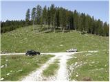
From highway Ljubljana - Jesenice we go to the exit Ljubelj. Further, we drive to the center of Tržič and we follow the road through gorge Dolžanova soteska to the village Jelendol, where signs for mountain pasture Kofce, Šija and Pungrat point us to the left. The road then loses an asphalt covering and starts ascending steeply. This road at the crossroads we follow in the direction of the mountain pasture Pungrat near of which we park on one of the parking lots by the road.
Path description:
From the parking lot, we at first walk to the mountain pasture Pungrat, after that few ten meters before the cottages on the mountain pasture we turn left on a wide meadow, through which in a gentle ascent, we ascend to the edge of the forest, where we notice a mountain signpost for Škrbina (initial part of the path is poorly marked).
We continue the ascent on a moderately steep forest path, which is rising above the mountain pasture Pungrat. After approximately 20 minutes of walking from the starting point, we step out of the forest on increasingly steep, at first with dwarf pines after that only with grass vegetated slopes. And steep path with increasingly beautiful views after a good hour of walking, it brings us to Škrbina, from which a view opens up on the Austrian side.
From Škrbina we continue left in the direction of Veliki vrh (right Tegoška gora). The path ahead at first crosses a steep grassy slope, and then passes on the ridge, which is occasionally slightly exposed. Ahead we are mostly ascending on the Slovenian side of the ridge, only occasionally the path passes on the northern Austrian side. This panoramic and in parts very steep path, which except on a short section isn't secured we follow on a partly exposed ridge to the top of Kladivo, which we reach after approximately one hour of walking from Škrbina (in wet and snow great risk of slipping).
The starting point - Škrbina 1:10, Škrbina - Kladivo 1:05.
Pictures:
 1
1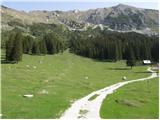 2
2 3
3 4
4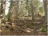 5
5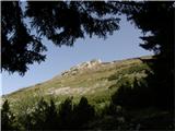 6
6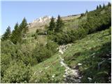 7
7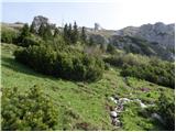 8
8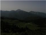 9
9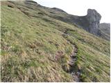 10
10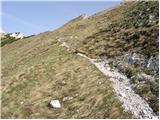 11
11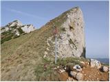 12
12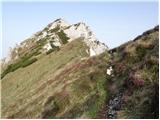 13
13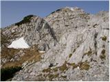 14
14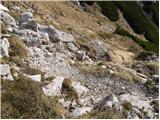 15
15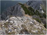 16
16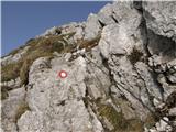 17
17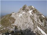 18
18 19
19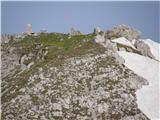 20
20 21
21 22
22