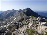
Starting point: Planina Zapleč (1201 m)
Starting point Lat/Lon: 46.2833°N 13.6308°E 
Time of walking: 2 h 40 min
Difficulty: difficult marked way
Difficulty of skiing: no data
Altitude difference: 941 m
Altitude difference (by path): 941 m
Map: Julijske Alpe - zahodni del 1:50.000
Access to starting point:
From Tolmin or Bovec we drive to Kobarid, from there we follow the road in the direction of Drežnica (turn-off of the road is from Kobarid bypass). We continue through a bridge over the river Soča and immediately after the bridge we turn left in the direction of Drežnica. In Drežnica we come to the crossroad, where branches off to the left road in the village Magozd, and we continue a little further to the next crossroad, where we turn left in the direction of Drežniške Ravne. The road then brings us to a crossroad in Drežniške Ravne, where we turn right upward in the direction of Krasji vrh. At the next crossroad, we again turn right and we follow the road to a trough with water, where the asphalt ends. We then follow the macadam road quite a few kilometers to a parking lot by the road in front of the sign TNP and a grazing fence.
Path description:
At the end of the parking lot where we cross a grazing fence, a signpost for Krn and the saddle Vrata points us right on a footpath. The path, which runs on a slightly grassy mule track, at first ascends diagonally and then ascends for a long time in long zig-zags on a grassy slope. The path, which is slightly less beaten, is otherwise marked with rare blazes, mostly in the shape of red lines. Later, the path leads for a shorter time on a slope, which is partly vegetated with bushes. Further, we are still ascending in long zig-zags on a grassy slope. Higher up, when we get closer to the ridge, the path crosses a slope to the right and brings us to a crossing, which is marked with an inscription on a rock.
To the left leads the path towards the saddle Vrata, and we continue straight where an inscription points us to Krn.
The path from the crossing soon brings us to exposed slopes, which we further cross in ascent towards the east. The path here runs on an old military mule track and leads us through a short tunnel. Next follows a hairpin ascent on a steep slope, which brings us to a crossing below Krnčica.
The path leads straight, bypassing the peak, and we go left upwards towards the summit of Krnčica, where a sign on the rock also directs us.
After a short ascent, the path brings us to a panoramic ridge. Here we continue right, and on the path marked with red triangles, we quickly reach the peak, where there are a cross and an inscription box.
Pictures:
 1
1 2
2 3
3 4
4 5
5 6
6 7
7 8
8 9
9 10
10 11
11 12
12 13
13 14
14 15
15 16
16 17
17 18
18 19
19 20
20 21
21 22
22 23
23 24
24 25
25 26
26 27
27 28
28 29
29 30
30 31
31 32
32 33
33 34
34 35
35 36
36 37
37 38
38 39
39 40
40 41
41 42
42 43
43 44
44 45
45 46
46 47
47