Planina Zapleč - Krnčica (unmarked mule track)
Starting point: Planina Zapleč (1201 m)
Starting point Lat/Lon: 46.2833°N 13.6308°E 
Path name: unmarked mule track
Time of walking: 3 h
Difficulty: partly demanding unmarked way
Difficulty of skiing: no data
Altitude difference: 941 m
Altitude difference (by path): 941 m
Map: Bovec 1:25000, Julijske Alpe -Triglavski narodni park 1:50000
Access to starting point:
From Drežnica leads an asphalt road to Drežniške Ravne, then macadam, in parts worn out forest road on the mountain pasture Zapleč. Some space for parking is just before the entrance on the mountain pasture.
Path description:
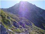
A beaten footpath from the parking lot leads into grassy slopes, where follows a well-preserved mule track, which is ascending in zig-zags on a saddle Vrata. A little below the saddle, the footpath branches off into a slope, through a short tunnel, on a ridge and to the summit. On the summit, there is a bigger cairn. The footpath, actually a horizontal mule track, on the southwest slope right below the ridge continues towards Srednji vrh and in the direction towards Krn, where it isn't possible to go without harder climbing.
On the way: sedlo Vrata (1938m),
Lopatnik (2012m), Skutnik (2074m), ostanki italijanskih vojaških položajev (2000m)
Pictures:
 1
1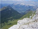 2
2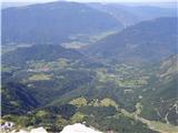 3
3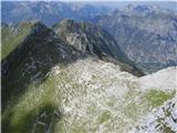 4
4 5
5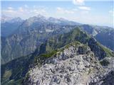 6
6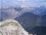 7
7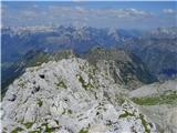 8
8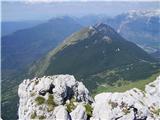 9
9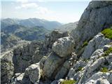 10
10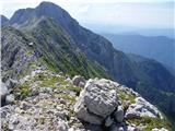 11
11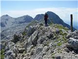 12
12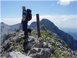 13
13