Platzwiese / Prato Piazza - Durrenstein / Pico di Vallandro (normalni dostop)
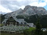
Starting point: Platzwiese / Prato Piazza (1920 m)
Path name: normalni dostop
Time of walking: 2 h 45 min
Difficulty: easy marked way
Difficulty of skiing: easily
Altitude difference: 919 m
Altitude difference (by path): 919 m
Map: Tabacco Dolomiti di Sesto 1:25000;
Access to starting point:
Through the Karawanks Tunnel on the highway past Spittal, then by Drau past Lienz and on the Italian side past San Candido / Innichen and Toblach. We continue on the road towards Bruneck, after the settlement Villabassa / Niederdorf we turn towards the south on the road in the direction of the lake Prags / Braies. Well marked turn-off for Prato di Piazza / Platzwiese brings us to the parking lot Ponticello / Bruckele. From here leads on the mountain pasture payable asphalt road (August 2011: 8 €), which ends by large parking lot and traffic light bus turning point only few meters below the mountain hut Rifugio di Prato Piazza / Berggasthof Platzwiese. The road is between 10:00 and 16:00 closed, in that time on the mountain pasture runs bus. In case if upper parking lot is full, they can close the road also earlier. By the road runs also a footpath to our starting point, which is for many final destination of the tour, so there can be a lot of people on the road.
Of course access is also possible from the south, highway Trst – Portogruaro – Pordenone - Belluno - through Cortina d'Ampezzo to Toblach, or from Karnija past Tolmezzo over mountain pass Monte Croce Comelico. From west from Brenner highway is access past Bruneck by the foot of Kronplatz.
Path description:
Between the mountain hut and hotel Hohe Geissl signposts point us past the chapel on pastures in the direction of east. We follow well-marked footpath (red dots, red triangles, red-white-red vertical blazes in the shape of Peru's flag and signposts). We stride across the grazing fence and at the crossings we check bilingual signposts. The path is on individual spots a little eroded, but large amounts of wood next to it show, that they maintain it. Wooden stairs here and there preventing erosion. On steeper sections, the path is winding upwards, otherwise it is steadily oriented towards the highest point. After approximately an hour of walking, we stride across some sort of gully, in which are settled wooden troughs for livestock, which is freely grazing on a wide western slopes. A little boring path is rescued by increasingly wide and spectacular views. When we reach the saddle on a ridge, left from the distinct wide groove, which is visible from the starting point, the path turns on the western slope and still runs steadily towards the summit. Just before the peak, the passage is over two meters rock secured with few meters of chain.
Pictures:
 1
1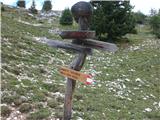 2
2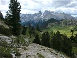 3
3 4
4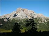 5
5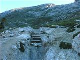 6
6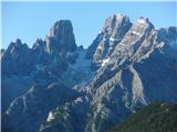 7
7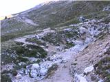 8
8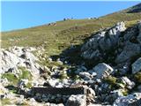 9
9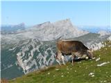 10
10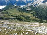 11
11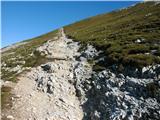 12
12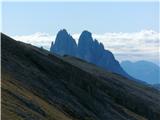 13
13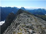 14
14 15
15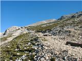 16
16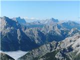 17
17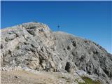 18
18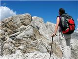 19
19 20
20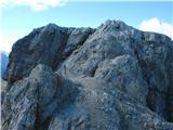 21
21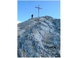 22
22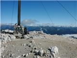 23
23 24
24 25
25 26
26 27
27 28
28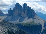 29
29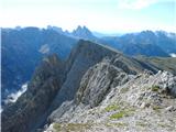 30
30