Poče - Dom na Poreznu (winter way)
Starting point: Poče (653 m)
Starting point Lat/Lon: 46.1537°N 13.9846°E 
Path name: winter way
Time of walking: 3 h 30 min
Difficulty: easy marked way
Difficulty of skiing: no data
Altitude difference: 937 m
Altitude difference (by path): 1075 m
Map: Škofjeloško in Cerkljansko hribovje 1:50.000
Access to starting point:
A) From regional road Idrija - Tolmin, at settlement Straža in hamlet Želin at the traffic light crossroad we turn right in the direction of Cerkno (if we come from the direction Tolmin we turn left). Further, we drive through the valley of river Cerknica, past Petrol gas station all the way to Cerkno, where at the crossroad behind the church of St. Jernej (by the church is also a cemetery and a parking lot) we continue left in the direction of Železniki, ski slope Cerkno, hospital Franja and center of Cerkno. At the next marked crossroad we continue left in the direction of the settlement Zakojca and Gorje. Further, we drive through the settlement Trebenče and past bigger picnic area, to a marked crossroad, where we turn right in the direction of village Poče (left Gorje). After further shorter ascent we reach fire station at the beginning of the village Poče, where there is a turning point for buses and by it NOB monument. The beginning of the footpath is a little further in the center of the village. Some options for parking is in the center of the village, or we can ask locals where we can leave a car.
B) From the road Škofja Loka - Žiri, after the settlement Trebija we turn right in the direction of Sovodenj and Cerkno (from the direction Žiri still before Trebija we turn left), from where we at first drive in Sovodenj, and from there over mountain pass Kladje (mountain pass is located in the settlement Podlanišče) we start descending towards Cerkno. In Cerkno at the first larger crossroad we continue straight (right we come in the center of the town and to the church of St. Ana), after that in second, about 300 meters ahead we turn right in the direction of Železniki, ski slope Cerkno, hospital Franja and center of Cerkno. At the next marked crossroad we continue left in the direction of the settlement Zakojca and Gorje. Further, we drive through the settlement Trebenče and past bigger picnic area, to a marked crossroad, where we turn right in the direction of village Poče (left Gorje). After further shorter ascent we reach fire station at the beginning of the village Poče, where there is a turning point for buses and by it NOB monument. The beginning of the footpath is a little further in the center of the village. Some options for parking is in the center of the village, or we can ask locals where we can leave a car.
C) From the road Škofja Loka - Podbrdo, at settlement Zali Log we continue left in the direction of Davča and ski slope Cerkno (if we come from the direction Podbrdo or Soriška planina, at the end of the settlement, we continue right). The road ahead at first ascends on Davča, and from there it starts descending towards Cerkno. In the center of Cerkno, at post office we turn right towards Zakojca and Gorje. Further, we drive through the settlement Trebenče and past bigger picnic area, to a marked crossroad, where we turn right in the direction of village Poče (left Gorje). After further shorter ascent we reach fire station at the beginning of the village Poče, where there is a turning point for buses and by it NOB monument. The beginning of the footpath is a little further in the center of the village. Some options for parking is in the center of the village, or we can ask locals where we can leave a car.
Path description:
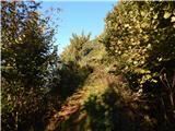
From the center Poče we continue right in the direction of Labinjske lehe (left - gentle and steep path on Porezen), and through the village we follow the blazes. When we reach a wider cart track we ascend there above the village, where we also get to a smaller hamlet, where two paths branch off to the left towards Porezen, and both join the gentle or steep path.
At the newer, in the time of the description (July 2020) still unfinished house we go slightly left on a cart track which then ascends diagonally through a panoramic meadow. When a little above the nearby homestead which is situated below the path, the path brings us into the forest, at numerous crossings we follow the blazes. Higher, where the path from Cerkno joins, we for some time step on the road, and from there only few steps further, at the crossing, where the path from Dolenji Novaki joins, we go left in the direction of Porezen.
After the crossing, we immediately leave the forest and we get to meadows Labinjske lehe, from where a nice view opens up on Cerkljansko, and the view reaches all the way to Krim, Snežnik and Trnovski gozd.
On the upper part of meadow path turns slightly left and passes on slopes named Počanska gora. Next follows light to moderate diagonal ascent towards the left, and we walk on a well-settled path, which is on short steep spot also well-secured and in dry undemanding.
After the secured part, the path splits, and we continue slightly right on the upper path in the direction of the winter way - zimska smer (slightly left - normal path). The path ahead starts steeply ascending, and after 15 minutes the steepness decreases and we step out of the forest on a pleasant meadow Vrše, where we join the path from Raspet. We continue left (right - Kopa and Črni vrh), where we at first diagonally ascend through a lane of thin forest and then we get very close to the road. We continue on a footpath which continues by the road, and a little further we leave a wider footpath and we continue in the direction of winter way - zimska smer. Follows few steps of ascent, and after the hunting observatory, the footpath by the edge of the pasture vanishes, and we descend to the saddle Velbnik, where we join the usual path (here a little left from the path there is a hunting cottage Na Šašu).
From the saddle Velbnik, where nam once again quite gets closer to a forest road which leads to Dom na Poreznu, we ascend through a narrow lane of a forest and then at the crossing grazing fence the path splits.
We continue on the path which is ascending (the left path bypasses the peak Medrce and isn't marked, but it is slightly shorter), and there in 10 minutes we ascend on a panoramic peak Medrce, from where a nice view opens up on Porezen.
From the top, we descend on a poorly visible footpath which is descending towards the northwest and after 5 minutes of descent brings us to a marked crossing, where from the left joins an already mentioned unmarked path and steep path from Poče. A little further from the left joins also gentle path from Poče, and from the right joins the path from Davča.
We continue in the direction of Porezen and further we are ascending on the more and more panoramic southeastern ridge. This path we then follow to the peak of Porezen, from which a nice view opens up also on Julian Alps.
From the top, we continue right and on a path which from the ridge passes on a slope, and in less than 5 minutes we descend to the mountain hut.
Poče - Labinjske lehe 1:05, Labinjske lehe - Velbnik 1:25, Velbnik - Medrce 0:10, Medrce - Porezen 0:45, Porezen - Dom na Poreznu 0:05.
Description refers to condition in July 2020, and pictures are from July 2020 and October 2018.
On the way: Labinjske lehe (962m), Velbnik (1331m), Medrce (1410m), Porezen (1630m)
Pictures:
 1
1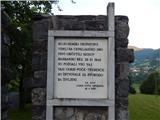 2
2 3
3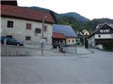 4
4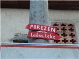 5
5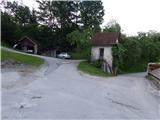 6
6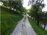 7
7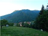 8
8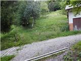 9
9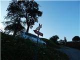 10
10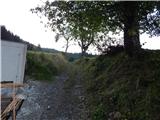 11
11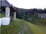 12
12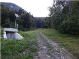 13
13 14
14 15
15 16
16 17
17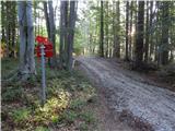 18
18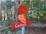 19
19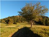 20
20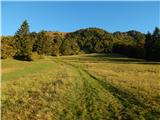 21
21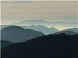 22
22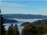 23
23 24
24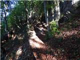 25
25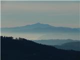 26
26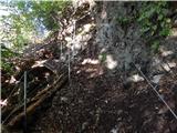 27
2728
 29
29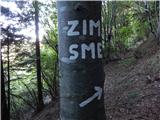 30
30 31
31 32
32 33
33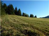 34
34 35
35 36
36 37
37 38
38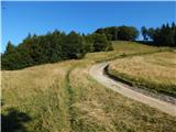 39
39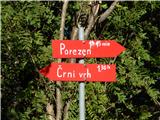 40
40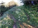 41
41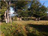 42
42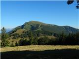 43
43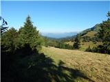 44
44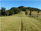 45
45 46
46 47
47 48
48 49
49 50
50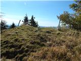 51
51 52
52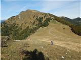 53
53 54
54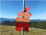 55
55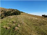 56
56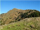 57
57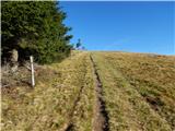 58
58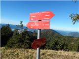 59
59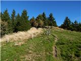 60
60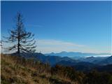 61
61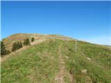 62
62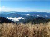 63
63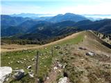 64
64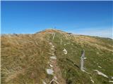 65
65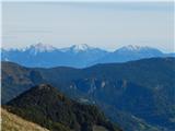 66
66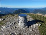 67
67 68
68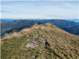 69
69 70
70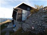 71
71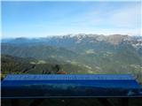 72
72