Podgora - Štor (via Slajka)
Starting point: Podgora (425 m)
Starting point Lat/Lon: 46.10218°N 14.11105°E 
Path name: via Slajka
Time of walking: 3 h
Difficulty: easy unmarked way, easy marked way
Difficulty of skiing: no data
Altitude difference: 580 m
Altitude difference (by path): 635 m
Map: Škofjeloško in Cerkljansko hribovje 1:50.000
Access to starting point:
A) From Železniki, Kranj or Medvode we drive to Škofja Loka, from there we continue driving towards Gorenja vas and Žiri. After the settlement Hotavlje we get to the settlement Podgora, where before the bus stop the road which leads towards the part of the settlement branches off to the right. At the mentioned bus stop, where there are no arranged parking spaces, the described path begins.
B) From Horjul or Polhov Gradec we drive to Lučine, from there we descend into Gorenja vas. In Gorenja vas we continue left towards Žiri. After the settlement Hotavlje we get to the settlement Podgora, where before the bus stop the road which leads towards the part of the settlement branches off to the right. At the mentioned bus stop, where there are no arranged parking spaces, the described path begins.
C) From Vrhnika, Logatec or Spodnja Idrija we drive to Žiri, and from there we continue driving towards Gorenja vas and Škofja Loka, but we drive on the main road only to the settlement Podgora, where at the crossroad behind the bus stop the described path begins. At the starting point, there are no arranged parking spaces.
D) First, we drive to Cerkno, and from there we continue driving through the pass Kladje (Podlanišče) towards Sovodenj. From Sovodenj we continue driving along the stream Hobovščica, and then in a somewhat larger crossroad we continue left in the direction of Gorenja vas (right Žiri). On the main road towards Škofja Loka we drive to the settlement Podgora, where at the crossroad behind the bus stop the described path begins. At the starting point, there are no arranged parking spaces.
Path description:
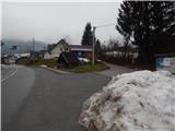
From the crossroad at the bus stop we head onto the side road which branches off from the main road towards the southwest, from it before the chapel we go right and ascend past a few more houses. At the smaller crossroad a little higher we go right, then we go past the last houses, where the asphalt ends. The path ahead leads us along a macadam road which crosses the slopes to the right, at two road forks we go slightly right and then cross the stream. After the stream the road changes into a wider cart track which starts to ascend more steeply. Higher the cart track, which gradually narrows, makes a few hairpin turns, then it joins the path from Hotavlje which leads along the ridge of Bela.
We continue left along the wider track which soon widens into a cart track, which turns slightly left and brings us out of the forest at the hunting observatory. Here along the lower edge we cross the meadow on the cart track, when we reach the macadam road we follow it to the right. The road soon starts to descend and brings us to a crossroad in a few minutes, where we reach an asphalt road. Along the asphalt road we ascend to the nearby crossroad from which we continue right in the direction of Slajka.
Next follows an ascent along the asphalt road, when we leave the forest a marked path from Hotavlje joins from the right.
The asphalt road then leads us past a bench, where a path branches off to the right towards Vrh Slajke, we follow the road which turns semicircularly to the left to the nearby farm, from which the Dom na Slajki is only a minute's walk away.
From the hut we return to the nearby farm, where we bypass the main buildings along the upper side and continue along the macadam road which on the nearby meadow changes into a cart track. Next follows walking through a strip of forest, then we arrive at the grassy slopes of Špik or Vranškov grič (both names appear on maps), which we cross with nice views. When we reach the poorer macadam road we descend along it (right private land), when the road levels out we join a wider macadam road which we reach above the farm Hom.
We continue in the direction of Ermanovec and then walk for quite some time along the macadam road which later becomes asphalt. Next follows some descent with nice views, then from a smaller crossroad we continue slightly right (slightly left we can descend to the church of St. Pavel in Stara Oselica), from the next crossroad we go slightly left (slightly right farm Rotovž).
Next follows a gentle ascent and the path brings us to the place where the marked path forks.
We continue along the slightly right path which continues along the road (left peak Ermanovec, it is also possible to reach Dom na Ermanovcu but the path is somewhat longer) and further ascend diagonally. Higher we continue slightly left, at the hamlet of a few houses the road turns sharply right, then brings us with nice views to the marked junction by the chapel and bell.
We continue straight in the direction of Dom na Ermanovcu (sharply left peak Ermanovec, left road which descends to Sovodenj) and continue walking along the gentle asphalt road to which a marked path from Sovodenj joins a little further on.
From the mentioned junction only a few dozen steps of easy walking remain and we arrive at Dom na Ermanovcu.
At the hut we notice the mountain signpost for Štor which directs us onto the footpath which ascends steeply through the forest. The path soon levels out and brings us from the forest to a panoramic meadow where the markers end. Here we continue right into the dense forest and continue the ascent along a gentle unmarked track, along which in 2 minutes of further walking we arrive at the indistinct and forest-covered summit.
Podgora - Dom na Slajki 1:25, Dom na Slajki - Dom na Ermanovcu 1:30, Dom na Ermanovcu - Štor 0:05.
On the way: Dom na Slajki (789m), Koča na Ermanovcu (968m)
Pictures:
 1
1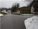 2
2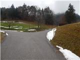 3
3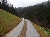 4
4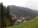 5
5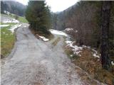 6
6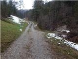 7
7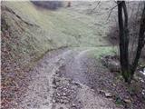 8
8 9
9 10
10 11
11 12
12 13
13 14
14 15
15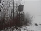 16
16 17
17 18
18 19
19 20
20 21
21 22
22 23
23 24
24 25
25 26
26 27
27 28
28 29
29 30
30 31
31 32
32 33
33 34
34 35
35 36
36 37
37 38
38 39
39 40
40 41
41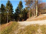 42
42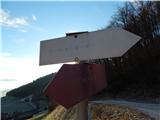 43
43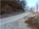 44
44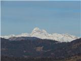 45
45 46
46 47
47 48
48 49
49 50
50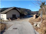 51
51 52
52 53
53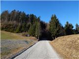 54
54 55
55 56
56 57
57 58
58 59
59 60
60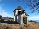 61
61 62
62 63
63 64
64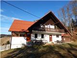 65
65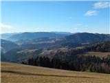 66
66 67
67 68
68 69
69 70
70 71
71 72
72 73
73 74
74