Podgorje ob Sevnični (Kurja vas) - Lisca
Starting point: Podgorje ob Sevnični (Kurja vas) (349 m)
Starting point Lat/Lon: 46.0598°N 15.36108°E 
Time of walking: 3 h 40 min
Difficulty: easy marked way
Difficulty of skiing: no data
Altitude difference: 599 m
Altitude difference (by path): 835 m
Map:
Access to starting point:
A) We drive to Sevnica (to here from Radeče, Mokronog or Krško), and then we go on the road in the direction of Planina pri Sevnici. When we arrive at the settlement Podgorje ob Sevnični, the described path begins by the bus stop in the hamlet Kurja vas. At the starting point, there aren't any parking spots.
B) We drive to Šentjur (to here from Celje, Štajerska highway exit Dramlje or Šmarje pri Jelšah), and then we follow the signs for Kozje and Planina pri Sevnici. At the end of Šentjur we go right in the direction of Planina pri Sevnici (slightly left - Kozje and Podsreda). Further, we mostly ascend, and when the road flattens and we notice the Petrol gas station on the right side, located in close proximity to Planina pri Sevnici, we gradually start descending towards Sevnica. When we arrive at the settlement Podgorje ob Sevnični, the described path begins by the bus stop in the hamlet Kurja vas. At the starting point, there aren't any parking spots.
Path description:
From the starting point, we continue along the main road in the direction of Sevnica, and when the settlement ends, we soon notice red hiking signposts for Lisca on the right side, which direct us across a meadow, then along a cart track to a nearby farm, where the path leads through the yard. After the farm, we reach an asphalt road, which we follow to the right upwards and ascend for some time alongside the stream Spodnji graben. A few minutes ahead, we turn left at a smaller crossroad in the direction of Lisca, and soon leave the forest, turning right onto a macadam path. This is followed by a few minutes of scenic ascent along a cart track, then we reach a partly abandoned hamlet, where the path becomes asphalt again, and we diagonally descend to Kmečki turizem Zupan, where we take a path leading through a pasture, following the signs for Lisca.
Across the pasture, we diagonally ascend, and upon entering the forest, we continue along a cart track, following the blazes at crossroads. Higher up, we continue on a forest footpath that crosses a steeper slope, then soon reach another cart track, along which we proceed towards the nearby climbing area Kolinčeva pečina. From here, we follow a diagonal ascent along a steep slope, where there is also an increased danger of falling stones. A few minutes higher, when the slope flattens slightly, we reach a wider cart track, along which we quickly arrive at cottage Darinkino zavetišče na Ivcah.
We bypass the cottage on the right side and ascend along a wide cart track to the saddle Ivce, where we join the path from the starting point at Planina pri Sevnici.
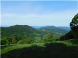
We continue left (right Planina pri Sevnici) and walk through a scenic meadow to a pleasant resting place on Vedonov hrib.
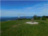
From here follows a descent along a cart track, where we follow the blazes at several crossings; lower down, we step onto a macadam road for a few steps but immediately turn slightly left towards the marked path. Next follows a somewhat longer ascent along the eastern ridge of Ješivec, which ends at the inscription box for Ješivec, with the highest point of the peak located slightly to the right of the path.
From Ješivec, we continue in the direction of Lisca and begin to descend steeply down a grassy slope. Lower down, the path leads us to a cart track, and we follow the marked trail to a marked crossing on the saddle between Ješivec and Lisca, where a marked path from Jurklošter joins from the right.
We continue straight towards Lisca and begin to ascend. A little further, we cross an asphalt road leading towards Lisca, and after a short ascent, the path levels out and temporarily returns to the road. We continue on the marked path, which runs slightly to the right of the road, then gently ascend through a meadow. The marked path then re-enters the forest and continues along the right side of Mala Lisca. A few minutes later, we temporarily leave the forest and then briefly come very close to the road. When we return to the road a little further on, we continue along it past a motorhome stop, and on the other side of the stop, the path splits. The right path leads directly to the summit of Lisca, but we continue straight and ascend to the summit of Lisca past Tončkov dom and Jurčkova koča.
The starting point - Darinkino zavetišče 1:45, Darinkino zavetišče - Ješivec 1:00, Ješivec - Lisca 0:55.
Description and pictures refer to the condition in May 2024.
Pictures:
 1
1 2
2 3
3 4
4 5
5 6
6 7
7 8
8 9
9 10
10 11
11 12
12 13
13 14
14 15
15 16
16 17
17 18
18 19
19 20
20 21
21 22
22 23
23 24
24 25
25 26
26 27
27 28
28 29
29 30
30 31
31 32
32 33
33 34
34 35
35 36
36 37
37 38
38 39
39 40
40 41
41 42
42 43
43 44
44 45
45 46
46 47
47 48
48 49
49 50
50 51
51 52
52 53
53 54
54 55
55 56
56 57
57 58
58 59
59 60
60 61
61 62
62 63
63 64
64 65
65 66
66 67
67 68
68 69
69 70
70 71
71 72
72 73
73