Podkraj / Unterort - Wackendorfer Spitze
Starting point: Podkraj / Unterort (650 m)
Starting point Lat/Lon: 46.5426°N 14.7744°E 
Time of walking: 5 h
Difficulty: easy marked way
Difficulty of skiing: no data
Altitude difference: 1424 m
Altitude difference (by path): 1485 m
Map: Koroška 1:50.000
Access to starting point:
A) Via the border crossing Jezerski vrh we drive into Austria, then after approximately 6 km past Železno Kaplo / Bad Eisenkappel we turn right towards Velikovec / Völkermarkt. We follow the main road towards Velikovec for 2 km, then we turn right again, this time in the direction of the settlement Pliberk / Bleiburg. Further on, we drive through the Podjuna valley, then at the next major intersection we turn right towards Pliberk. The road leads us further through some roundabouts, and we continue to follow it in the direction of the ski area Peca / Petzen. Further on, we drive through Bistrica pri Pliberku / Feistritz ob Bleiburg to the large parking lot at the bottom station of the cable car to Peca. From the border crossing Jezerski vrh to the starting point it is approximately 40 km.
B) From Dravograd or Slovenj Gradec we drive to Ravne na Koroškem, then we continue driving towards the border crossing Holmec. Once we enter Austria, we first drive towards Pliberk / Bleiburg, then we follow the signs for the ski area Peca / Petzen. Further on, we drive through a few villages, and we follow the road to the large parking lot at the bottom station of the cable car to Peca. From the border crossing Holmec to the starting point it is approximately 8 km.
Path description:
From the parking lot, we first walk to the bottom station of the circular-cabin cable car that goes to Peca, then we head to the path marked No. 3, 7 and 8. The path first leads along a wide cart track, along which we quickly reach the ski slope. We continue along the left edge of the ski area, then the path turns slightly to the right and brings us into a dense forest. Here it flattens and joins a cart track, along which we slightly descend to the nearby marked junction.
From the junction we continue along the left ascending road, where the signs for path No. 3 and 7 also direct us. Just a few minutes higher, the road splits into two parts, where we continue left along path No. 3 (right initially slightly downhill path No. 7, which leads towards Veška planina). About 100 m higher, we join the marked path that comes from the village Rute / Ruttach, so further on we cross a poor forest road several times. Higher up, the road along which we occasionally continue the path for some time finally ends, and we continue between two rocks into the forest. The path ahead steeply ascends through the forest, which on hot days provides pleasant shade. Higher up, the forest gradually thins, and nice views open up onto Podjuna and the Golica range. A little further on, the trail turns sharply to the left and brings us below the steep slopes of Mala Peca, where in the middle of the right-hand bend, the via ferrata path named Walter Mory Klettersteig branches off to the left, leading to the upper station of the circular-cabin cable car.
From the junction we continue right, where we first ascend transversely across steep scree, then the path turns right and crosses a small gully. For a short time we cross the slopes to the right, then the path turns slightly to the left, quickly bringing us near a decaying wooden shack. From here we continue a short ascent and arrive at the marked junction at the hunting hut Na Križah.
At the junction we leave the path marked No. 3 and continue right along path No. 4, which leads to Bistriška špica. From the junction the path descends slightly, then turns sharply to the right and gradually moves onto the slopes that we saw on the right side of the valley during the ascent. Here the path first ascends transversely through a belt of dwarf pines, then enters the forest, where it briefly crosses a steeper slope. The path ahead begins to ascend steeply and leads us continuously through larch forest. Higher up we reach the ridge of Najbrževa peč, where the path turns left and gradually flattens. Further on we walk for some time along the edge (a few meters away) of cliffs, from which a nice view opens towards the valley, Svinja and Golica. Just a little higher, the path completely flattens and brings us to a vast meadow, across which we begin to ascend first gently, then more steeply. A short steep ascent follows through a belt of dwarf pines, and the increasingly panoramic path quickly brings us to the main ridge of Peca, where we arrive at a marked junction.
Here we continue right in the direction of Globasnica / Globasnitz and Podpeca / Koprein Petzen (left Bistriška špica 5 minutes) along a gentle path, which quickly splits into two parts. The left path, which begins to descend, leads towards Podpeca, our right path towards Globasnica and Veška kopa. A few short ascents and descents follow, and the panoramic path brings us to the summit of Veška kopa in a few minutes.
On the way: Na Križah (1578m)
Pictures:
 1
1 2
2 3
3 4
4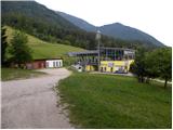 5
5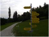 6
6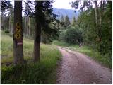 7
7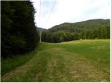 8
8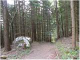 9
9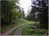 10
10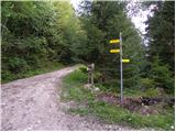 11
11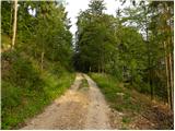 12
12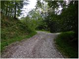 13
13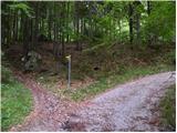 14
14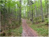 15
15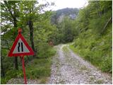 16
16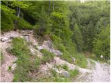 17
17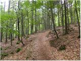 18
18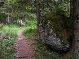 19
19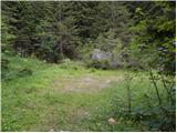 20
20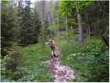 21
21 22
22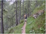 23
23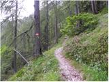 24
24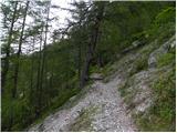 25
25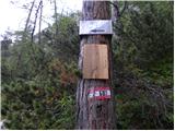 26
26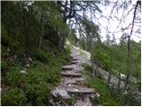 27
27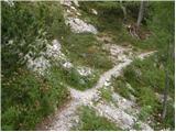 28
28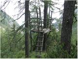 29
29 30
30 31
31 32
32 33
33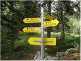 34
34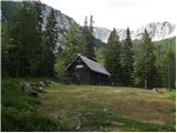 35
35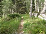 36
36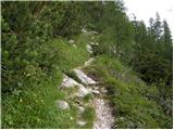 37
37 38
38 39
39 40
40 41
41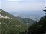 42
42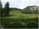 43
43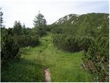 44
44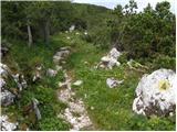 45
45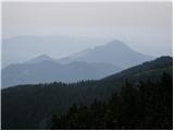 46
46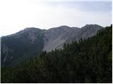 47
47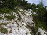 48
48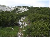 49
49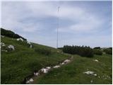 50
50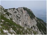 51
51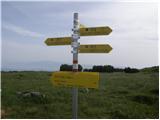 52
52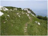 53
53 54
54 55
55 56
56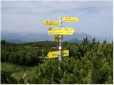 57
57 58
58 59
59 60
60 61
61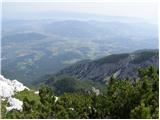 62
62