Podljubelj - Dom na Kofcah (via Matizovec)
Starting point: Podljubelj (658 m)
Starting point Lat/Lon: 46.3979°N 14.2876°E 
Path name: via Matizovec
Time of walking: 2 h 30 min
Difficulty: easy marked way
Difficulty of skiing: no data
Altitude difference: 830 m
Altitude difference (by path): 830 m
Map: Karavanke - osrednji del 1:50.000
Access to starting point:
From the highway Ljubljana - Jesenice, we take the Podtabor exit (Tržič, Ljubelj), then continue driving towards Ljubelj. After approximately 6 km of driving from the gas station at Bistrica pri Tržiču, we leave the main road, as the signs for Podljubelj direct us to the right onto a local road. Only a little further, we arrive at the next crossroad, where we continue right and then after some 10 meters park at a suitable place in the middle of the village.
If at the crossroad when entering Podljubelj we turn left, we will hardly find a suitable parking spot.
Path description:
From the starting point, we return some 10 meters back to the crossroad, from there we continue on the asphalt road in the direction of Matizovec and Kofce. The road ahead starts to ascend moderately through the village, then flattens and brings us to a smaller crossroad, where we continue right in the direction of Kofce.
Further on, we ascend for quite some time on the asphalt road, which past a smaller cross brings us to a hamlet with a few houses (Pod Košuto). Here we continue straight on a somewhat steeper road again, which soon loses the asphalt covering. Some 10 meters ahead, there is a large macadam parking lot, which we bypass on the right side. From the road, from which occasional views open up on Dobrča and the surrounding mountains, a few turns higher a marked footpath branches off to the right, which cuts one turn. The footpath returns to the road at the last turn before the farm Matizovec.
From Matizovec we continue on a rougher road in the direction of Dom na Kofcah, carefully following the blazes at several successive junctions. After a few minutes of walking on the rougher road or cart track, the blazes direct us to a steep footpath, which first ascends diagonally to the left, then transitions to a forested ridge, where it turns slightly to the right. Further, we ascend on a steep mountain path, which higher crosses the cart track and gradually flattens behind it. Only a little further, the forest thins out, the marked path turns right into the forest and a little higher joins the cart track, which ascends diagonally to the right. The cart track higher turns left, and from the right the marked path from Kal also joins.
From the junction onwards the forest ends, and the increasingly scenic path brings us to the Dom na Kofcah in 5 minutes of further walking.
On the way: Matizovec (1072m)
Trip can be extended to: Planina Spodnja Dolga njiva
,
Tegoška planina
,
Planina Pungrat
,
Planina Ilovica
,
Zavetišče na planini Šija
,
Planina Zgornja Dolga njiva
,
Mala Košuta
,
Kofce gora
,
Toplar
,
Malo Kladivo
,
Veliki vrh (Košuta) (1 h 45 min)
,
Veliko Kladivo
Pictures:
 1
1 2
2 3
3 4
4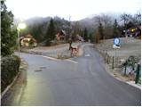 5
5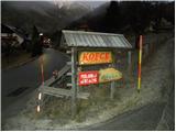 6
6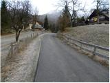 7
7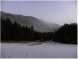 8
8 9
9 10
10 11
11 12
12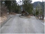 13
13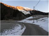 14
14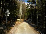 15
15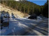 16
16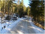 17
17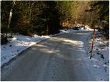 18
18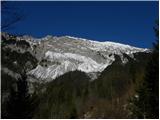 19
19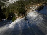 20
20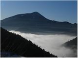 21
21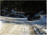 22
22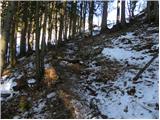 23
23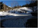 24
24 25
25 26
26 27
27 28
28 29
29 30
30 31
31 32
32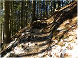 33
33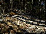 34
34 35
35 36
36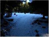 37
37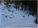 38
38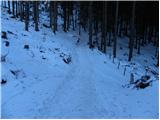 39
39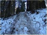 40
40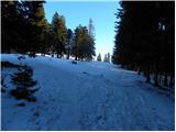 41
41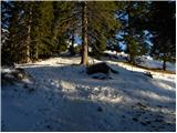 42
42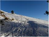 43
43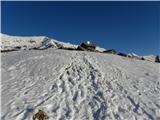 44
44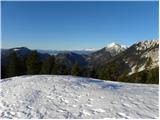 45
45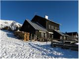 46
46