Podolševa (Rogar) - Obel kamen (Olševa) (east path)
Starting point: Podolševa (Rogar) (1240 m)
Starting point Lat/Lon: 46.4398°N 14.6656°E 
Path name: east path
Time of walking: 2 h 10 min
Difficulty: difficult marked way
Difficulty of skiing: no data
Altitude difference: 671 m
Altitude difference (by path): 685 m
Map: Kamniške in Savinjske Alpe 1:50.000
Access to starting point:
A) We drive to Luče, and then we continue driving towards the valley Logarska dolina. In the settlement Solčava, before the bridge through the river Savinja we leave the road towards the valley Logarska dolina and we continue right in the direction of Podolševa and Črna na Koroškem. After approximately 5 km of the ascent, we get to a crossroad, where we go left towards Sveti Duh (right Črna na Koroškem), and then on Solčava Panorama road we drive to the spot, where the road branches off to the right towards the tourist farm Rogar. We park on an appropriate place near the crossroad. Parking in front of the farm is allowed for guests of the tourist farm. From the main road to the starting point, there is approximately 7.5 km.
B) We drive to Črna na Koroškem, and then we continue driving in the direction of Koprivna and Solčava. Further, we for some time drive through the valley by the river Meža, and then we go left in the direction of Solčava and valley Logarska dolina. Next follows an ascent to mountain pass Spodnje Sleme, and from there some descent to a crossroad, where we go right towards Sveti Duh, and then on Solčava Panorama road we drive to the spot, where the road branches off to the right towards the tourist farm Rogar. We park on an appropriate place near the crossroad. Parking in front of the farm is allowed for guests of the tourist farm. From the center of Črna na Koroškem, to the starting point, there is approximately 22.5 km.
C) Over the border crossing Pavličev Vrh we drive to Slovenia and we start descending towards Solčava. Soon after mountain hut Majerhold we go left in the direction of Podolševa and Solčava Panorama road. On Panorama road we drive for approximately 500 more meters further from tourist farm Strevc, which is situated below the church of the Holy Spirit. We park on an appropriate place by the road, on the part where the road branches off towards the tourist farm Rogar. From the border crossing Pavličev Vrh to the starting point, there is approximately 10.5 km.
Path description:
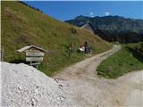
From the spot, where we've parked, we at first walk to tourist farm Rogar, and from there we continue on a marked path in the direction of Olševa. Above the farm a beautiful view opens up, and the path soon passes into the forest. Few minutes we are ascending through the forest and then we cross a macadam road, where from the left joins the path from tourist farm Strevc.
We continue in the direction of Potočka zijalka, Obel kamen and Govca. Further, we are ascending on a well-beaten and gradually steeper path, which higher comes to the national border. Next follows few minutes of a steep ascent and from the left joins the path from Austria.
We continue right and then follows good 10 more minutes of ascent and the path brings us to archaeological site Potočka zijalka.
We continue on a marked path, which on the right side bypasses the cave and with the help of fixed safety gear ascends on the right side of a quite steep gully. A little further with the help of iron spikes we cross the gully, and then we steeply ascend from the gully. Further, the path is still quite steep, and with every gained altitude meter also more panoramic.
On a smaller ridge path splits, and we continue straight towards Govca (left Obel kamen). Next follows crossing of the steep slopes of Olševa, on more exposed parts, we also get help from some steel cables. Further, the path turns to the left and it brings us to a marked crossing.
This time we continue left in the direction towards Obel kamen (straight Govca), where we at first cross the slopes towards the left and then we start steeply ascending. The last part of the ascent, before we reach the ridge is technically more demanding and isn't secured. Above a short demanding part we reach a panoramic ridge, on and by which we continue all the way to Obel kamen, which we recognize by the border stone with number XXII 1.
From the top, we can continue also to approximately 10 minutes distant cross, where there is also an inscription box.
The starting point - Potočka zijalka 1:05, Potočka zijalka - Obel kamen 1:05.
Description refers to condition in August 2018, and pictures are from various periods.
Pictures:
 1
1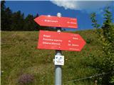 2
2 3
3 4
4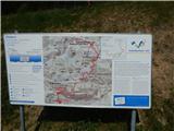 5
5 6
6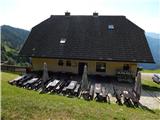 7
7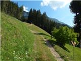 8
8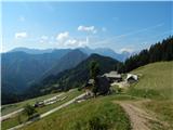 9
9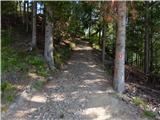 10
10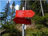 11
11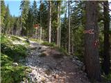 12
12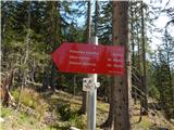 13
13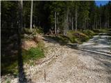 14
14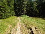 15
15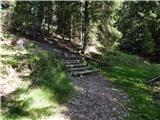 16
16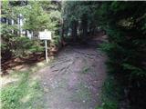 17
17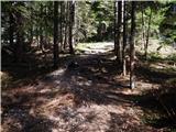 18
18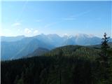 19
19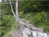 20
20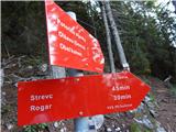 21
21 22
22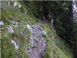 23
23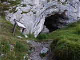 24
24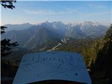 25
25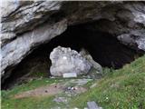 26
26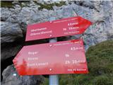 27
27 28
28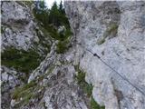 29
29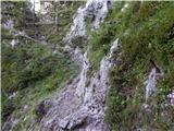 30
30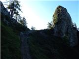 31
31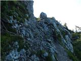 32
32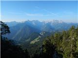 33
33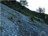 34
34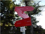 35
35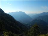 36
36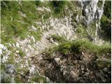 37
37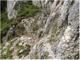 38
38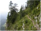 39
39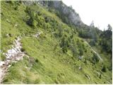 40
40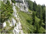 41
41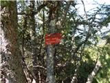 42
42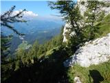 43
43 44
44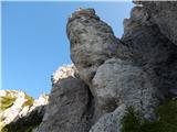 45
45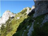 46
46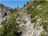 47
47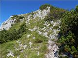 48
48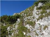 49
49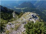 50
50 51
51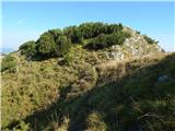 52
52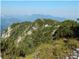 53
53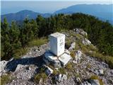 54
54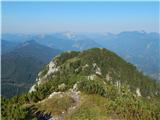 55
55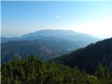 56
56 57
57