Podolševa (Rogar) - Potočka zijalka
Starting point: Podolševa (Rogar) (1240 m)
Starting point Lat/Lon: 46.4355°N 14.6595°E 
Time of walking: 1 h 5 min
Difficulty: easy marked way
Difficulty of skiing: easily
Altitude difference: 420 m
Altitude difference (by path): 420 m
Map: Kamniške in Savinjske Alpe 1:50.000
Access to starting point:
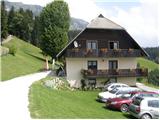
A) We drive into Luče (to here from Mozirje or from Kamnik over mountain pass Volovljek (Kranjski Rak)), and then we continue driving towards Logarska dolina. In the village Solčava we leave the main road towards Logarska dolina and we continue driving right in the direction of Podolševa, mountain pass Spodnje Sleme and Črna na Koroškem. Further road loses an asphalt covering, and after few kilometers at the crossroad in Podolševa we turn left in the direction of Panorama road (right mountain pass Spodnje Sleme and Črna na Koroškem). Further, we drive towards the church of the Holy Spirit, and we park already few 100 meters before the church on an appropriate place by the road near the farm Rogar
A) We drive to Črna na Koroškem (to here from Ravne na Koroškem or from Šoštanj through the mountain pass Spodnje Sleme), and then we continue driving towards Luče. At first asphalt road, higher becomes a macadam and it brings us to the crossroad of several roads on the mountain pass Spodnje Sleme. From the mountain pass, we continue towards Solčava, after that already little lower we turn right in the direction of Panorama road (on the left road we get to Solčava). Further, we drive towards the church of Sveti Duh, and we park already few 100 meters before the church on an appropriate place by the road near the farm Rogar.
Path description:
From the starting point, we at first walk to tourist farm Rogar, and from there we continue left on a cart track which starts ascending through the forest. A little higher from the left joins also cart track which comes from the church of Sveti Duh, and we continue right on a marked path which leads towards Olševa. Cart track then changes into a footpath which quickly brings us to the national border. Further, we are ascending for some time by the national border, and then we get to a marked crossing, where we continue right in the direction of Potočka zijalka (left Remšenik / Remschenig).
From the crossing follows for approximately 10 minutes of a steep ascent and we are already at karst cave named Potočka zijalka.
Pictures:
 1
1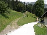 2
2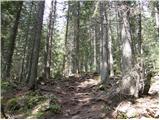 3
3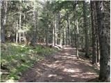 4
4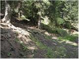 5
5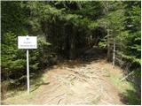 6
6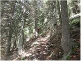 7
7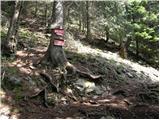 8
8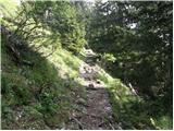 9
9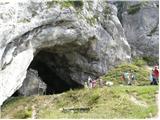 10
10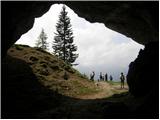 11
11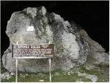 12
12