Podpeca (Helenski potok) - Koča na Pikovem
Starting point: Podpeca (Helenski potok) (625 m)
Starting point Lat/Lon: 46.4701°N 14.8212°E 
Time of walking: 1 h 15 min
Difficulty: easy marked way
Difficulty of skiing: no data
Altitude difference: 367 m
Altitude difference (by path): 367 m
Map: Kamniške in Savinjske Alpe 1:50.000
Access to starting point:
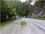
A) We drive to Črna na Koroškem, where from the roundabout in the center of the settlement, we go to the exit towards Koprivna. At the next crossroad, we go slightly right, so that over the bridge we cross river Meža, and next to it we then continue driving. Črna na Koroškem then ends, and we drive to the road sign 5.5 km, where still before crossing stream Helenski potok we park on an appropriate place by the road.
B) We drive to Solčava, and then we follow the signs for Črna na Koroškem. Next follows an ascent on the mountain pass Spodnje Sleme, and from there descent towards Koprivna. Lower, we drive by river Meža and we are still driving in the direction of Črna na Koroškem. When a road towards Podpeca branches off to the left, we continue straight and then after crossing the stream Helenski potok we park on a parking lot by the road. At the starting point, there is road sign 5.5 km.
Path description:
From the starting point, we walk to the nearby crossroad and we continue in the direction of Podpeca, Peca and Pikovo. Asphalt path at first leads by stream Helenski potok, and after approximately 15 minutes we get to a mine gnome - Perkmandeljc.
From the gnome we still walk on the road by stream Helenski potok and we soon get to a crossroad, where the path branches off to the left over Mirjance on Peca, and we still continue on the road which leads by the stream. Higher, we go also past few homesteads, and we leave the main road at the spot, where we notice signs for homestead Pori.
We continue sharply right on a macadam road which ascends diagonally and after few houses, it passes into the forest. While walking on the road, we notice some faded blazes, which still before the road passes out of the forest on the edge of pastures, point us to the left in the forest, where we continue on a cart track. Further, we are still accompanied by occasional old blazes, and at the smaller crossing, we go left (right chapel, and past the nearby homestead it is possible to descend back to the asphalt road) and further we walk by the edge of the forest. Higher, we for some time step into a dense forest and then we ascend to the mountain hut Koča na Pikovem, by which stands the church of St. Helena.
Description and pictures refer to a condition in July 2018 and February 2020.
Pictures:
 1
1 2
2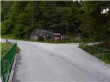 3
3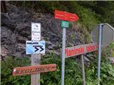 4
4 5
5 6
6 7
7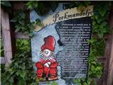 8
8 9
9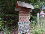 10
10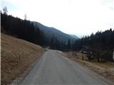 11
11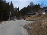 12
12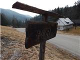 13
13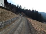 14
14 15
15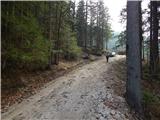 16
16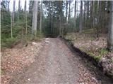 17
17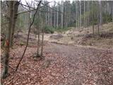 18
18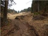 19
19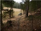 20
20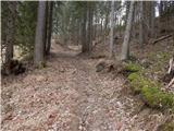 21
21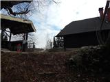 22
22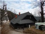 23
23