Podsreda - Stara sveta gora (by Stations of the Cross)
Starting point: Podsreda (243 m)
Starting point Lat/Lon: 46.04299°N 15.59191°E 
Path name: by Stations of the Cross
Time of walking: 25 min
Difficulty: easy unmarked way
Difficulty of skiing: no data
Altitude difference: 143 m
Altitude difference (by path): 143 m
Map:
Access to starting point:
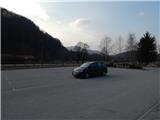
A) We drive to Šentjur (to here from Celje, Štajerska highway exit Dramlje or Šmarje pri Jelšah), and then we follow the signs for Kozje and Planina pri Sevnici. At the end of Šentjur we continue straight towards Kozje (right - Planina pri Sevnici), and then we drive through Lesično, Kozje to Podsreda, where we park on a parking lot by the fire station and Dom krajanov.
B) We drive to Brestanica (to here from Sevnica or Krško), and then we follow the signs for Senovo and forward Podsreda. In Podsreda we go left towards Kozje (right - Bistrica ob Sotli), and when we get to the fire station and Dom krajanov we park on a parking lot by the building.
Path description:
From the parking lot, we walk on the south side of the building, and behind it we continue left on a narrower asphalt road which starts ascending. The path at first leads past the chapel of St. Florijan, and after the next chapel the path splits.
We continue left on the path which continues by Stations of the Cross (straight - path on the road). Next follows an ascent in zig-zags, where at each hairpin turn stands a chapel with Station of the Cross, and nice views are opening up on Podsreda, and surrounding hills. When the path and the slope flatten out from the right joins also a little longer path on the road, and we walk to the nearby church of Mary and the seven sorrows, and a little ahead there is also the chapel of St. Ana.
Description and pictures refer to a condition in March 2022.
Pictures:
 1
1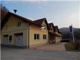 2
2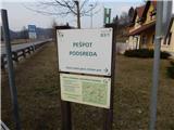 3
3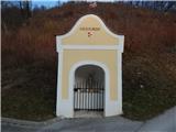 4
4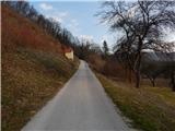 5
5 6
6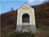 7
7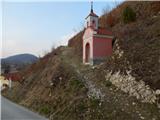 8
8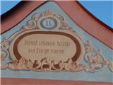 9
9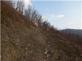 10
10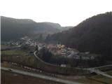 11
11 12
12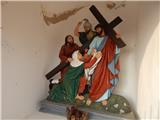 13
13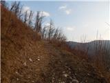 14
14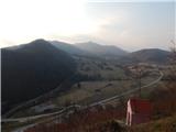 15
15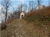 16
16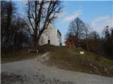 17
17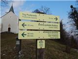 18
18 19
19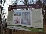 20
20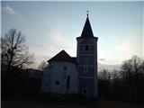 21
21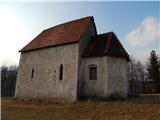 22
22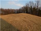 23
23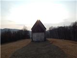 24
24