Pogorelec - Sedlata gorica (Pogorelec)
Starting point: Pogorelec (598 m)
Starting point Lat/Lon: 45.72288°N 15.02772°E 
Time of walking: 45 min
Difficulty: easy unmarked way
Difficulty of skiing: no data
Altitude difference: 219 m
Altitude difference (by path): 235 m
Map: Dolenjska - Gorjanci, Kočevski Rog 1:50.000
Access to starting point:
A) From the direction of Žužemberk we drive towards Črnomelj. At the beginning of the village Podturn pri Dolenjskih Toplicah we turn right towards Kočevski Rog on the road towards Baza 20 and Kočevje. On a good asphalt road after 4 km we get to a crossroad, where to the left goes the road towards Baza 20, and we follow the main road in the direction of Kočevje to the right. After approximately 1.5 km asphalt ends and we get to a crossroad at Pogorelski križ. The far left road continues towards Rog and Kočevje, the far right on the eastern slopes goes into a valley, and we continue on the middle. After about 1.5 km of the macadam road we get to the hamlet Pogorelec, where we can park at NOB monument or few ten meters ahead at Polharski dom.
B) From the direction of Črnomelj we drive towards Žužemberk, and at the end of the village Podturn pri Dolenjskih Toplicah we turn left towards Kočevski Rog. Further, the same as above.
C) From the direction Novo mesto or Dolenjske Toplice after we get to Podturn we turn right in the direction of Žužemberk or Ljubljana, and forward as described before.
Path description:
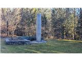
The starting point is at NOB monument in hamlet Pogorelec. Left from the monument we notice a forest logging trail, which ascends straight through the forest and a smaller meadow in the direction of east. Higher, the logging trail turns right, steepness decreases and we get to the next logging trail, which comes from the right. We step on this logging trail and we follow it to the left uphill. After a longer left turn the logging trail goes towards the north and the path slightly descends and in a small valley we get to another crossroad of logging trails. We cross a logging trail and go on the one which sticks to direction towards the north. On this logging trail we walk only few ten strides, and when after the initial ascent, the path flattens, on the left we look for otherwise poorly visible turn-off to the left. On this worse logging trail, which is already partly overgrown and covered with stones we walk approximately 5 minutes, when another logging trail crosses our path. There we go left and already after few steps we turn to the right, on a logging trail, which will again go in the direction of north. From here on, the path is nice and wide and is very mildly ascending on a slope. There we walk to the point, when even this mild ascent flattens and because of the clearing a view opens up into a valley, here on the left we notice a logging trail, which goes steeply uphill. The ascent is quite steep but already after about 100 meters at the crossing we turn to the right, and the steepness for a short time decreases. We all the time continue straight, even when we come to a young beech forest. Here the logging trail is again steep and rocky, and higher near the peak the logging trail ends and we just continue in the same direction so that we look for passages among trees and rocks. In the vicinity of the summit we get to another logging trail. We can continue ten more strides to the top, and then we continue with a short descent in the direction of grassy and panoramic paragliding site, which we already see on the right.
At the paragliding site there is also a modest cottage owned by the club of paragliders.
From the top, a beautiful view opens up on Dolenjska, Dolenjske Toplice is below us and Novo mesto is a little ahead. In nice weather the view reaches to Kamnik and Savinja Alps, and if we step on the western slope of the peak, the view reaches up to Snežnik.
Pictures:
 1
1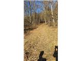 2
2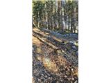 3
3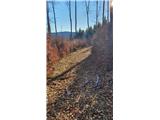 4
4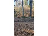 5
5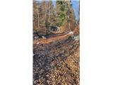 6
6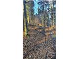 7
7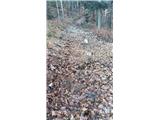 8
8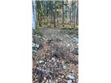 9
9 10
10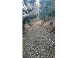 11
11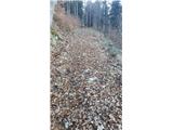 12
12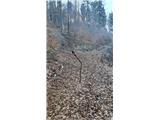 13
13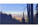 14
14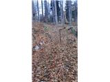 15
15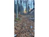 16
16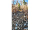 17
17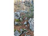 18
18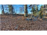 19
19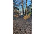 20
20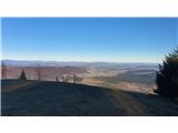 21
21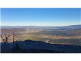 22
22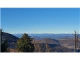 23
23 24
24 25
25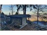 26
26