Poldov rovt (Vrata) - Bivak na Jezerih
Starting point: Poldov rovt (Vrata) (941 m)
Starting point Lat/Lon: 46.4216°N 13.86289°E 
Time of walking: 4 h
Difficulty: difficult unmarked way
Difficulty of skiing: more demanding
Altitude difference: 1177 m
Altitude difference (by path): 1177 m
Map: Triglav 1:25.000
Access to starting point:
We drive to Mojstrana, then follow the signs for the Vrata valley. We continue driving through the Vrata valley, about 100 meters before the 10 km road sign, and we will notice a cart track that branches off to the right perpendicular to the main road. Here is the start of the described path. The marked parking lot where parking is allowed is located approximately 500 meters further along the main road.
Path description:
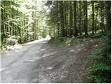
We head onto the cart track that leads into the forest and then past a smaller house, where we continue slightly to the left onto a footpath. Through the forest, we ascend slightly to the left towards Rdeči potok. A little before the stream, the path over Brinje branches off to the right (placed cairn, and on the tree is carved some kind of face and letter L). The path then brings us to the stream bed. Here the path goes along the right side (left bank) upwards and then soon crosses the stream to the left side. The path ascends through a small valley until a smaller wall blocks the path, where we usually also encounter a small spring. The path goes from here to the right and steeply ascends on a natural passage. Slightly exposed, not secured. We are above a small waterfall (if there is water). Here we come out of the forest and ascend over some scree fields. The path over the scree is not comfortable as storms and avalanches destroy it every year. The path soon turns slightly to the right and ascends for a short time on a grassy slope. Next follows ascent beside the scree fields and soon we reach the bivouac na Jezerih, which we will notice on our left.
Pictures:
 1
1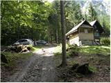 2
2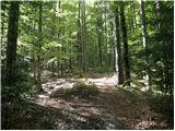 3
3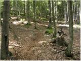 4
4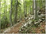 5
5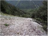 6
6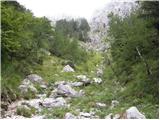 7
7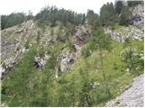 8
8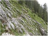 9
9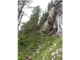 10
10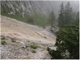 11
11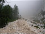 12
12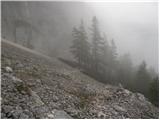 13
13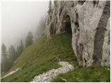 14
14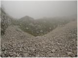 15
15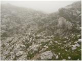 16
16 17
17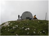 18
18