Starting point: Polje (523 m)
Starting point Lat/Lon: 46.2695°N 13.9128°E 
Time of walking: 5 h 5 min
Difficulty: partly demanding marked way, easy pathless terrain
Difficulty of skiing: no data
Altitude difference: 1413 m
Altitude difference (by path): 1565 m
Map: Škofjeloško in Cerkljansko hribovje 1:50.000
Access to starting point:
From highway Ljubljana - Jesenice we go to the exit Lesce, and then we continue driving towards Bled and Bohinjska Bistrica. From Bohinjska Bistrica we continue on the main road towards Lake Bohinj, and after the village Kamnje we need to pay attention, because we will on the right side, only few meters before the beginning of the village Polje, park on a parking lot by the river Sava Bohinjka.
Path description:
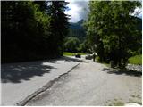
From the parking lot at first we carefully cross the road, after that for a short time, we continue by the main road towards Polje. When we get to Polje, we continue left on a local road, on which we quickly walk to a smaller crossroad, by which we notice the first signposts for mountain hut Orožnova koča, mountain pasture Planina Osredki and Črna prst. We continue in the mentioned direction and further we walk on a narrower asphalt road which in a gentle ascent brings us to the next crossroad, where we continue on the bottom right road (left Bohinjska Bistrica). The path ahead brings us to the beginning of the village Žlan and a little further also to the center of the mentioned village. Above the village the asphalt ends and macadam road brings us to some sort of turning point and trough with water (to here we can also come with a car, this shortens the path for approximately 20 minutes).
From the trough we continue left, where at first through a smaller bridge we cross nearby stream and then we start moderately ascending by the edge of ample pasture. A little higher we cross a grazing fence, so that we pass over on inner side of the pasture. Further, we are ascending through an ample pasture, and the path mostly leads through very thin forest. Higher, we leave the pasture, and the path passes into a dense forest. Further, we cross a very rough cart track, after that for a short time, we are ascending by smaller torrent stream. The path ahead ascends to rough forest road, on which for some time we continue the ascent. When we get to a crossroad, where we join a wider macadam road (road which leads from Ravne towards the mountain pasture Storeča raven) we follow it to the left and there even descend a little (when we reach the road we don't continue straight on an ascending cart track, on which partly misleadingly points mountain signpost). After a short descent, marked cart track branches off to the right.
We continue on a slightly overgrown cart track which after few minutes of additional walking brings us to a marked crossing.
We continue straight (left Črna prst past the mountain hut Orožnova koča and mountain pasture Planina za Liscem) on a cart track which higher brings us into a smaller valley through which we ascend to the next forest road. When we step on the road, we continue few steps to the left, after that mountain sign for Črna prst points us right in the forest, where starts to ascend steeply. The path a little higher crosses an overgrown clearing (fern and raspberry bushes) and then returns into the forest, through which continues all the way to the mountain pasture Osredki.
From the mountain pasture on which there are two smaller wooden cottages (one is converted into a bivouac) we continue on the left side of trough pond, on a poorly visible path which starts moderately ascending among bushes and individual trees. A still poorly visible path, which is well marked higher brings us on a little larger meadow by the edge of which we notice the next pond. The path is then steeper and steeper ascending and is slowly turning towards the left. On the top of the ascent, we step on a smaller saddle, after which the path turns right and it ascends diagonally. Next follows few minutes of ascent on a slope covered with dwarf pines and the path brings us on the main ridge of Spodnje Bohinjske gore.
From the ridge from where a beautiful view opens up towards the south, we continue right in the direction towards Vogel (left Črna prst 10 minutes). The path ahead becomes demanding and with the help of steel cables, or mostly without them crosses very steep grassy slopes, which are dangerous for slipping. The path then flattens a little and brings us on a saddle Vrata (1721m). The path then again avoids the ridge on left and then it ascends diagonally over the next steep slope. That the path isn't entirely easy, we get also warned by a memorial plaque. The steepness of the slopes then gradually decreases and the path again gets closer to the main ridge (here we can in 15 minutes ascend on Četrt - easy pathless terrain).
We continue on panoramic, mostly with grass vegetated ridge (towards the west), that is gently ascending towards Konjski vrh, which the path bypasses on the left side. After that, the path slightly descends and it brings us to an indistinct small saddle between Konjski and Poljanski vrh. The latter path, which again starts slightly ascending also bypasses on the left side and then it brings us by the foot of Matajurski vrh, which we will notice on the left side. At the spot, where the path gets close to Matajurski vrh we will notice on the left side poorly beaten footpath which is at first ascending gently towards the south. The path which is getting worse turns a little to the right and after a shorter steep ascent brings us on a side ridge. When we step on the ridge, we continue slightly left on a poorly visible path by which we notice some old faded blazes. This more and more panoramic "path" we then follow to the peak, which we reach after some additional 10 strides.
Because path larger part runs on the ridge because of possible lightning we should only go on the path in good weather.
The starting point - Planina Osredki 2:30, Planina Osredki - Matajurski vrh 2:35.
Pictures:
 1
1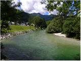 2
2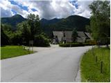 3
3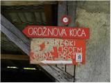 4
4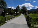 5
5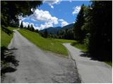 6
6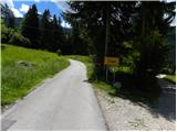 7
7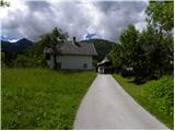 8
8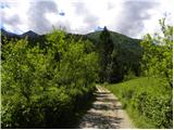 9
9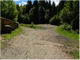 10
10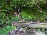 11
11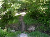 12
12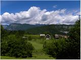 13
13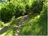 14
14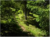 15
15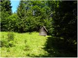 16
16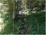 17
17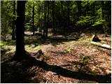 18
18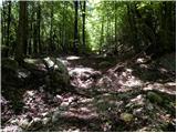 19
19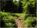 20
20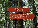 21
21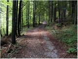 22
22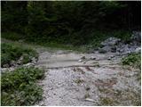 23
23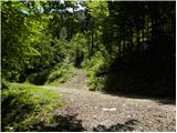 24
24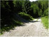 25
25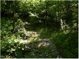 26
26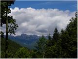 27
27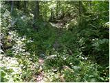 28
28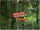 29
29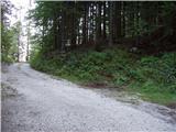 30
30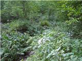 31
31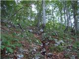 32
32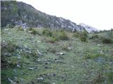 33
33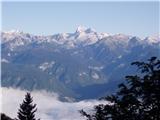 34
34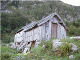 35
35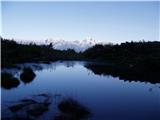 36
36 37
37 38
38 39
39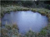 40
40 41
41 42
42 43
43 44
44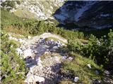 45
45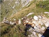 46
46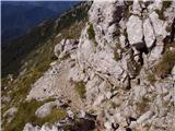 47
47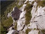 48
48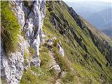 49
49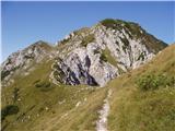 50
50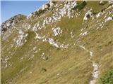 51
51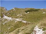 52
52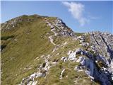 53
53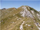 54
54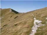 55
55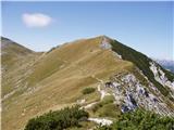 56
56 57
57 58
58 59
59 60
60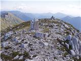 61
61