Prebold - Reška planina (via Gradišče)
Starting point: Prebold (281 m)
Starting point Lat/Lon: 46.23663°N 15.09309°E 
Path name: via Gradišče
Time of walking: 3 h 10 min
Difficulty: partly demanding marked way
Difficulty of skiing: demanding
Altitude difference: 644 m
Altitude difference (by path): 695 m
Map: Posavsko hribovje - zahodni del 1:50.000
Access to starting point:
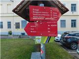
We leave Štajerska highway at the Šentrupert exit, and then we follow the signs for Prebold. In the center of Prebold, at the red hiking signposts, the described path begins, and we park at one of the parking lots in the center of the settlement, by the kindergarten, the primary school, or the cemetery.
Path description:
From the center of Prebold we follow the signs for Mrzlica, Golava, and Hom and initially walk on the sidewalk along road Reška cesta, where blazes soon direct us right onto the street Skozi Gaj, passing a few more houses, and at the edge of a meadow, the path splits again.
We continue left towards Golava and Mrzlica (straight for Žvajga and the Dom na Reški planini via Žvajga) and quickly reach the road leading to Podmeja and Trbovlje, continuing along the sidewalk by the road. A few minutes ahead, a path branches off to the left towards Mrzlica and an easier path to Golava, but we continue walking on the sidewalk along the road towards Trbovlje until the start of the settlement Marija Reka, where we turn right behind a chapel onto a side road, marked with signs for Marija Reka and hiking signs for Gradišče and the mountain hut below Reška planina.
We continue past a few more houses, then the road transitions into the forest and continues along the stream Mala reka. A few minutes further, we reach a cross on the left side, and shortly after, blazes guide us left uphill, where we begin a steep ascent on an occasionally overgrown path. After about 30 minutes of steep ascent, we reach an indistinct ridge where the path levels out, and a little further, a path from quarry Strgarjev kamnolom joins from the left, or a path to Golava branches off to the left.
We continue straight, gradually starting to ascend more steeply again, and higher up, we cross a cart track. A short ascent through overgrown forest follows, then we reach the scenic grassy slopes below the farm Podbregar, through which we ascend to the mentioned farm.
At the farm, there is a stamp for Gradišče (the peak is located above the farm), and we continue along the road, which returns to the forest and begins descending diagonally across the slopes of the hill Gradišče. When we reach the northwest slopes of Gradišče, the road splits, and we continue on the upper left road, which leads us past a homestead and a chapel to a slightly wider road, which we only cross. Just a few steps above the road, we join the usual path from Prebold, which leads through the saddle at Počivalnik.
We continue left on the path, which returns to the forest and proceeds across the slopes of Reška planina, where we notice several educational trail signs along the way. As we approach the church of St. Mary of the Assumption, the marked path turns left and slightly descends, then we ascend in a few steps to near the mountain hut, from which we are only a few dozen steps of easy walking away.
Before the mountain hut, we turn right and continue toward Reška planina. We quickly leave the road and proceed along a footpath, ascending to the church.
We bypass the church on the left side, and from the crossing, we continue straight toward Adijev bivouac and Reška planina (left Šmiglova zidanica, Sveta planina or Partizanski vrh, Mrzlica, and Grajska vas). We follow an older cart track that turns right, and after a short traverse, it becomes a footpath. The footpath initially ascends alongside a torrent ditch, crosses it higher up, and then transitions to a steep slope over which we climb steeply. A steep ascent follows, requiring extra caution, especially during descent, to avoid slipping. Even in dry conditions, some care is needed. When we reach the ridge higher up, the path flattens. We continue left, following the signs for the stamp. After a few minutes of mostly gentle ascent along the ridge, we reach bivouac Adijev bivak na Reški planini.
We bypass the bivouac on the right side and continue toward Šmiglova zidanica and the peak. In approximately 10 minutes of gentle to moderate ascent, we reach the highest point of Reška planina.
Prebold - Dom pod Reško planino 2:15, Dom pod Reško planino - Adijev bivak 0:45, Adijev bivak - Reška planina 0:10.
Pictures:
 1
1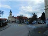 2
2 3
3 4
4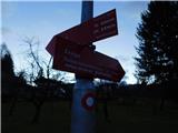 5
5 6
6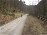 7
7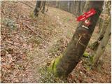 8
8 9
9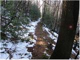 10
10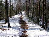 11
11 12
12 13
13 14
14 15
15 16
16 17
17 18
18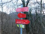 19
19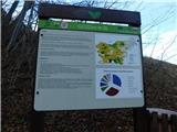 20
20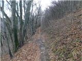 21
21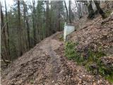 22
22 23
23 24
24 25
25 26
26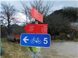 27
27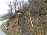 28
28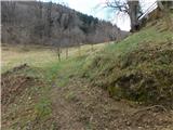 29
29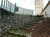 30
30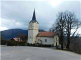 31
31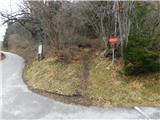 32
32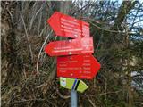 33
33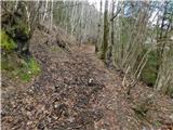 34
34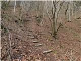 35
35 36
36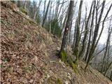 37
37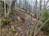 38
38 39
39 40
40 41
41 42
42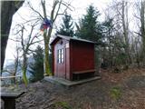 43
43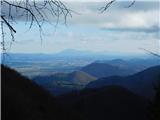 44
44 45
45 46
46 47
47 48
48 49
49 50
50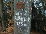 51
51