Prebold - Reška planina (via Tolsti vrh and Strnik)
Starting point: Prebold (281 m)
Starting point Lat/Lon: 46.23663°N 15.09309°E 
Path name: via Tolsti vrh and Strnik
Time of walking: 3 h
Difficulty: easy marked way
Difficulty of skiing: no data
Altitude difference: 644 m
Altitude difference (by path): 845 m
Map: Posavsko hribovje - zahodni del 1:50.000
Access to starting point:
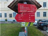
We leave Štajerska highway at the Šentrupert exit, and then we follow the signs for Prebold. In the center of Prebold, at the red hiking signposts, the described path begins, and we park at one of the parking lots in the center of the settlement, by the kindergarten, the primary school, or the cemetery.
Path description:
From the center of Prebold, we follow the signs for Žvajga, vineyard cottage Šmiglova zidanica, Dom pod Reško planino, Reška planina, and Adijev bivak on Reška planina, initially walking through the central part of the settlement, where at crossroads we follow the blazes, and the path leads us past Hotel Prebold, the NOB monument, and Prebold mansion, with the blazes gradually leading us onto road Tovarniška cesta. We continue alongside the industrial zone, then the blazes guide us left into the forest, through which we walk for a few minutes before returning to the road, which we follow to a marked crossing.
From the crossing, we continue toward Reška planina (right vineyard cottage Šmiglova zidanica), bypassing some houses on the right, and a few times higher up we cross a road or briefly continue along it.
The fairly well-marked path then bypasses the last house in this area on the right and transitions to grassy slopes, where slightly higher up we reach a path branching left toward linden tree Dežnikarjeva lipa.
We continue straight (left Dežnikarjeva lipa, two minutes) and return to the forest, with the path ahead ascending diagonally. After a few minutes of diagonal ascent, we reach a marked crossing at the saddle by Počivalnik, where we turn right toward Dom pod Reško planino and Tolsti vrh (left Žvajga and Prebold via Žvajga), and for a short time, we walk along the eastern ridge of Tolsti vrh. When the ridge starts to ascend more noticeably, the path splits, and we choose the slightly right path marked with signs for Tolsti vrh (slightly left for Dom pod Reško planino).
We continue the ascent along the eastern ridge of Tolsti vrh, ascending through the forest. At the bench, the forest on the right side temporarily ends, offering a beautiful view of Savinjska dolina and the surrounding mountains. The path then flattens and leads us to an older cart track, which we follow briefly before the blazes guide us left back onto the ridge. A few more minutes of ascent follow, and we reach Tolsti vrh, from where a partial view opens up through the trees toward the Kamniško Savinjske Alpe.
At the inscription box, signs for Strnik direct us to the left, and we begin descending first through a band of bushes, then through the forest. Lower down, we reach a cart track, along which we descend to a saddle that separates Tolsti vrh from Strnik.
Here, we continue straight, bypassing chapel Lobnikarjeva kapela on the left, and ascend along a slightly steeper cart track, from which we soon turn left onto a less-trodden footpath that becomes even steeper. This is followed by a few minutes of quite steep ascent, where there is a greater risk of slipping, especially in wet conditions, before the path levels out, and in a few steps, we arrive at Strnik, where an inscription box is located.
We continue in the direction of bivouac Adijev bivak on Reška planina and start by lightly descending; lower down, when the path turns left and crosses onto a grassy slope, we begin steeply descending towards Mrzličar. On the lower part of the meadow, a nice view opens up towards Čemšeniška planina when looking to the right, and we bypass the Mrzličar homestead on the right side.
When we reach the circular learning path Marija Reka, which encircles Reška planina, we continue right towards Adijev bivouac and the mountain hut Dom pod Reško planino (left towards Prebold, Gradišče, Žvajga, and Dom pod Reško planino ).
We proceed along a cart track that crosses the northern slopes of Reška planina, continuing straight at several smaller crossings. After some time, a path from the right joins, passing vineyard cottage Šmiglova zidanica, or a path starting from Grajska vas. A little further, we reach an asphalt road, where the next marked crossing is at the saddle Čeren.
Here, we turn sharply left towards Reška planina along the ridge and bivouac Adijev bivak (slightly left towards the mountain hut Dom pod Reško planino, right along the driving road towards Tabor and Grajska vas).
The path ahead leads us along the western ridge of Reška planina, ascending moderately at first, then more steeply. We soon reach the indistinct peak Popelova skala, followed by a short descent along and beside the ridge, where additional caution is needed in some spots due to the considerable steepness of the slopes. Further along, the ridge becomes less steep, and in a gentle ascent, we reach the indistinct peak of Reška planina, recognizable by the inscription on a tree.
Starting point - saddle at Počivalnik 0:50, saddle at Počivalnik - Tolsti vrh 0:35, Tolsti vrh - Strnik 0:30, Strnik - Reška planina 1:05.
Description and pictures refer to the condition in January 2025.
Pictures:
 1
1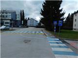 2
2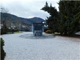 3
3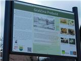 4
4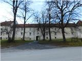 5
5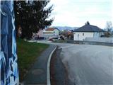 6
6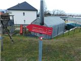 7
7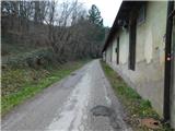 8
8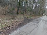 9
9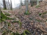 10
10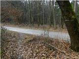 11
11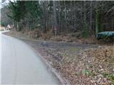 12
12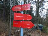 13
13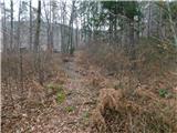 14
14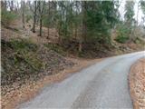 15
15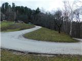 16
16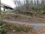 17
17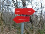 18
18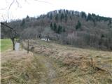 19
19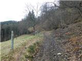 20
20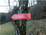 21
21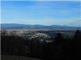 22
22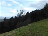 23
23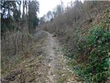 24
24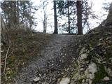 25
25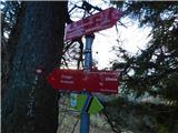 26
26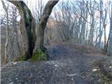 27
27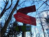 28
28 29
29 30
30 31
31 32
32 33
33 34
34 35
35 36
36 37
37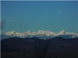 38
38 39
39 40
40 41
41 42
42 43
43 44
44 45
45 46
46 47
47 48
48 49
49 50
50 51
51 52
52 53
53 54
54 55
55 56
56 57
57 58
58 59
59 60
60 61
61 62
62 63
63 64
64 65
65 66
66 67
67 68
68 69
69 70
70 71
71 72
72 73
73 74
74 75
75 76
76 77
77 78
78 79
79 80
80 81
81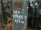 82
82