Predmeja - Kucelj na Čavnu (by road)
Starting point: Predmeja (1020 m)
Starting point Lat/Lon: 45.956°N 13.8541°E 
Path name: by road
Time of walking: 1 h 45 min
Difficulty: easy marked way
Difficulty of skiing: easily
Altitude difference: 217 m
Altitude difference (by path): 300 m
Map: Goriška 1:50.000
Access to starting point:
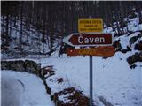
From central Slovenia we drive to Logatec and forward towards Idrija but only to Godovič. Here we turn left in the direction of Črni vrh. We follow this road ahead towards Predmeja. Behind the village Predmeja we go right in the direction of village Lokve. Then we drive on the forest road to a sharp right turn, where the road on Čaven branches off to the left. Here we park on an appropriate place. Near is few smaller parking spots.
From Primorska side we drive to valley Vipavska dolina, where we further follow the signs for village Lokavec. From here ahead we drive in the direction of Predmeja. In parts quite scenic road brings us to a crossroad before Predmeja. Here we go straight in the direction of village Lokve and we follow the road to a sharp right turn, where the road on Čaven branches off to the left. Here we park on an appropriate place. Near is few smaller parking spots.
Path description:
From the parking lot, we go on a road towards Čaven. The road which runs through the forest is slightly ascending and after approximately 15 minutes brings us to a crossroad, where we go to the left bottom road. Only few minutes before the mountain hut on the left side of the road nice views open up towards Primorska. After that follows only a shorter descent and in front of us, we notice the mountain hut Koča na Čavnu.
Behind the mountain hut, we come to the next crossroad, where we go left downwards. The road soon goes into the forest and starts descending. After this descent follows a shorter ascent and we get to signposts, where a sign for Kucelj points us left upwards by the fence. After few meters, the path turns right and crosses the fence. Next follows a crossing of a grassy slope to the spot, where the path brings us on the ridge. This part of the path is hard to follow because the path is in parts poorly visible. And when we come on the ridge the path starts ascending steeper. The ascent on a wide ridge is very pleasant because with every step new views opening up. Only few meters below the summit path avoids the ridge so that we reach the peak from the north side.
The starting point - Koča na Čavnu 1:00, Koča na Čavnu - Kucelj 45 minutes.
Pictures:
 1
1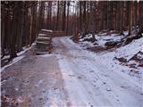 2
2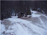 3
3 4
4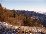 5
5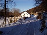 6
6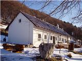 7
7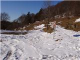 8
8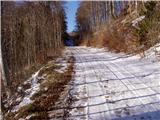 9
9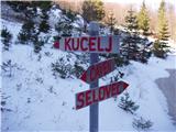 10
10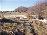 11
11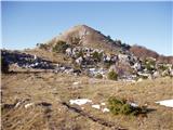 12
12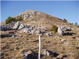 13
13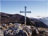 14
14