Predmeja (tunnels) - Kucelj (na Čavnu) (via Koča na Čavnu)
Starting point: Predmeja (tunnels) (800 m)
Starting point Lat/Lon: 45.9377°N 13.8692°E 
Path name: via Koča na Čavnu
Time of walking: 2 h 15 min
Difficulty: easy marked way
Difficulty of skiing: no data
Altitude difference: 437 m
Altitude difference (by path): 550 m
Map: Goriška 1:50.000
Access to starting point:
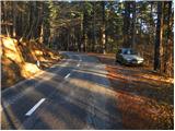
From highway Razdrto - Nova Gorica we go to the exit Ajdovščina and follow the road ahead towards the village Lokavec (to Lokavec we come from the center of Ajdovščina, or from old road Ajdovščina - Nova Gorica, where at settlement Cesta we turn right). From Lokavec we continue driving on ascending winding road in the direction of Predmeja. The mentioned road, we follow to mountain signposts for Čaven, Veliki rob and Kucelj (signposts are located between the quarry and tunnels, the road sign approx. 10 km). We park few 10 meters lower on a parking lot by the road.
To the starting point, we can also come from Godovič, over Črni vrh and Col to Predmeja. In this case from Predmeja we descend towards Ajdovščina and then soon after the third tunnel we park.
Path description:
From the parking lot, we at first walk to signposts, and then we go on the path Srednječavenska pot. The path which goes immediately in the forest, at first moderately ascends and then it continues by crossing the slopes towards the south. Wide and well made mountain path, soon passes on steep slopes (danger of falling stones) and is gradually turning more and more towards the right. A little further from the path beautiful views opening up on Nanos and Vipava valley, and the path gradually passes on more rocky terrain. Even a little further, the path again passes into a dense forest, where it starts lightly descending. After a shorter gentle descent we come to a marked crossing, where we continue right steeply upwards in the direction of Čaven (left downwards Lokavec, and straight continues the path Srednječavenska pot).
We continue the ascent on the path "lokavška pot" and it is ascending quite steeply. And after a time the path which was most of the time running through the forest again crosses some panoramic slopes. A little further, the path brings us to the ridge, where we have two options to continue. Left runs little below the ridge and has less view than the one, that runs on the ridge, but is better in case of a strong wind. After 10 minutes both paths join and they bring us on grassy slopes east from Mala gora.
Here the steepness decreases and the path continues on nice meadows, where in spring and summer time we notice a lot of the mountain flowers. Higher from the left the path from Stomaž joins, and we continue straight on the path which in few minutes of additional walking brings us to the mountain hut Koča na Čavnu.
Behind the mountain hut signs for Kucelj point us slightly to the left on a footpath which starts descending diagonally. The path ahead crosses a short lane of a forest and then turns to the right, where it is still lightly descending. After that, the path gradually passes into the forest and from the left path from the village Kamnje joins (there are turn-offs for Kamnje). We continue in the direction of Kucelj on the path which gradually passes on the right side of "Čaven" ridge. The path continues through a large clearing, from which a view opens up on surrounding hills, and then it returns into the forest. A little further, we leave a gently sloping cart track and we continue the ascent left and further we are ascending through a dense forest. The steepness soon decreases and the path out of the forest brings us on more panoramic grassy slopes. Follows few minutes of easy walking, and then the path brings us below the peak of Kucelj, where it again steeply ascends. This path, which offers increasingly beautiful views, we then follow all the way to the top of Kucelj, and we reach it after few minutes of additional walking.
Pictures:
 1
1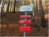 2
2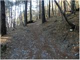 3
3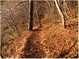 4
4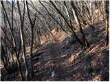 5
5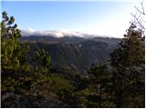 6
6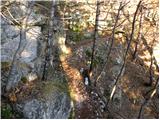 7
7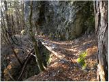 8
8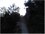 9
9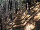 10
10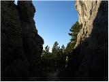 11
11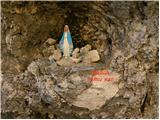 12
12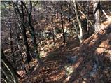 13
13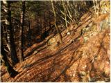 14
14 15
15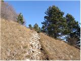 16
16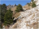 17
17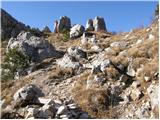 18
18 19
19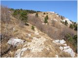 20
20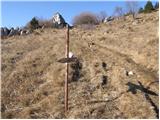 21
21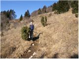 22
22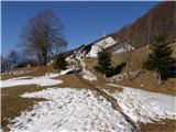 23
23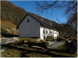 24
24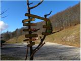 25
25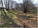 26
26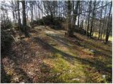 27
27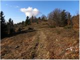 28
28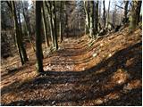 29
29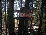 30
30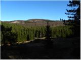 31
31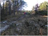 32
32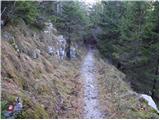 33
33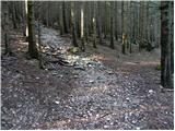 34
34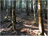 35
35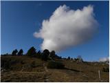 36
36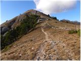 37
37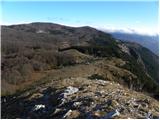 38
38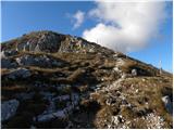 39
39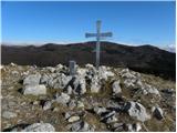 40
40 41
41