Prelaz Vrhe - Donačka gora
Starting point: Prelaz Vrhe (426 m)
Starting point Lat/Lon: 46.2583°N 15.7586°E 
Time of walking: 1 h 35 min
Difficulty: difficult marked way
Difficulty of skiing: more demanding
Altitude difference: 458 m
Altitude difference (by path): 495 m
Map: Rogaška Slatina z Bočem in Donačko goro 1:25.000
Access to starting point:
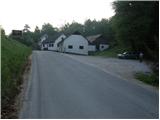
From highway Ljubljana - Maribor we go to the exit Dramlje and follow the road ahead in the direction of Šentjur, Rogaška Slatina and Rogatec. In Rogatec signs for Donačka gora point us to the left on a little narrower road which we then follow towards the village Žetale. On a smaller mountain pass, right at the spot, where municipality Rogatec ends, we will on the right side notice a little larger parking lot, where we park.
Path description:
From the parking lot, we at first walk to mountain pass, where we continue on the left ascending road in the direction of Donačka gora. After a short ascent, only few meters after the house with thatched roof, signs for Donačka gora point us to the right on a gently sloping cart track which after few steps goes into a short lane of a forest.
Cart track quickly comes out of the forest and then it continues through panoramic meadows. Higher, the path brings us to lonely homestead, past which leads the marked path. Only a little above the mentioned farm, we join a little wider cart track which we follow to the right (left Sveti Jurij and Sveti Donat). Cart track, which is further ascending diagonally, mostly through the forest brings us to the next crossing, where we continue left in the direction of Donačka gora (right Žetale).
After a short ascent on a well-made path from the right joins the path from the mountain hut Rudijev dom. Here we continue straight in the direction of Donačka gora on the path which is further relatively steeply ascending. When the steepness decreases follows a crossing of steep slopes. And the path ahead brings us below the steep upper slope of the eastern peak of Donačka gora. Next follows a very steep ascent, on a well-secured path to the ridge. Here is left 20m from the path, eastern peak of Donačka gora (marked, last meters secured with iron spikes).
We continue right on a path, which at first descends a little and then it ascends by the ridge of Donačka gora. After approximately 20 minutes of walking on a steep vegetated ridge we come on the western peak, where there is also an inscription box.
Pictures:
 1
1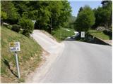 2
2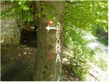 3
3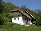 4
4 5
5 6
6 7
7 8
8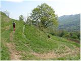 9
9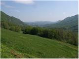 10
10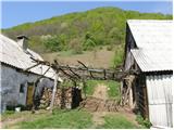 11
11 12
12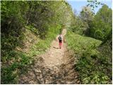 13
13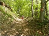 14
14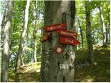 15
15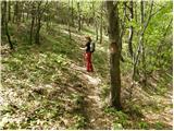 16
16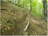 17
17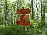 18
18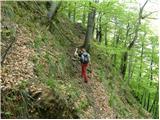 19
19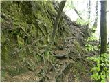 20
20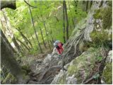 21
21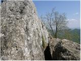 22
22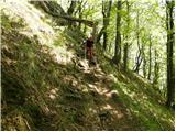 23
23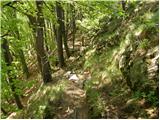 24
24 25
25 26
26 27
27