Starting point: Preserje (400 m)
Starting point Lat/Lon: 45.9613°N 14.4205°E 
Time of walking: 20 min
Difficulty: easy marked way
Difficulty of skiing: easily
Altitude difference: 84 m
Altitude difference (by path): 84 m
Map: Ljubljana-Okolica 1:50.000
Access to starting point:
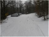
From highway Ljubljana - Koper we go to the exit Brezovica, and then we continue driving in the direction of Podpeč. In Podpeč, from where also roads from Črna vas and Ig join, we continue right in the direction of Krim, Rakitna and Borovnica. The road towards Borovnica we follow for a short time, and then signs for Rakitna point us to the left upwards on a little narrower and steep road which we then follow to a smaller saddle. On the mentioned saddle we turn left and after 100 meters we park on a marked parking lot.
Path description:
From the parking lot, we go on a wide and marked path in the direction of Sveta Ana. The path is at first gently, and then moderately ascending on a wide cart track. After approximately 15 minutes of easy walking the forest ends, and the path brings us on a small saddle, where paths from Podpeč and Jezero join. Here we continue left and after 2 minutes of additional walking, we get to the top of Sveta Ana, from where a nice view opens up on Ljubljana Marshes and surrounding hills.
Pictures:
 1
1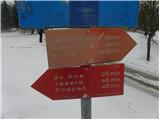 2
2 3
3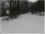 4
4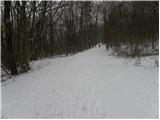 5
5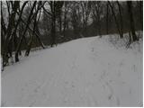 6
6 7
7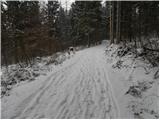 8
8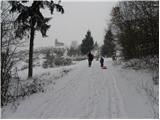 9
9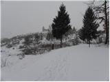 10
10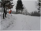 11
11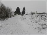 12
12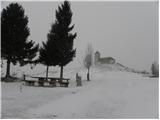 13
13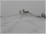 14
14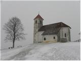 15
15