Prevala - Škabrijel (via Veliki hrib)
Starting point: Prevala (325 m)
Starting point Lat/Lon: 45.9838°N 13.6647°E 
Path name: via Veliki hrib
Time of walking: 1 h 5 min
Difficulty: easy marked way
Difficulty of skiing: no data
Altitude difference: 321 m
Altitude difference (by path): 345 m
Map: Goriška - izletniška karta 1:50.000
Access to starting point:
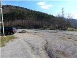
A) We drive to Nova Gorica, then continue driving towards Tolmin and Kobarid. We follow the main road towards Tolmin only to Solkan, where at the traffic-light intersection we continue right in the direction of Sveta Gora and Grgar. The ascending road further leads us past the Solkan quarry, then a little higher it turns sharply to the right and brings us to the Skalnica inn, behind which we first reach a junction where a steep road branches off to the left towards Sveta Gora, and only a little further also to a junction where the road continues slightly to the left towards Grgar, Čepovan and Banjšice, but we continue slightly right towards Trnovo and Lokvam. From the junction we drive a good 100 m further, then park on a larger macadam parking lot on the left side of the road.
B) From Tolmin or Most na Soči we drive on the main road towards Nova Gorica, then only a little before Nova Gorica, more precisely at the traffic-light intersection in Solkan we turn left in the direction of Sveta Gora and Grgar. The ascending road further leads us past the Solkan quarry, then a little higher it turns sharply to the right and brings us to the Skalnica inn, behind which we first reach a junction where a steep road branches off to the left towards Sveta Gora, and only a little further also to a junction where the road continues slightly to the left towards Grgar, Čepovan and Banjšice, but we continue slightly right towards Trnovo and Lokvam. From the junction we drive a good 100 m further, then park on a larger macadam parking lot on the left side of the road.
C) From Goriška Brda we drive to Solkan, where at the first intersection after the new Solkan bridge we continue straight in the direction of Sveta Gora. The ascending road further leads us past the Solkan quarry, then a little higher it turns sharply to the right and brings us to the Skalnica inn, behind which we first reach a junction where a steep road branches off to the left towards Sveta Gora, and only a little further also to a junction where the road continues slightly to the left towards Grgar, Čepovan and Banjšice, but we continue slightly right towards Trnovo and Lokvam. From the junction we drive a good 100 m further, then park on a larger macadam parking lot on the left side of the road.
Path description:
From the parking lot, we cross the road, then continue in the direction of the marked path to Škabrijel. On the other side of the road, we first continue on a rocky cart track, then after crossing the power line, from where a nice view opens up on the Solkan bridge with the largest stone arch in the world, we arrive at a junction, by which there is a small bench.
From the junction, we continue left in the direction of Škabrijel (straight ahead still on the Kekec and Škabrijel cart track past the Hungarian pyramid) on the path, which starts to ascend more steeply. Further on, we ascend moderately to steeply for some time, then, when higher up the path flattens, we arrive at the next marked junction.
To the right the "direct" path to Škabrijel continues, but we continue left in the direction of the circular path and signs for elevation point 526. The path ahead continues with some shorter descents and ascents, then in a longer semicircle we reach the monument on Veliki hrib.
From the monument, we continue on a gently sloping path, on which we quickly return to the "direct" path, which we follow to the left.
Further on, we ascend gently to moderately, and the path during the ascent also leads us past a pleasant viewpoint, from where a view opens up towards both Solkan bridges and the surroundings. A few minutes of moderate ascent follow, and we arrive at the top of Škabrijel, where a metal lookout tower stands, from which a view opens up that reaches all the way to the Alps.
Description and pictures refer to the condition in 2016 (February).
Pictures:
 1
1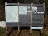 2
2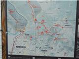 3
3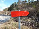 4
4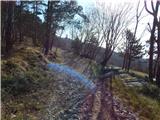 5
5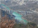 6
6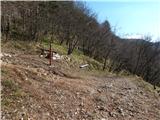 7
7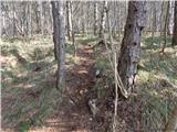 8
8 9
9 10
10 11
11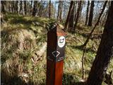 12
12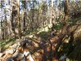 13
13 14
14 15
15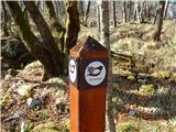 16
16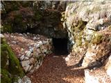 17
17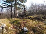 18
18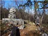 19
19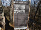 20
20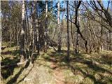 21
21 22
22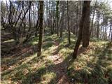 23
23 24
24 25
25 26
26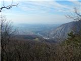 27
27 28
28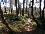 29
29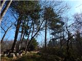 30
30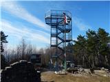 31
31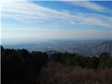 32
32 33
33