Prezid (at Gračac) - Bili kuk (direct way)
Starting point: Prezid (at Gračac) (750 m)
Starting point Lat/Lon: 44.25547°N 15.81098°E 
Path name: direct way
Time of walking: 2 h 30 min
Difficulty: very difficult marked way
Difficulty of skiing: no data
Altitude difference: 421 m
Altitude difference (by path): 600 m
Map:
Access to starting point:
a) Highway A1 we leave at the Sveti Rok exit. We continue towards Gračac. There we continue right towards Obrovac. The road ascends more steeply, and when it flattens, we pay attention to an asphalted turn-off straight ahead. We park at the crossroad or slightly before along the road.
b) Highway A1 we leave at the Maslenica exit. We continue towards Obrovac and later Gračac. The road crosses the vegetated slopes of Južni Velebit. After the tunnel, we pay attention to an asphalted turn-off to the right. We park at the crossroad or a few meters further along the road.
Path description:
From the starting point, we continue in the direction of Crnopac. The path ascends through some meadows past a small lake. After 15 minutes of walking, we reach a crossing, where we continue left (right Crnopac). The path initially ascends through forest and sandy terrain, then crosses some rocky jumps onto a side ridge of Mali Crnopac, from where the path descends, turns left, and ascends diagonally across the slopes of Veliki Bat and then Mali Bat. On the path, there are also a few descents. When the traverse ends, the path steeply turns onto the saddle between Orlov kamen and Mali Bat. From the saddle, the path descends slightly and begins traversing again to a crossing. We continue left (right Crnopac over Veliki Bat). The path descends and ascends around sinkholes and, in the final part, avoids rocks. After 10 minutes of walking from the crossing, a path from the left joins along the road, and we soon reach the bivouac, from where there is a nice view toward Crnopac. We continue slightly back to the last crossing, where we proceed in the direction of the path Put Malog Princa. The path descends gently with the help of stairs to the next crossing, where we continue right. The path descends somewhat more steeply into a small valley and then begins to traverse. After approximately 15 minutes from the crossing, we reach another crossing, where we continue left toward Bili kuk and Kita Gaćešina (right path Put Malog Princa). The path continues to traverse the slopes for some time, then we arrive at a barely noticeable crossing, where we continue right (straight Kita Gaćešina and the path Put Malog Princa). We continue past the inscription "B. KUK" on a tree to the first rocks and walls. The path turns right past a small cave and then, with the help of steel cables, overcomes the first jump. We reach a wide ledge, along which we traverse to the next steel cables. First, we overcome a smaller jump, then through a window and a vertical jump, we reach an outside corner. With the help of steel cables, which end just below the summit, we soon reach a panoramic peak.
Description and pictures refer to conditions in April 2023.
Pictures:
 1
1 2
2 3
3 4
4 5
5 6
6 7
7 8
8 9
9 10
10 11
11 12
12 13
13 14
14 15
15 16
16 17
17 18
18 19
19 20
20 21
21 22
22 23
23 24
24 25
25 26
26 27
27 28
28 29
29 30
30 31
31 32
32 33
33 34
34 35
35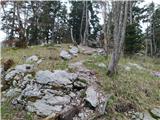 36
36 37
37 38
38 39
39 40
40 41
41 42
42 43
43 44
44 45
45 46
46 47
47 48
48 49
49 50
50 51
51 52
52 53
53 54
54 55
55 56
56 57
57 58
58 59
59 60
60 61
61 62
62 63
63 64
64 65
65 66
66 67
67