Pri Babi - Hleviška planina
Starting point: Pri Babi (600 m)
Walking time: 1 h 30 min
Difficulty: easy marked way
Elevation gain: 308 m
Elevation difference along the route: 400 m
Map: Nanos 1:50.000
Recommended equipment (summer):
Recommended equipment (winter):
Views: 15.826
 | 2 people like this post |
Access to starting point:
From Logatec we drive towards Tolmin or vice versa. When we come to Idrija we turn left (from the direction Logatec - Tolmin) towards the center. In the middle of Idrija we turn left in the direction of Vojsko and we follow the road to the next crossroad, where we continue left in the direction of Hleviška planina. The road higher brings us to a smaller crossroad and mountain signposts. We park on a parking lot by the road near this crossroad named Pri Babi.
Route description:
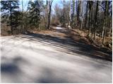
From the parking lot, we continue on the path in the direction of "Spomenik sanitetne postaje" (medical station monument). A wide path already after a few minutes brings us to a crossing, where we continue straight upwards on the path which ascends steeply (right NOB monument). After a few minutes, the steepness decreases and the path descends and ascends a few times. After the last descent, the path brings us on a wide cart track which we follow to the left and after a few steps immediately right. The path ahead brings us to a larger parking lot in front of scout hut Pšenk (to here also possible with a car). From the hut, we continue on the path which crosses a smaller bridge and then ascends by the stream. The path then goes past a spring and a little ahead brings us on the forest road which we follow to the right. The road ahead runs past another smaller crossroad, where we continue straight. Only a little ahead we leave the road because a poorly marked path goes left upwards. After a few minutes, we again come on the road which we then follow to the cottage on Hleviška planina. From the cottage, we continue on the path in the direction of the summit. After 10 minutes of ascent through the forest, the path brings us on a panoramic peak.

Photos:
 1
1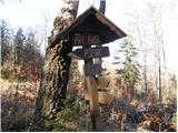 2
2 3
3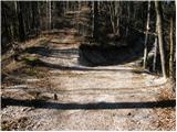 4
4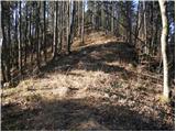 5
5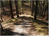 6
6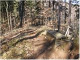 7
7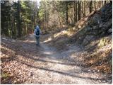 8
8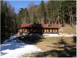 9
9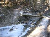 10
10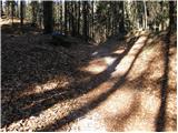 11
11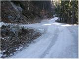 12
12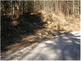 13
13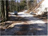 14
14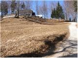 15
15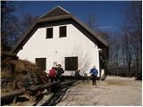 16
16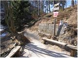 17
17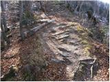 18
18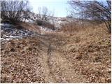 19
19 20
20
Discussion about the trip Pri Babi - Hleviška planina
|
| main27. 04. 2011 |
Before the scout hut, the junction from this direction is completely unmarked. Complaint to the PD.
|
|
|
|
| miri27. 04. 2011 |
Just for information. Best regards http://www.planinsko-drustvo-idrija.si/Mackova_pot.htm
|
|
|
|
| main29. 04. 2011 |
I checked the PZS and PD Idrija pages and this path is not described anywhere and no one takes care of it. Don't forget the path description from this side if you go on foot. Especially if these areas are not familiar to you, it's better to drive by car almost to the hut and then about 200m on foot.
|
|
|
|
| miri29. 04. 2011 |
http://www.planinsko-drustvo-idrija.si/
On the first page of PD Idrija under the title Mačkova pot, explanation why PD does not maintain this path. There are too many paths to Hleviška planina, they would mark them all. Best regards and see you at Hleviška planina.
|
|
|
|
| Ajda_Zitnik1. 01. 2012 |
Yesterday I walked this trail, and I must say, although it's not marked, it's not very hard to follow, but indeed higher up there were footprints in the snow to help. The trail is nice, but especially from the hut to the top caution is needed due to the slightly icy path.
|
|
|
|
| bernard1128. 06. 2025 16:22:28 |
The path is not marked, but it is well visible and traceable. I went to Hleviška planina via Pšenka, back past the monument of the sanitary station. GPS track.
|
|
|
To post a comment you must log in:
If you do not yet have a username, you must first
register.