Pri Mlinču - Mangart (italijanska pot)
Starting point: Pri Mlinču (1094 m)
Starting point Lat/Lon: 46.4234°N 13.5937°E 
Path name: italijanska pot
Time of walking: 4 h 45 min
Difficulty: difficult marked way
Difficulty of skiing: no data
Altitude difference: 1585 m
Altitude difference (by path): 1585 m
Map: Julijske Alpe - zahodni del 1:50.000
Access to starting point:
A) Over the border crossing Rateče we drive to Italy, after that in Trbiž / Tarvisio we turn left in the direction of Predel / Cave del Predil. After few 100 meters we go once again left in the same direction, and then at the crossroad by lake Rabeljsko jezero / Lago del Predil we continue straight on the main road in the direction of Slovenia (right Nevejski preval (Na Žlebeh) / Sella Nevea). Next follows few hairpin turns and driving through the tunnel, and then we get to the border crossing Predel, after which we again drive into Slovenia. Further, we start descending, and then before the bridge with largest arch in Julian Alps (bridge over the stream Mangartski potok (on the road sign marked bridge Predel 129 meters)) we turn left in the direction of Mangart. Immediately after the crossroad side branch of the road branches off, where there is a marked parking lot.
B) From Primorska we drive to Log pod Mangartom, and from there we continue driving towards Italy. Before we get to the border crossing Predel, after the bridge Predel (bridge over the stream Mangartski potok) we turn right in the direction of Mangart. We park immediately after the bridge on a marked parking lot by side branch of the road.
Path description:
From the starting point, we continue on the asphalt road which leads towards the saddle Mangartsko sedlo, and we are ascending there to first right turn, or to the spot, where it crosses the stream Mangartski potok. At the mentioned turn, before we cross the bridge, we continue straight on a footpath in the direction of the mountain pasture Mangartska planina. We continue with a nice view towards Mangart, on the path which is ascending parallel with the stream and a little higher we cross also landslide Stože, which happened in November 2000. When we leave the area of landslide we gradually pass into the forest, through which we moderately ascend to the western edge of the mountain pasture Mangartska planina.
When we step on the mountain pasture we walk to the near shepherd hut, behind which we continue on a little overgrown path which leads over mountain pasture. After the crossing of the mountain pasture we get into a lane of a forest and then we quickly reach narrower lane of a meadow, on which continues old abandoned road (to here possible also, if we continue through mountain pasture on the road and then at the first crossing left in the direction of Mangartsko sedlo). The worse road or cart track is ascending gently, after that when we cross a torrent it finally changes into a mountain path. Next follows few minutes of a moderate ascent, and then we cross an asphalt road. On the other side of the road, we ascend on gentle stairs, and then we reach clearing, where the path turns left and starts relatively steeply ascending. After few minutes of the ascent, we again cross the road, after that only few steps higher we once again reach it.
Here the marked path continues right (left unmarked path over Gladki rob) and with nice views on Loška stena brings us to a smaller tunnel. After the tunnel nice view opens up also towards Mangart, after we get to lane of larch forest, we leave the road and we continue left on a marked path, which cuts a turn. When after few steps we again step on an asphalt road, we only cross it and we continue the ascent on a marked path, which at first moderately ascends, and then it flattens and continues diagonally towards the right. During the crossing at first we get to a smaller gully, and then also to a torrent gully Nakel (gully Nakel starts already on the border ridge and then it is steeply descending all the way to river Koritnica (in the lower part stream runs under the name Ilovec)). We step out from the gully diagonally towards the right, and then the path turns left and starts ascending steeply. Few minutes we are steeply ascending, and then we again get closer to a torrent, where the path turns right and it ascends diagonally over a shorter jump. After the jump, the path flattens a little and then over mostly grassy slope, with nice views on surrounding mountains again brings us to Mangart road which we follow to the right. Soon after we step on the road path brings us to the last tunnel, which is quite long. Because the road is quite busy, it is good that in the tunnel we use lamp, that others will notice us easier. After the tunnel we cross one more gully, and then we get to a smaller crossroad, where we continue left in the direction of the mountain hut Mangartska koča na Mangartskem sedlu. From the crossroad follows only few minutes of walking and we get to the mentioned mountain hut.
Behind the mountain hut, we look for further marked path which leads towards the saddle Mangartsko sedlo. The path ahead is at first gently, and then moderately ascending on a panoramic grassy slope. Higher, we reach an asphalt road, and we step there right at the crossroad, where starts one-way road. We continue on the upper right road, and from there we soon go left on a marked footpath (we can also continue on the road and on the border ridge or on diagonal path below Travnik ascend from few minutes distant left zig zag), on which past of less known two-thousander (Rdeča glava 2043 meters) we ascend to a saddle Mangartsko sedlo.
Before we reach the saddle we once again cross the road, after that when we reach the ridge, we continue right. The path ahead leads us with nice views towards lakes Mangartska (Belopeška, also Klanška) jezera and other surrounding mountains, and the view reaches all the way to Carnic Alps, Gailtal Alps and High Tauern. Next follows few minutes of crossing, and then from the right joins already mentioned path, which avoids saddle Mangartsko sedlo. After the crossing of Travnik or Strmi nos, follows a crossing below the steep Rateški Mali Mangart, and then we quickly reach the marked crossing, where seperate Italian and Slovenian path.
We continue left on technically easier Italian path, which already after a shorter ascent passes on the Italian side of massif Mangart. Further, we are at first only moderately ascending, and already after few minutes, the path becomes pretty steep and brings us on smooth rocky plates, where we get some help from fixed safety gear, mainly steel cables. After that part path turns a little towards the left and passes on steep scree, where in the early summer, there are still snow fields (ice axe, crampons). Over the scree we are ascending diagonally, and the path is further turning more and more towards the right. The path which is larger part also exposed to falling stones, higher passes on the eastern side of the mountain, where there is a marked crossing.
We continue right in the direction of Mangart (left Jalovec, Vevnica, Tamar) on the path which is still turning towards the right. Higher, we cross one more gully, and then we start quite steeply ascending on a steep slope, which is due to a lot of people additionally exposed to falling stones. When the path after few minutes flattens, to the top separates us only few 10 strides, with great views on the nearby and far surrounding.
Pri Mlinču - Mangartska planina 35 minutes, Mangartska planina - Mangartska koča 1:45, Mangartska koča - Mangartsko sedlo 25 minutes, Mangartsko sedlo - Mangart 2:00.
Pictures:
 1
1 2
2 3
3 4
4 5
5 6
6 7
7 8
8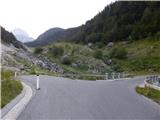 9
9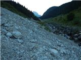 10
10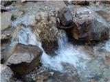 11
11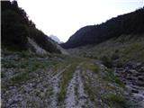 12
12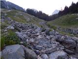 13
13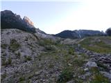 14
14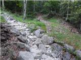 15
15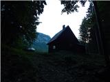 16
16 17
17 18
18 19
19 20
20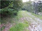 21
21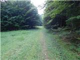 22
22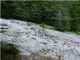 23
23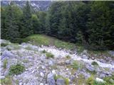 24
24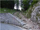 25
25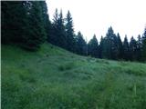 26
26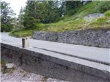 27
27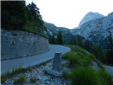 28
28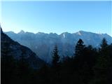 29
29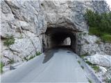 30
30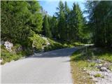 31
31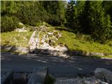 32
32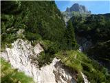 33
33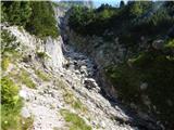 34
34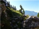 35
35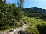 36
36 37
37 38
38 39
39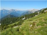 40
40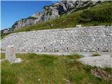 41
41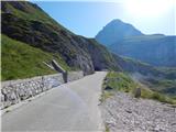 42
42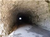 43
43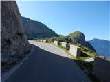 44
44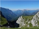 45
45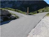 46
46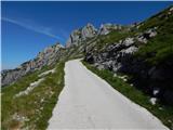 47
47 48
48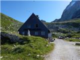 49
49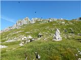 50
50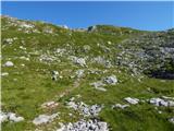 51
51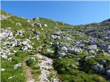 52
52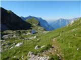 53
53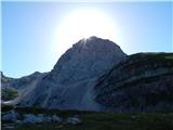 54
54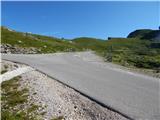 55
55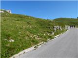 56
56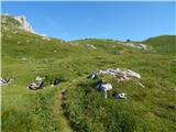 57
57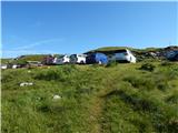 58
58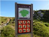 59
59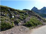 60
60 61
61 62
62 63
63 64
64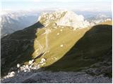 65
65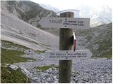 66
66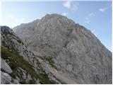 67
67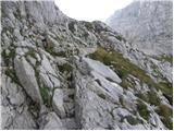 68
68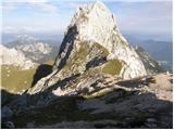 69
69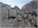 70
70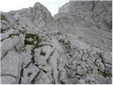 71
71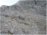 72
72 73
73 74
74 75
75 76
76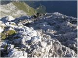 77
77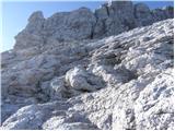 78
78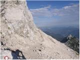 79
79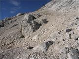 80
80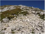 81
81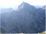 82
82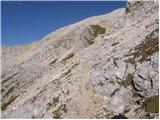 83
83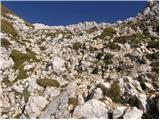 84
84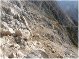 85
85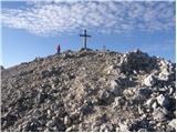 86
86 87
87