Prvine - Črni vrh (Čemšeniška planina)
Starting point: Prvine (870 m)
Starting point Lat/Lon: 46.1867°N 14.9395°E 
Time of walking: 1 h
Difficulty: easy marked way
Difficulty of skiing: easily
Altitude difference: 334 m
Altitude difference (by path): 334 m
Map: Posavsko hribovje - zahodni del 1:50.000
Access to starting point:
From highway Ljubljana - Celje we go to the exit Trojane. Further, we continue in the direction of Zagorje and the road then runs through the tunnel V Zideh after which we will get to the spot, where the road towards the village Šentgotard branches off to the left upwards. At the end of the village Šentgotard we come to the crossroad, where we continue left in the direction of Prvine (right Čemšenik). A little further, we come to the next crossroad, where we continue right again in the direction of Prvine (left Zaplanina). The road then soon brings us to the next crossroad, where we continue left in the direction Prvine (right Čemšenik). This road which then runs past the hunting lodge we follow to the parking lot near the ski center on Prvine.
From Zagorje we drive through Kisovec and Izlake towards Trojane, but only to spot, when the road towards Šentgotard branches off to the right. Further, follow the upper description.
Path description:
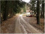
From the parking lot, we continue on the road by which we've parked. The road then on the left side bypasses house, which we see in front of us and only a little further crosses a ski slope. Right at the spot, where the road crosses a ski slope, we leave it and go right upward on a cart track which also crosses the ski slope. The path then goes into the forest and is ascending gently towards the east. The path which only occasionally ascends a little steeper crosses some paths and cart tracks. But because the path is well marked there aren't any problems with orientation. A little further from the right joins the path from Zagorje, Izlake and Čemšenik. The path ahead runs by the edge of a steep meadow of Čemšeniška planina from which beautiful views are opening up mainly towards Kum. Next follows few minutes of walking by the edge of a steep meadow, and then we come to the spot, where cargo cableway crosses mountain path. Here we carefully cross cableway and in doing so, we have to be careful, that with head we don't hit into a steel cable. On the other side of the cableway, we already notice a mountain hut, which we reach in few steps.
From the mountain hut, we continue forward towards the east on the path which at first runs by the edge of a steep meadow and then goes into the forest. The path through the forest is then only slowly ascending and after 15 minutes of walking from the mountain hut brings us to the inscription box, which is situated only few steps below the summit.
Pictures:
 1
1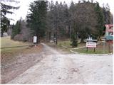 2
2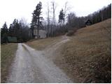 3
3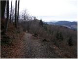 4
4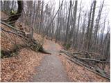 5
5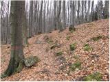 6
6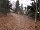 7
7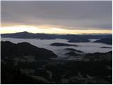 8
8 9
9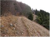 10
10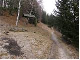 11
11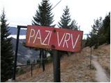 12
12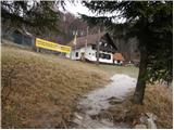 13
13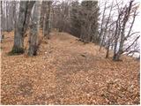 14
14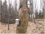 15
15 16
16