Radovna - Frčkova planina
Starting point: Radovna (695 m)
Starting point Lat/Lon: 46.4208°N 13.9772°E 
Time of walking: 2 h 10 min
Difficulty: easy unmarked way
Difficulty of skiing: no data
Altitude difference: 640 m
Altitude difference (by path): 640 m
Map: Kranjska Gora 1:30.000
Access to starting point:
A) From the Ljubljana - Jesenice highway, we take the Lesce exit and follow the road ahead towards Bled. In Bled, at the traffic lights, the signs for Pokljuka direct us to the right. We continue driving through Spodnje and Zgornje Gorje to the village of Krnica, where we leave the main road and continue driving right towards Radovna and Krnica. Through Krnica, we follow the main road, then after the bridge over the Radovna River, we turn left towards Mojstrana and Radovna. After a few kilometers of further driving, the asphalt ends, and we follow the macadam road across the bridge over the Radovna River. When we cross the bridge, we arrive on the left side of the river (right bank); from the bridge, we drive to the first left turn-off of the macadam road. We park in a suitable place by the road near the intersection.
B) We leave the Gorenjska highway at the Hrušica exit and follow the road ahead towards Kranjska Gora. Just before the village of Dovje, a road branches left from the main road leading to Mojstrana (Vrata, Kot, and Krma). We follow the road ahead towards the village of Radovna and the Krma and Kot valleys. The relatively steep road then takes us past the TNP sign, after which the road soon flattens and brings us to an intersection where a macadam road branches right into the Kot valley. We continue straight on the road, which begins to descend, and from it a road quickly branches right leading to Krma. Here, we continue straight on the main road, quickly arriving at Zgornja Radovna; at the end of the hamlet, we reach another intersection where a second road to Krma branches right. Here, we go left and continue driving on the macadam road, following it to the first right turn-off. We park in a suitable place by the road near the intersection.
Path description:
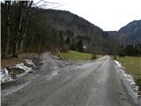
From the starting point, we head onto the side road, next to which there is a sign that further driving is prohibited (exceptions are landowners). A little further on, the path leads past the cottage of the Slovenia Forest Institute and past the green gate, which prevents further driving (even if the gate is open, we must not continue driving, as another traffic sign warns us of this).
Further on, the road leads across a bare slope (consequences of the windthrow in October 2009), from which a nice view opens towards Mežakla. At the intersection on the upper part of the windthrow area, we continue right, then gradually enter the forest. The relatively steep road higher up splits again into two parts, and we once again continue on the right road (the road slightly to the left leads towards Konavčev žleb and Zimova peč). We continue briefly along the Stresena dolina valley, then the road turns sharply right and ascends transversely to the next intersection, where we continue sharply left along the "main" road (the right road ends in the nearby forests). Just a little above the mentioned intersection, we arrive at the point where we leave the road leading towards Pokljuka and continue sharply right onto the road leading to Frčkova planina.
From the intersection onward, the road gradually flattens, and from it we get occasional views of the Kamniško Savinjske Alpe and part of the Karavanke. We walk along the road to its end, then slightly right along the ascending cart track, which brings us to Frčkova planina in a few minutes.
Pictures:
 1
1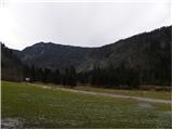 2
2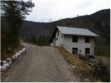 3
3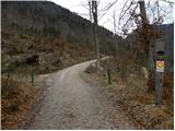 4
4 5
5 6
6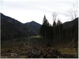 7
7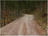 8
8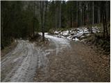 9
9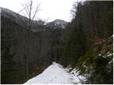 10
10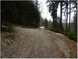 11
11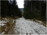 12
12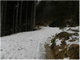 13
13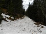 14
14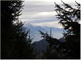 15
15 16
16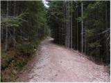 17
17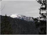 18
18 19
19 20
20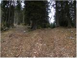 21
21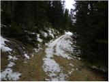 22
22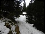 23
23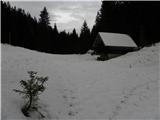 24
24