Starting point: Rateče (865 m)
Starting point Lat/Lon: 46.4962°N 13.7193°E 
Time of walking: 20 min
Difficulty: easy marked way
Difficulty of skiing: no data
Altitude difference: -20 m
Altitude difference (by path): 5 m
Map: Kranjska Gora 1:30.000
Access to starting point:
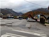
A) First, we drive to Kranjska Gora, and then we continue driving towards Rateče. At the crossroad, where the road to Planica branches off to the left, and straight ahead it continues towards Italy, we turn right and drive to the center of Rateče, where we park at an appropriate place next to the main bus station.
B) Through the border crossing Rateče we drive into Slovenia, and then at the crossroad, where the road towards Planica branches off to the right, we continue left, a little further at the crossroad at the NOB monument turn left again, and then we park at an appropriate place next to the main bus station.
Path description:
From the bus station, we return a few dozen steps back to the crossroad by which the NOB monument is located, and from there we continue straight in the direction of Zelenci. We continue along a dead-end street, walking past several houses, and we follow the mentioned road to its end. When the road ends, we descend in a few steps to the main road Kranjska Gora - Rateče, and follow it left towards Kranjska Gora. We walk along the main road for a minute or two, then carefully cross the main road and arrive at the parking lot at the snack bar Zelenci. From the parking lot we continue on a nicely arranged tourist path, at the junctions of which we follow the left paths. In a few minutes of pleasant walking through the forest we arrive at Zelenci, after a few more steps also to the smaller wooden tower.
Description and pictures refer to the condition in 2015 (October).
Pictures:
 1
1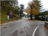 2
2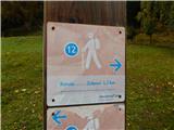 3
3 4
4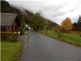 5
5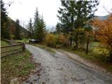 6
6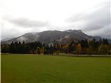 7
7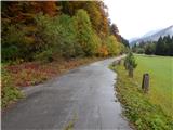 8
8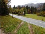 9
9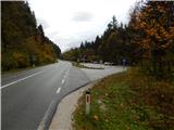 10
10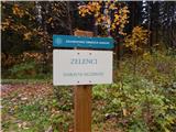 11
11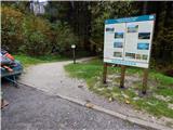 12
12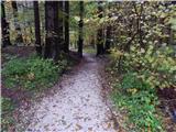 13
13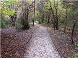 14
14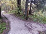 15
15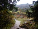 16
16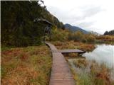 17
17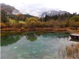 18
18