Ravenska Kočna - Kokrska Kočna (on ferrata and Kremžarjeva pot)
Starting point: Ravenska Kočna (1000 m)
Starting point Lat/Lon: 46.385°N 14.5364°E 
Path name: on ferrata and Kremžarjeva pot
Time of walking: 6 h
Difficulty: extremely difficult marked way
Difficulty of skiing: no data
Altitude difference: 1520 m
Altitude difference (by path): 1580 m
Map: Kamniške in Savinjske Alpe 1:50.000
Access to starting point:
From the Ljubljana - Jesenice highway, take the Kranj - east exit and continue along the road towards Jezersko. At Zgornje Jezersko, just a little after the gas station, we will notice a road that branches off to the right from the main road (direction Planšarsko jezero). The road then leads us past the mentioned lake and behind it steeply ascends for a short time. Higher up, the road flattens and at the beginning of a large meadow loses its asphalt surface. We then follow the macadam road to a marked larger parking lot.
Path description:
From the parking lot, we continue on the macadam road following the signs »Češka koča, Ledine« and after approximately 15 minutes of walking, we come to a cargo cableway. At the cargo cableway where there is a junction, we continue following the signs Kranjska koča na Ledinah (Skozi žrelo/Slovenska pot) and Češka koča (umik žrela). At first for a short time, we walk through the forest, then the path brings us to terrain which is partly covered with dwarf pines. The path here starts to ascend somewhat more steeply and then brings us to a junction.
We turn right onto the scree where a sign on the rock »Ferata Češka koča« directs us. After a short ascent on the scree, we come to the entrance to the climbing path. At the entrance to the climbing path, an easier path also branches off to the left, which bypasses the initial most difficult part of the climbing path. This path is marked with the sign »umik«.
At the beginning, the climbing path ascends very steeply along the steel cable (difficulty C/D) and since there are few footholds, considerable arm strength is needed. A short less demanding traverse follows on the slope covered with grass and dwarf pines (A/B). The path then becomes more demanding again and ascends diagonally up the steep wall (C/D). In the wall, the path turns left upwards and brings us through a short but nevertheless quite demanding overhang (E) to somewhat less demanding terrain. Here we ascend along the steel cable on the slope which is partly covered with grass and dwarf pines (B/C). The path then brings us to easier terrain where the first part of the climbing path ends.
For some time, we then ascend on an undemanding slope through dwarf pines, then we come again to steel cables where the second part of the secured path begins. Here, the path that bypasses the initial most difficult part also joins from the left. For some time, we then ascend along the steel cable on a not overly demanding slope (A/B), then the path turns left and a short vertical ascent follows (D). In the continuation, we then steeply ascend along the steel cable for quite some time (C and C/D). Such a path then brings us to the summit log box where for a short time the path becomes a shade less demanding (B/C). The path then ascends more steeply once again (C/D), then the steepness starts to ease. The steel cables then end and soon we join the path »umik Žrela«. Here we continue right and to the hut, which we already see in front of us, it is only a few minutes' walk.
From the hut, we continue right on the path in the direction of Kočna, Grintovec and Vratca (left Kranjska koča through Žrelo). After a short ascent, we come to flat ground with sign H (intended for helicopter landing). The path ahead runs on initially gentle scree which is partly overgrown with dwarf pines. In the lower part of the scree, the path to Vratca branches off to the right, while we continue straight in the direction of Kočna and Grintovec. After approximately half an hour of walking from the hut, we come to the next junction. We continue right in the direction of Kočna (left Grintovec over Mlinarsko sedlo) and continue ascending on partly overgrown scree to Zgornje Ravni. At Zgornje Ravni, the path turns sharply right and ascends over the scree. Higher, the path, which continues turning right, brings us to the side ridge of the central Grintovci. Here a nice view opens towards the north, where we can clearly see most of the peaks that surround Jezersko. Here, where we turn sharply left, the climbing part of the path begins. A well-protected and in dry conditions not overly demanding climbing path brings us, with nice views and past a natural window which we will notice on the right side, after almost three hours of walking from Češka koča to the main ridge of Grintovci (Zdolška škrbina), where there is a junction. We continue sharply right in the direction of Jezerska Kočna (left Grintovec, straight Cojzova koča) on the path which quickly brings us to one of the most interesting passages in the Slovenian mountains. The path brings us to a potbellied passage through which we must crawl. The ceiling above us is so low that there is no other way (watch your head). The path ahead transitions to a short scree, after which we step onto a steeper path where some pegs and steel cables assist us. We then follow this increasingly scenic path to the somewhat spacious summit.
From the summit, we descend a few meters and continue on the ridge path towards Kokrska Kočna (marked). The path, which at the beginning descends into the gully between the two summits, is well secured with pegs and steel cables. From the gully, the path starts ascending again and with the aid of protections brings us to the spacious summit of Kokrska Kočna.
Ravenska Kočna - Češka koča 2:00, Češka koča - Zdolška škrbina 2:45, Zdolška škrbina - Jezerska Kočna 45 minutes, Jezerska Kočna - Kokrska Kočna 30 minutes.
Pictures:
 1
1 2
2 3
3 4
4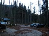 5
5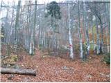 6
6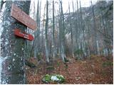 7
7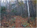 8
8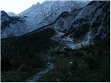 9
9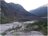 10
10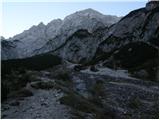 11
11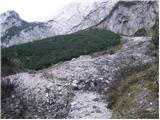 12
12 13
13 14
14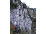 15
15 16
16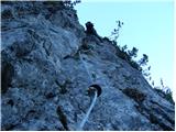 17
17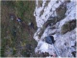 18
18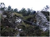 19
19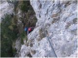 20
20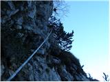 21
21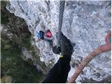 22
22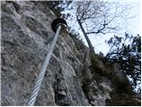 23
23 24
24 25
25 26
26 27
27 28
28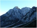 29
29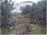 30
30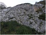 31
31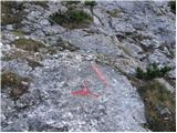 32
32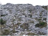 33
33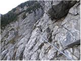 34
34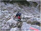 35
35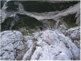 36
36 37
37 38
38 39
39 40
40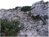 41
41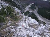 42
42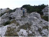 43
43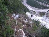 44
44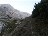 45
45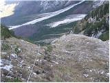 46
46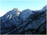 47
47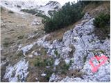 48
48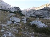 49
49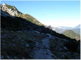 50
50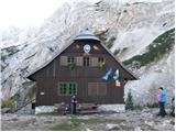 51
51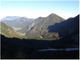 52
52 53
53 54
54 55
55 56
56 57
57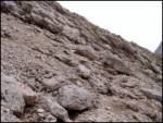 58
58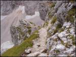 59
59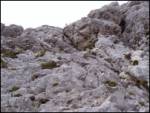 60
60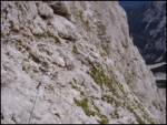 61
61 62
62 63
63 64
64 65
65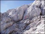 66
66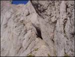 67
67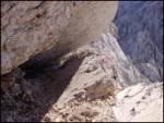 68
68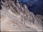 69
69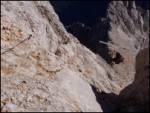 70
70 71
71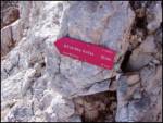 72
72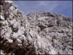 73
73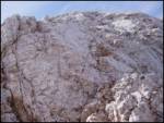 74
74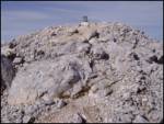 75
75