Ravenska Kočna - Kranjska koča na Ledinah (hunter's way)
Starting point: Ravenska Kočna (1000 m)
Starting point Lat/Lon: 46.385°N 14.5364°E 
Path name: hunter's way
Time of walking: 2 h 15 min
Difficulty: partly demanding marked way
Difficulty of skiing: very demanding
Altitude difference: 700 m
Altitude difference (by path): 700 m
Map: Kamniške in Savinjske Alpe 1:50.000
Access to starting point:
From Gorenjska highway, Kranj or Preddvor, we drive to Zgornje Jezersko, after that approximately 1 km after Petrol gas station, we turn right in the direction of the lake Planšarsko jezero and Češka koča. Further, we drive past the mentioned lake, and then the road leads us through a larger meadow, where the asphalt ends and from which a beautiful view opens up on surrounding mountains, and then the road returns into the forest, where at first crosses a torrent. A little further, the road splits, and we continue on the right road (left Gorniški center Davo Karničar and also the footpath on the mountain pasture Jenkova planina and former starting point for the mentioned mountain pasture), on which we quickly reach large marked parking lot, where we park.
Path description:
Somewhere in the middle of large parking lot to the left opens a passage, by which there are signposts for Velika Baba, Goli vrh and a sign for hunting path on Ledine. We start on a cart track which brings us on the edge of a meadow, where we will on the left side notice Gorniški center (mountaineering center). We continue straight to well visible signposts at the nearby crossing, from which we continue right (straight Goli vrh, Velika Baba) in the direction of the mountain hut on Ledine (on the sign Vadine). The path ahead for some time still runs through the forest and then below the mountain walls of Velika (Koroška) Baba forest starts to get thinner, and the path more and more passes among dwarf pines. A little further, we cross also a mighty torrent, which all the time of walking, we had on the right side, and then we join the path from the bottom station of a cargo cableway, where used to be a starting point. The path follows the torrent for a short time or to the beginning of a steeper part of the path. The path then steeply ascends, and we also get help from some steel cables, with the help of which we ascend a level higher (in wet dangerous for slipping). Difficulties then decreases and the path continues steeply ascending, mostly on the northern slopes. After an hour and a half of walking, we come to a pleasant resting place, where there are bench and table. Near the resting place, which is also nice viewpoint, is situated memorial plaque in the memory of victims of helicopter crash. From here ahead to the hut, which we reach after good 20 minutes of additional walking, there isn't any technically demanding spots.
Pictures:
 1
1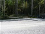 2
2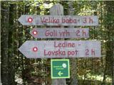 3
3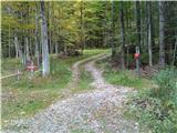 4
4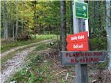 5
5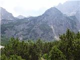 6
6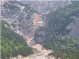 7
7 8
8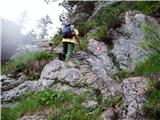 9
9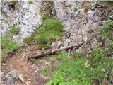 10
10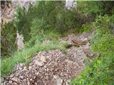 11
11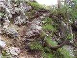 12
12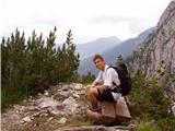 13
13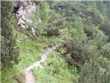 14
14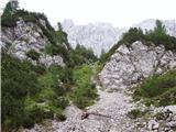 15
15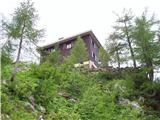 16
16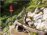 17
17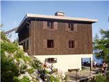 18
18