Ravne - Bela peč (above Dovje)
Starting point: Ravne (1200 m)
Starting point Lat/Lon: 46.4678°N 13.9917°E 
Time of walking: 45 min
Difficulty: easy unmarked way
Difficulty of skiing: easily
Altitude difference: 260 m
Altitude difference (by path): 260 m
Map: Kranjska Gora 1:30.000
Access to starting point:
A) We leave the Gorenjska motorway at the Jesenice west (Hrušica) exit, and then we continue driving in the direction of Kranjska Gora. On the main road towards Kranjska Gora we drive to the first turn-off of the road towards Dovje, and through the settlement and above it, we follow the signs for Dovška Baba. Further, we drive for quite some time to the next crossroad, where we turn sharply left in the direction of Dovška Baba (straight Plavški Rovt). We follow this road, which then leads past the meadow named Ravne (some holiday cottages), to a gate which prohibits further driving. We can park already a little lower on one of the parking lots by the road (from Dovje to the starting point there is approximately 6.5 km).
B) First, we drive to Kranjska Gora, and then we continue driving towards Jesenice. We leave the main road towards Jesenice when signs for Dovje direct us to the left, and through the settlement and above it, we follow the signs for Dovška Baba. Further, we drive for quite some time to the next crossroad, where we turn sharply left in the direction of Dovška Baba (straight Plavški Rovt). We follow this road, which then leads past the meadow named Ravne (some holiday cottages), to a gate which prohibits further driving. We can park already a little lower on one of the parking lots by the road (from Dovje to the starting point there is approximately 6.5 km).
Path description:
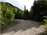
From the starting point, we continue on the road by which we have parked, and it quickly brings us to a gate and a traffic sign, which prohibit further driving. At first from the road a view opens up a little, and then we gradually ascend to the saddle between Bela peč and Dovška Baba, where at the notification sign "Kako varno prečiti pašnike" (How to safely cross the pastures), we continue left on a marked path which leads towards Dovje. We leave the marked path, which turns left and continues parallel with the road, already after a few steps and continue straight on an unmarked footpath which starts ascending towards Bela peč. Occasionally a pretty steep path, where mainly in wet conditions additional caution is needed, brings us higher on or by the ridge, where the footpath flattens a little, and only a few minutes of walking separate us from the top.
Description and pictures refer to the condition in May 2020.
Pictures:
 1
1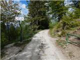 2
2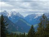 3
3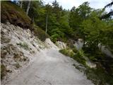 4
4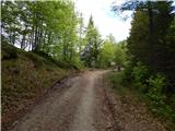 5
5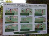 6
6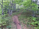 7
7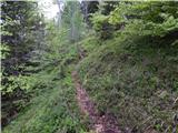 8
8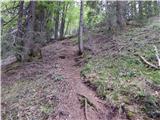 9
9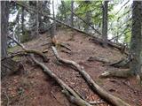 10
10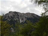 11
11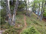 12
12 13
13 14
14