Starting point: Ravne (743 m)
Starting point Lat/Lon: 45.558°N 14.7692°E 
Time of walking: 1 h 50 min
Difficulty: easy marked way
Difficulty of skiing: no data
Altitude difference: 132 m
Altitude difference (by path): 380 m
Map:
Access to starting point:
A) First, we drive to Ribnica, and then we continue driving towards Kočevje. After Dolenja vas we continue right in the direction of Grčarice, Gotenica and Kočevska Reka. In Kočevska Reka we continue right in the direction of Borovca pri Kočevski Reki, mountain pass Strma Reber and Osilnice. In Borovec once again we continue right, and then we get to a hamlet Ravne, we continue driving a little further, but only to a spot, where by the road we notice traffic sign for 10% road gradient. We park by the road, where there is enough space for that.
B) From Kočevje we drive towards the border crossing Petrina, and then at the end of the settlement Štalcerji we continue right towards Kočevska Reka. In Kočevska Reka we continue left in the direction of Borovec pri Kočevski Reki, mountain pass Strma Reber and Osilnice. In Borovec we continue right, and then we get to to a hamlet Ravne, and we continue driving a little further, but only to the spot, where by the road we notice traffic sign for 10% road gradient. We park by the road, where there is enough space for that.
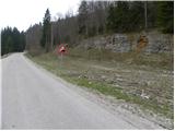
C) From Osilnica or Sela pri Osilnici we continue in the direction settlements Žurge, Padovo pri Osilnici, Zgornji Čačič and mountain pass Strma Reber. Further, we drive on at first slightly winding, and higher zig zag road which after nineteen marked hairpin turns brings us to mountain pass Strma Reber (993 meters). From the mountain pass ahead the road starts descending, and we drive to the turn-off for hunting lodge Ravne. We park near the turn off or about 100 meters ahead by the main road, where on the opposite side of the road, we notice traffic sign for 10% road gradient (caption of course from our side isn't visible), and on the right a rock with a blaze.
Path description:
On the other side of the road as is traffic sign, we notice signposts for Cerk, which point us on the path which gently ascends through a meadow and in few minutes brings us to the near hunting cottage (we can also start at mentioned hunting cottage).
From the hunting cottage, we continue slightly left on a poorly visible footpath which quickly brings us to feeding site for animals. Further, the path passes into the forest, where continues on a moderately steep cart track. After approximately 15 minutes of walking from the starting point, cart track splits into two parts, and we continue on the right by which at first there aren't any blazes (left better beaten path leads to Kameni zid and forward towards Krempa). Right cart track, on which we continue an ascent quickly brings us to the next crossing, by which we again notice the blazes. We continue on a marked cart track, and higher it changes into poorly beaten footpath. The path ahead crosses a smaller torrent, and then it ascends to the next cart track which we follow to the left. We continue the ascent on rocky and with leaves covered cart track, and it soon brings us to a forest road.
From the forest road soon marked path towards the summit Cerk branches off to the left, and we continue straight on the road which starts gradually descending. After the left hairpin turn, at the crossroad we continue right, after that few minutes ahead, by the memorial of former partisan hospital left in the direction of Firstov rep (if we continue on the right road we get to the main road Osilnica - Kočevska Reka).
From the crossroad ahead, the road leads through a large clearing, and then passes into the forest, where it starts slightly ascending. On the part, where the road starts ascending, from the right joins also the marked path from the mountain pass Strma Reber and mountain pasture Bezgarska planina, and we continue straight and on the road we walk few more minutes to the spot, where at turning point it ends.
On the left side of turning point we notice signs for Firstov rep and first time also for Loška stena, which point us on a cart track which starts gradually descending. When after few minutes the cart track ends, on the left we notice a salt lick for wild animals, and we continue straight downwards, on a marked footpath, on which in few steps we get to the inscription box on Firstov rep.
From the inscription box, we continue the descent on a marked path in the direction of Loška stena. Quite scenic path, from which beautiful views opening up on the nearby walls, towers and hills, leads us by the edge of the cliffs, which the path avoids on the right side, so that there isn't any bigger danger of slipping, except of course, if we go on the edge for a nice view. A little lower path passes into the forest and flattens. Next follows a short ascent, and then an easy descent to a precipitous edge of the peak of Loška stena, from where a really nice view opens through a valley Zgornja Kolpska dolina and surrounding hills.
Ravne - Firstov rep 1:25, Firstov rep - Loška stena 25 minutes.
Pictures:
 1
1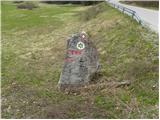 2
2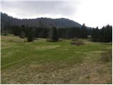 3
3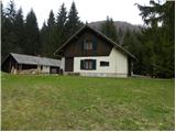 4
4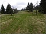 5
5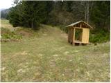 6
6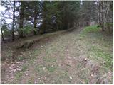 7
7 8
8 9
9 10
10 11
11 12
12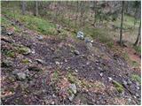 13
13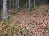 14
14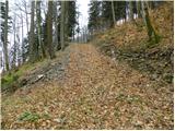 15
15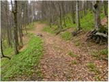 16
16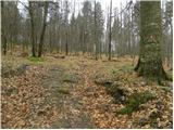 17
17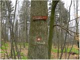 18
18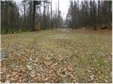 19
19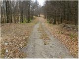 20
20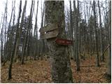 21
21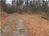 22
22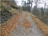 23
23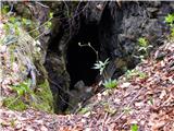 24
24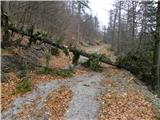 25
25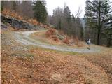 26
26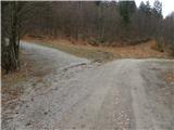 27
27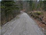 28
28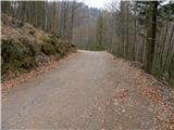 29
29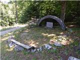 30
30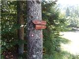 31
31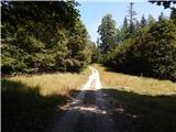 32
32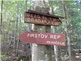 33
33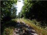 34
34 35
35 36
36 37
37 38
38 39
39 40
40 41
41 42
42 43
43 44
44 45
45 46
46 47
47 48
48 49
49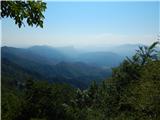 50
50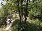 51
51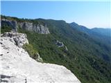 52
52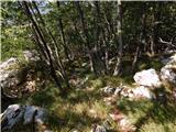 53
53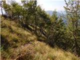 54
54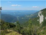 55
55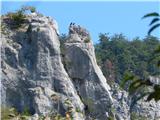 56
56 57
57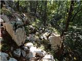 58
58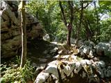 59
59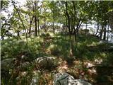 60
60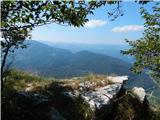 61
61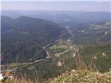 62
62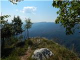 63
63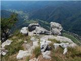 64
64 65
65