Rebrca / Rechberg - Stara gora / Altberg (via Rokov vrh)
Starting point: Rebrca / Rechberg (602 m)
Starting point Lat/Lon: 46.527°N 14.5772°E 
Path name: via Rokov vrh
Time of walking: 3 h 10 min
Difficulty: easy unmarked way
Difficulty of skiing: no data
Altitude difference: 950 m
Altitude difference (by path): 1050 m
Map: Karavanke - osrednji del 1:50.000
Access to starting point:
A) Over the border crossing Ljubelj we drive to Austria, and then in the settlement Podljubelj / Unterloibl we turn right in the direction of store Hofer. When we get to Borovlje / Ferlach, at the crossroad a little behind the railway track we turn left (right from the crossroad there is store Eurospar), and at the next crossroad after few 100 meters right in the direction of Železna Kapla / Bad Eisenkappel. Towards Železna Kapla we drive to the settlement Jeriše / Jerischach, and after the settlement at the crossroad we turn right in the direction of the settlement Podkraj / Unterort (left Goriče Goritschach). At the smaller crossroad in the middle of Podkraj we continue left and then we start ascending to a smaller saddle, by which there are a crossroad and chapel. Here we continue straight and only a little further we get to the settlement Rebrca / Rechberg, where we park on a parking lot by the football field.
B) Over the border crossing Jezerski vrh we drive to Austria, and after Železna Kapla we continue slightly left on the road in the direction of village Rebrca / Rechberg. On the road, we then quickly ascend into the mentioned village, at the crossroad in the middle of the village we continue left. We park on a parking lot by the football field.
C) We drive into Podjuna, and then we follow the signs for Železna Kapla / Bad Eisenkappel. After the settlement Miklavčevo / Miklauzhof, we leave the road towards Železna Kapla and we continue right in the direction towards Celovec / Klagenfurt and Borovlje / Ferlach. Further, we drive on the main road towards Borovlje, and there we don't drive long, because signs for Podkraj / Unterort point us to the left on a little narrower road. At the smaller crossroad in the middle of Podkraj we continue left and then we start ascending to a smaller saddle, by which there are a crossroad and chapel. Here we continue straight and only a little further we get to the settlement Rebrca / Rechberg, where we park on a parking lot by the football field.
Path description:
At the starting point signs for Rokov vrh / Rochusberg point us on the side road, on which we quickly ascend to the church and cemetery in Rebrca. We both bypass on the left side, and after the shed we continue on a footpath which mostly continues through the forest. After few minutes mostly of a moderate ascent, the path splits and we choose the upper right path (straight Setzhube). Next follows few minutes of a steep ascent and the path flattens, when we reach the cart track, and there without large changes in altitude we continue to a crossing.
From the crossing, we go right, at first slightly downwards, and then we walk on a cart track which crosses slopes towards the right. When the cart track ends, we continue on again steeper mountain path, which a little below the summit joins also the path past the homestead Bukovnik.
Here we go right and in few steps we reach panoramic Rokov vrh.
From the top, we return to the last crossing, and then we continue straight to the near forest road. From the road, we soon go right, after that for a short time, we continue parallel with the road. A little further, we return on the road, after that from the crossroad we continue straight on a worse road, and from there we then go slightly right on a footpath which continues on a ridge. We at first walk parallel with the road, and then we start steeply descending. Lower, we reach a small saddle, where the path passes on the left side of the nearby steep slope. Next follows traversing of a steep slope, and then we reach a worse road which we follow to a marked crossing by an old chapel, where the path past Bukovnik joins.
We continue slightly right (left Setzhube, right Bukovnik) in the direction of old signs for Ojstrc and Stara gora. And until now still relatively easy to follow path further becomes more overgrown, and soon it also splits. In direction of straight continues more overgrown marked path towards Obir, and we continue right on less overgrown, but further unmarked path which leads on Stara gora. Even though the path further isn't marked with blazes, occasionally we can notice some marks in form of Austrian blazes, only that the colors are different, namely white, black and once again white, and most of the time we can also notice signs with fluorescent spray.
From the crossing ahead, the path passes into the forest and starts ascending steeper. On parts quite overgrown, but mostly relatively easy to follow path higher reaches the cart track, where it flattens, and we soon leave the cart track, after that for a short time, we continue parallel with the cart track. A little further, we for some time touch cart track, and the path then again becomes steeper. Further, we are ascending a little left from the ridge and gradually we get closer to a forest road, on which we don't step. The path soon returns on the ridge and then continues a little to the left from the ridge, on some sort of old, partly overgrown clearing. Next follows a steep ascent, and when higher we get closer to a cliff, the path for some time turns a little to the left. Above the cliff by the path, we notice a large crack, and we continue on the right side of the crack, and after the crack path turns left and again gets closer to a forest road. Next follows a little less steep ascent, on still followable, but occasionally overgrown path. Higher, we once again get closer to the road, and from the ridge path occasionally a view opens up a little. A little further by the path, we notice natural window with vertical entrance, and the path a little higher flattens and it brings us on a smaller clearing with a salt lick. At the salt lick for the last time we get closer to the road, and then we follow the ridge path, which runs through the forest all the way to the top of Stara gora.
Description and pictures refer to a condition in the year 2017 (August and September).
Pictures:
 1
1 2
2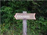 3
3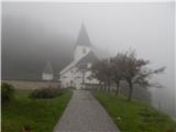 4
4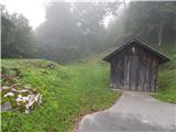 5
5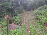 6
6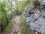 7
7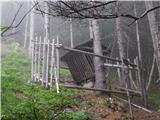 8
8 9
9 10
10 11
11 12
12 13
13 14
14 15
15 16
16 17
17 18
18 19
19 20
20 21
21 22
22 23
23 24
24 25
25 26
26 27
27 28
28 29
29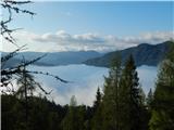 30
30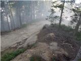 31
31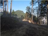 32
32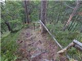 33
33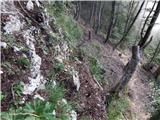 34
34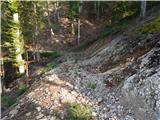 35
35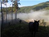 36
36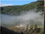 37
37 38
38 39
39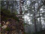 40
40 41
41 42
42 43
43 44
44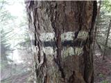 45
45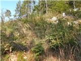 46
46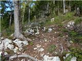 47
47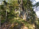 48
48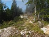 49
49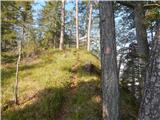 50
50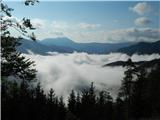 51
51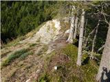 52
52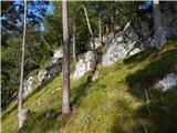 53
53 54
54 55
55 56
56 57
57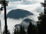 58
58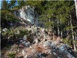 59
59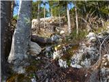 60
60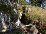 61
61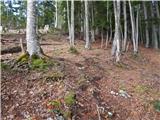 62
62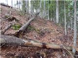 63
63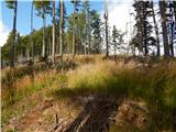 64
64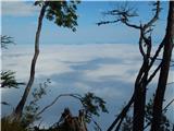 65
65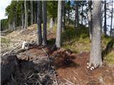 66
66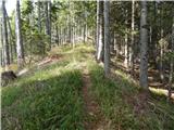 67
67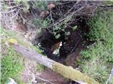 68
68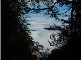 69
69 70
70 71
71 72
72 73
73 74
74