Reißkofelbad - Reißkofel (via bivouac)
Starting point: Reißkofelbad (988 m)
Starting point Lat/Lon: 46.6659°N 13.1395°E 
Path name: via bivouac
Time of walking: 4 h 30 min
Difficulty: very difficult marked way
Difficulty of skiing: no data
Altitude difference: 1383 m
Altitude difference (by path): 1430 m
Map:
Access to starting point:
From Beljak/Villach we drive towards Hermagor and further towards Lienz, but only to the village Reisach. In the mentioned village, we turn right and follow the ascending road to the pension Reißkofelbad, near which we park.
Path description:
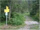
By the road near the cottage we will notice signposts, which point us to the left onto a footpath (signs Reißkofel Biwak). After a few meters of walking, we come to a junction where we go left (signs Schmalzgruben Welzberg). After a short descent, we are again at a junction, this time we go right following the signs Ochsenschlucht Alm (path 233). The path then starts ascending through the forest and brings us to a meadow. The path runs on the right side of the meadow and then past a few houses brings us to signposts (we follow the signs for Reißkofelbiwak). We again ascend across the meadow, this time on the left side. At the end of the meadow then the path turns right into the forest and first ascends on a worse cart track, which quickly turns into a trail. The path then steeply ascends through the forest for quite some time and several times crosses a mountain road. In the last part of the path towards the bivouac we come out of the forest onto grassy slopes, where nice views open up on the neighbouring Torkofel and on the Carnic Alps.
At the bivouac we follow the signs Reißkofel (path 223). The path a little above the bivouac turns to the right and starts ascending through scrub, which gradually becomes rarer. When we come to the ridge, a view opens up on the steep slopes of Reißkofel. The path along the wide grassy ridge soon brings us to the entry into the climbing part of the path.
First, we ascend along the steel cable along the ridge, then the path turns slightly to the left onto the northwestern slopes and steeply ascends along the steel cable. The path is almost vertical in some places and special care is needed, because the slope is quite crumbly, and there is also quite a lot of scree on the path. When we come back to the ridge we go left and continue along the narrow unsecured ridge. The path then turns slightly to the left and crosses steep slopes. Here the path becomes somewhat less demanding, but due to the scree on the path considerable caution is still needed. There follows a shorter descent and then we cross steep northern slopes. On the path we also cross a few gullies in which there can still be some snow in early summer. The path is secured with a steel cable or rope on the more dangerous sections. In the last part the path becomes somewhat less demanding and a few meters below the summit an easier path joins us from the left, which leads along the eastern ridge. There follows a short ascent to the panoramic summit.
Pictures:
 1
1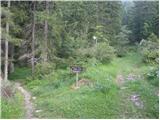 2
2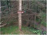 3
3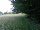 4
4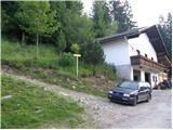 5
5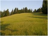 6
6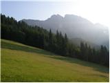 7
7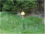 8
8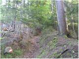 9
9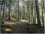 10
10 11
11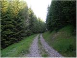 12
12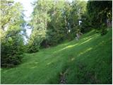 13
13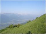 14
14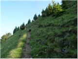 15
15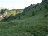 16
16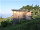 17
17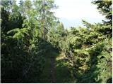 18
18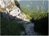 19
19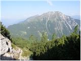 20
20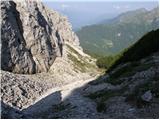 21
21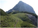 22
22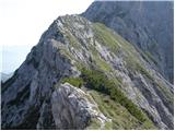 23
23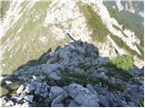 24
24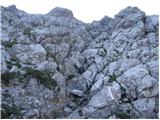 25
25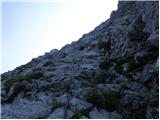 26
26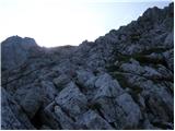 27
27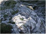 28
28 29
29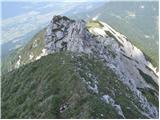 30
30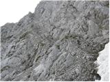 31
31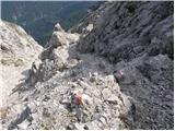 32
32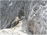 33
33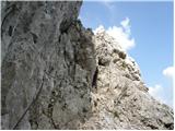 34
34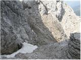 35
35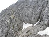 36
36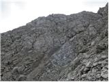 37
37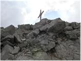 38
38