Reklanska dolina - Sart / Žrd
Starting point: Reklanska dolina (700 m)
Starting point Lat/Lon: 46.3937°N 13.4405°E 
Time of walking: 5 h 15 min
Difficulty: difficult marked way
Difficulty of skiing: very demanding
Altitude difference: 1624 m
Altitude difference (by path): 1750 m
Map: Julijske Alpe - zahodni del 1:50.000
Access to starting point:
From Kranjska Gora over the border crossing Rateče we drive to Trbiž / Tarvisio. In Trbiž we continue left in the direction of Bovec and we follow the road to the crossroad near the lake Rabeljsko jezero. Here we continue right in the direction of Nevejski preval / Sella Nevea. From the saddle, we descend on the road through numerous tunnels on Reklanica side. Approximately 1km after the last tunnel we park on one of the parking lots by the road.
From Bovec, we drive to the border crossing Predel, from which we descend to italian side. Only a little after the lake Rabeljsko jezero we come to the crossroad, where we continue left in the direction of Nevejski preval / Sella Nevea. Further, follow the upper description.
Path description:
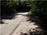
From the parking lot by the road we then descend few ten meters to the spot, where on the left side of the road, we notice signposts for mountain pasture Gorjuda (Casera Goriuda). The path immediately leads in the forest, where it is at first gently and then steeper and steeper ascending. After a good 20 minutes of walking, the path brings us to first more demanding part, where with the help of steel cables we cross wide and secured carved ledge. Similar passage then repeats two more times, on all passages we are accompanied by trickling of water drops, so that we are pretty wet. The path is then even steeper ascending on a steep and in wet for slipping dangerous slope. All key spots, mainly passages over gullies are well-secured. The problem arises only, if we go on the path after heavy rains or thaw, when the gullies are full of water and then crossing is not possible. The steepness then decreases a little and quite an overgrown path then through the forest brings us below a rocky cliff, where the path turns sharply left. With the help of steel cables we cross one more short slightly exposed spot, after that problems vanish. Further, the path quickly brings us out of the forest and in front of us, we notice old shepherd hut (converted in bivouac) on the mountain pasture Gorjuda, where there is a crossing. We continue on the right side of the cottage in the direction of bivouac Marussich on a quite overgrown path, which after a short ascent brings us back into the forest. Considerably overgrown path a little further with the help of the small bridge crosses a torrent stream and then it brings us in thin mostly larch forest. Here the path gets very close mighty limestone pavement plates, and then it avoids them slightly to the right and then it is ascending parallel with them. When the path for a short time flattens on the right side we notice entrance in ice cave. Here we can a little cool down, ascent in the cave because of the ice can be deadly dangerous. Further, more and more scenic path over a series of valleys brings us on high mountain terrain of Kanin mountains. After additional few minutes of walking on a plateau terrain we come on a poorly marked crossing, where we continue left (right Tamaroz). The path ahead is ascending on karst terrain full of limestone pavements and abysses so we carefully follow the path which after good 20 minutes of ascent from a crossing, brings us on the path Rifugio Giberti - Žrd. Here we continue to the right and follow a relatively gentle path to bivouac Marussich, which we reach after a few minutes. Only few steps from the bivouac we come on a saddle Peravo, where there is the next crossing.
We continue straight in the direction of M.Sart on the path which starts ascending towards the west. And soon the path flattens and turns on the right northern side of Vrh Grubij. Considerably gentle path then brings us on nice high mountain meadow (Škrbina v Senožečah), where we leave mule track. We continue the ascent right and on a poorly visible path we ascend to the ridge, where we continue the ascent. The path ahead is steeply ascending on in parts slightly exposed ridge. After half an hour ascent, when we already think, that we are on the summit we step on a secondary peak of Žrd (in fog many people think, that this is the peak), from which a nice view opens up on our destination. A gentle descent follows on barely visible path which still runs on a partly exposed ridge. Ridge then from the left side slowly widens and the path after additional few minutes of ascent brings us on a panoramic peak.
The starting point - mountain pasture Gorjuda 2:00, mountain pasture Gorjuda - bivouac Marussich 2:00, bivouac Marussich - Žrd 1:15.
Pictures:
 1
1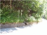 2
2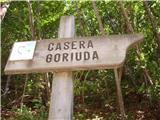 3
3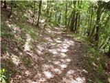 4
4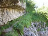 5
5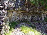 6
6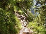 7
7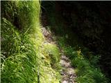 8
8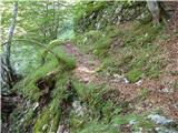 9
9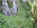 10
10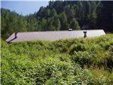 11
11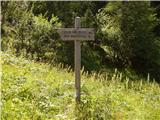 12
12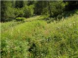 13
13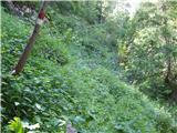 14
14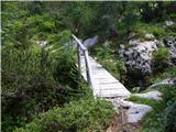 15
15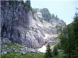 16
16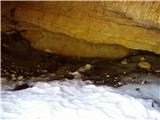 17
17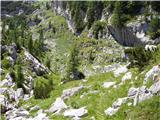 18
18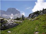 19
19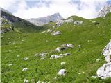 20
20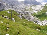 21
21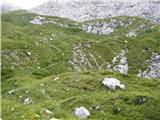 22
22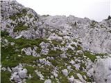 23
23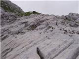 24
24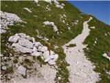 25
25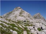 26
26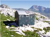 27
27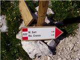 28
28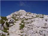 29
29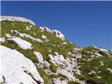 30
30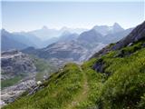 31
31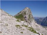 32
32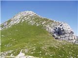 33
33 34
34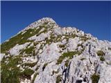 35
35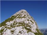 36
36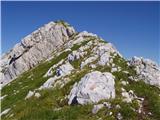 37
37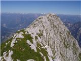 38
38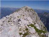 39
39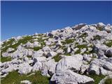 40
40 41
41